Skrwa Lewa
| Skrwa Lewa | |
|---|---|
 | |
| Location | |
| Country | |
| Physical characteristics | |
| Source | |
| • location | south of Łanięta, Łódź Voivodeship |
| • coordinates | 52°20′53″N 19°17′29″E / 52.34806°N 19.29139°E |
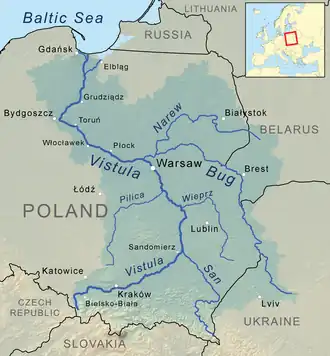
| Mouth | Vistula |
• location | east of Soczewka, Masovian Voivodeship |
• coordinates | 52°32′53″N 19°34′33″E / 52.548008°N 19.575821°E |
• elevation | 56.9 m (187 ft) |
| Length | 45.2 km (28.1 mi) |
| Basin features | |
| Progression | Vistula→ Baltic Sea |
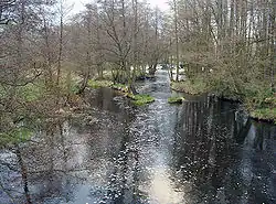
The Skrwa Lewa (Left Skrwa; in Polish also Skrwa Lewobrzeżna or Skrwa Południowa) is a river of Poland, and a left tributary of the Vistula. It flows through the Gostynin-Włocławek Landscape Park. From the town of Gostynin to its mouth, the Skrwa Lewa is a kayaking area.
Its counterpart, the Skrwa Prawa (Right Skrwa), joins the Vistula about three miles downstream on the opposite bank.
Tributaries of the Vistula River | ||
|---|---|---|
| Forming rivers |
|  |
| Main tributaries of the left bank | ||
| Main tributaries of the right bank |
| |
| Distributary |
| |