Siverskyi Donets – Donbas Canal
| Siverskyi Donets – Donbas Canal | |
|---|---|
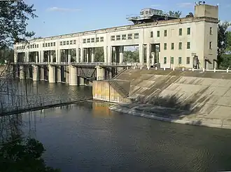 The northern terminal of the canal, connecting with Siverskyi Donets
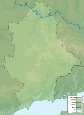 Start End Start and end points of the canal | |
| Location | |
| Specifications | |
| Length | 133.4 km (82.9 miles) |
| History | |
| Date completed | 1958 |
| Geography | |
| Direction | South |
| Start point | Siverskyi Donets |
| End point | Kalmius river |
| Beginning coordinates | 48°54′54″N 37°45′04″E / 48.915°N 37.751°E |
| Ending coordinates | 48°06′22″N 37°52′37″E / 48.106°N 37.877°E |
The Siverskyi Donets – Donbas Canal (Ukrainian: Канал Сіверський Донець — Донбас, romanized: Kanal Siverskyi Donets — Donbas; Russian: Канал Северский Донец — Донбасс) is a canal in the Donetsk Oblast, Eastern Ukraine, connecting the Siverskyi Donets river with the Kalmius river. The canal was built in the 1950s to improve the area's water supplies.[1]
Location
The canal starts near the village of Raihorodok, about 12.2 miles (19.6 km) northeast of Sloviansk, at the Siverskyi Donets. It runs southwards and ends near the city of Yasynuvata, about 11.6 miles (18.7 km) northeast of Donetsk, at the Kalmius River.[2]
History
During the 20th century, Soviet industrialization depleted supplies of fresh water in the Donbas region. The production of many industrial products, such as cast iron and steel, and coal mining require large amounts of fresh water. At the same time, mining in the area disrupted groundwater, making supplies even more scarce.
Construction of a canal to improve the supply of freshwater in the Donetsk Oblast began in 1955, and was completed by 1958. The canal was expanded in 1979 to increase its water capacity.[3] In 2014, the canal was heavily damaged due to the War in Donbas. As of 2021, the canal was run by the state-owned company "Water of Donbas" (Вода Донбасу).[4]
Characteristics
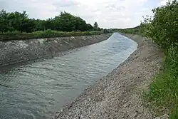
The total length of the canal is 133.4 kilometres (82.9 mi), where 107 kilometres (66 mi) consist of conventional canals, and another 26.4 kilometres (16.4 mi) are pipe bridges. There are four pump stations to carry water over higher elevations, and five reservoirs to ensure smooth operations.[3]
See also
References
- ^ "Donets-Donbas Canal". Internet Encyclopedia of Ukraine. 1984.
- ^ "Kalmius" (in Russian). Geographical encyclopedia.
- ^ a b "Ukraine: Water Infrastructure is the Strategic Prize in Donbas". Daily Kos. September 4, 2022.
- ^ "КП «Компанія «Вода Донбасу» контролює якість питної води" (in Ukrainian). dn.gov.ua. January 15, 2021.