Sham Asbi
Sham Asbi
Persian: شام اسبي | |
|---|---|
Village | |
 Sham Asbi | |
| Coordinates: 38°11′36″N 48°14′38″E / 38.19333°N 48.24389°E[1] | |
| Country | Iran |
| Province | Ardabil |
| County | Ardabil |
| District | Central |
| Rural District | Balghelu |
| Population (2016)[2] | |
• Total | 2,817 |
| Time zone | UTC+3:30 (IRST) |
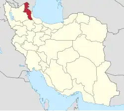
Sham Asbi (Persian: شام اسبي)[a] is a village in, and the capital of, Balghelu Rural District[4] in the Central District of Ardabil County, Ardabil province, Iran.
Etymology
The locals of Sham Asbi identify the first part of the village's name with Sham, i.e. "Syria", interpreting it as "a place with Syrian horses."[5] According to Alice Assadoorian in Iran and the Caucasus, the toponym appears to be an old compound, and thus the folk etymology "can hardly be satisfying."[5] Assadoorian notes that the final –ī in the place name alludes to a patronymic formation, which allows for the reconstruction of the Middle Iranian form of the toponym as *Šāmaspīk or *Šāmāspīk, which translates as "a village belonging to (or founded by) *Šāmāsp."[5] The name *Šāmāsp is a familiar personal name, and derives from Old Iranian *S(i)yāmāspa-, i.e. "(a man) having black or dark studs" (compare Avestan Syāvaspi- and Armenian Šawasp).[5] Assadoorian argues that there was "secondary dissimilation of the initial s- to š-."[5]
Demographics
Population
At the time of the 2006 National Census, the village's population was 2,148 in 511 households.[6] The following census in 2011 counted 2,609 people in 734 households.[7] The 2016 census measured the population of the village as 2,817 people in 820 households. It was the most populous village in its rural district.[2]
See also
Notes
References
- ^ OpenStreetMap contributors (18 August 2024). "Shaam Asbi, Ardabil, بخش مرکزی [Central District], Ardabil city, Ardabil Province, Iran" (Map). OpenStreetMap (in Persian). Retrieved 18 August 2024.
- ^ a b سرشماري عمومي نفوس و مسكن 1395 : استان اردبیل [General Population and Housing Census 2016: Ardabil Province]. مرکز آمار ایران [Statistical Centre of Iran] (in Persian). Archived from the original (Excel) on 22 March 2019. Retrieved 19 June 2025.
- ^ Sham Asbi can be found at GEOnet Names Server, at this link, by opening the Advanced Search box, entering "-3084402" in the "Unique Feature Id" form, and clicking on "Search Database".
- ^ Mousavi, Mir-Hossein (22 April 1987) [تاریخ تصویب (Approval date) 1366/02/02 (Iranian Jalali calendar)]. ایجاد و تشکیل تعداد 21 دهستان شامل روستاها، مزارع و مکانهای واقع در شهرستان اردبیل تابعه استان آذربایجان شرقی [Creation and formation of 21 rural districts including villages, farms and places in Ardabil County under East Azerbaijan province]. لام تا کام [Lam ta Kam] (in Persian). وزارت کشور [Ministry of the Interior]. هیات وزیران [Council of Ministers]. شناسه [ID] FEB9CB78-0F1F-47EF-8168-BEAC75F0CE8B. شماره دوره [Course number] 66, شماره جلد [Volume number] 4. Archived from the original on 18 June 2025. Retrieved 18 June 2025.
- ^ a b c d e Assadoorian, Alice (2006). "Šām-aspī (A Toponym from Ardabīl)". Iran and the Caucasus. 10 (2): 261. doi:10.1163/157338406780345916.
- ^ سرشماري عمومي نفوس و مسكن 1385 : استان اردبیل [General Population and Housing Census 2006: Ardabil Province]. مرکز آمار ایران [Statistical Centre of Iran] (in Persian). Archived from the original (Excel) on 20 September 2011. Retrieved 19 June 2025.
- ^ سرشماري عمومي نفوس و مسكن 1390 : استان اردبیل [General Population and Housing Census 2011: Ardabil Province]. Iran Data Portal—Syracuse University (in Persian). مرکز آمار ایران [Statistical Centre of Iran]. Archived from the original (Excel) on 15 January 2023. Retrieved 19 June 2025.
