Senawang
Senawang
Sonawang (Negeri Sembilan Malay) | |
|---|---|
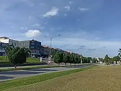 Persiaran Senawang 1, downtown Senawang | |
| Country | Malaysia |
| State | Negeri Sembilan |
| District | Seremban |
| Luak | Sungai Ujong |
| Government | |
| • Administered by | Seremban City Council |
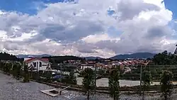
Senawang (Negeri Sembilan Malay: Sonawang) is a suburb in Seremban, Negeri Sembilan, Malaysia. It is administered by the Seremban City Council.
It is at the south of Seremban neighbouring two districts, Rembau and Kuala Pilah.[1]
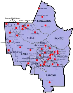
Neighbourhoods
- Lavender Heights [2]
- Taman Bandar Senawang [3]
- Taman Matahari Height [4]
- Taman Seri Pagi
- Taman Teratai
- Taman Tuanku Jaafar
- Taman Tasik Jaya
- Taman Kobena
- Taman Desa Dahlia
- Taman Desa Ixora
- Taman Desa Orkid
- Taman Desa Melor
- Taman Desa Melor Indah
- Taman Desa Flora
- Taman Senawang Indah
- Taman Nusa Intan
- Taman Alamanda
- Taman Cempaka
- Taman Cendana
- Taman Senawang Jaya
- Taman Cattleya
- Taman Sri Mawar
- Taman Sri Kasih
- Taman Lily
- Taman Setia Hati
- Taman Komersial Senawang
- Angsi Ville
- Kasia Ville
- Taman Marida
- Taman Widuri
- Taman Jasmin
- Taman Bukit Emas
- Seremban Forest Heights
- Taman Guru
- Taman Rashidah Utama
- Taman Rasa Sayang
- Taman Ros Mewah
- Taman Kiambang Indah
- Taman Satria
Economy
Industrial sector

.jpg)
Senawang has a mature industrial background, therefore the town is known as one of Negeri Sembilan's primary hubs of industry, alongside Bandar Sri Sendayan, Chembong, Nilai and Bandar Enstek. Sri Senawang Light Industries is an industrial area in Senawang, adjacent to the interchange between Federal Routes 242 and 97. A notable electronics manufacturing company is onsemi, others are located in Tuanku Jaafar Light Industrial area such as Samsung SDS and NXP Semiconductors. Other companies in Senawang area include Seagate Systems (Malaysia) Sdn Bhd in New Senawang Industrial Area (Malay: Kawasan Perusahaan Senawang Baru).
Senawang is included in the Parcel F of the Malaysia Vision Valley economic corridor, which intends to bolster its E&E industry, mainly semiconductor devices.
Retail
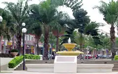
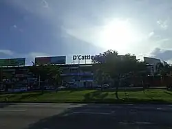
Senawang Commercial Park

Senawang Commercial Park (Malay: Taman Komersial Senawang) also known as Taipan Senawang or Dataran Senawang is the major retail centre in Senawang.[5]
It includes Giant hypermarket and eateries such as McDonald's, KFC, Pizza Hut, Domino's Pizza and Secret Recipe.
Commercial banks includes Maybank, Bank Rakyat, Bank Simpanan Nasional, and RHB Bank.
Senawang City Centre
Senawang City Centre (Malay: Pusat Bandar Senawang) includes amenities such as Proton service centre, a Pos Malaysia (Pos Laju) centre and sports complex for futsal. It also includes major retail lots known as Taipan 2 Senawang which is the extension of Taipan Senawang located side by side to each other.
Commercial banks includes Bank Islam, Affin Bank and SME Bank.
Bandar Prima Senawang
A relatively new retail centre, just adjacent to Senawang Commercial Centre. The centrepiece of Bandar Prima Senawang is a Mydin mall.
Infrastructures
Transportation
 Kajang–Seremban Highway, near Temiang. Senawang is the southern terminus of the highway.
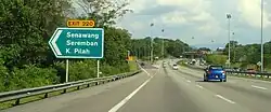
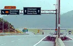
 North–South Expressway Southern Route.
Senawang has connected interchanges with the North–South Expressway, Seremban–Port Dickson Highway, a highway that connects Seremban district and Port Dickson district, both are districts of Negeri Sembilan and Kajang–Seremban Highway, (Malay: Lebuhraya Kajang- Seremban), or LEKAS Highway that connects the states of Negeri Sembilan and Selangor.
KTM Komuter has extended commuter service to Senawang.[6] The 8.5 km (5.3 mi) extension commuter services is from Seremban to Senawang and Sungai Gadut, Negeri Sembilan. Completed in 2011, it was part of the Seremban-Gemas line.[6]
Indian company IRCON International was awarded the project to build and upgrade the 98 km stretch between Seremban and Gemas.[7] The project had been divided into two phases – Seremban–Sg Gadut (11.3 km) and Sg Gadut–Gemas (86.8 km).[7]
Senawang is also served by Senawang and Sungai Gadut stations on the KTM Komuter Seremban Line.
Education
There are 8 national schools in Senawang consist of 5 primary schools and 3 secondary schools. Primary schools in Senawang are:
- SK Senawang
- SK Lavender Heights
- SK Senawang 3
- SK Sri Mawar
- SK Seri Pagi
Secondary Schools in Senawang are:
- SMK Senawang
- SMK Seri Pagi
- SMK Taman Forest Height
Also, there are two private Islamic schools in Senawang:
- Sekolah Rendah Islam As-Saadiyah
- Sekolah Tinggi Islam As-Sofa
While there are plenty of kindergartens and tuition ran by the locals.
Health
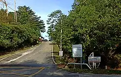
The two major healthcare centres in Senawang is a government-owned Senawang Health Clinic at Persiaran Senawang [8] and a privately owned SALAM Senawang Specialist Hospital at Lavender Heights Business Centre[9]
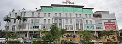
SALAM Senawang provides specialized medical and healthcare services, accessible, affordable and acceptable to all in Senawang and its surrounding areas. A 105 - bed hospital, offering a comprehensive range of medical, surgical and consultative services, it also has a 24-hours emergency facility that enables it to attend to the surrounding urgent medical needs outside of the official hours for the Senawang residents.[10]
Another is a private maternity hospital, Hospital Bersalin Sukhilmi at Taman Bandar Senawang [11]
In popular culture
Taman Rashidah Utama, one of the neighbourhoods around Senawang, holds significance in the Malaysian rock scene, as it was immortalized in a similarly-titled song by renowned rock kapak band Wings. The song remains one of the band's most timeless pieces, which has been subjected to covering in numerous jamming and karaoke sessions.[12][13]
References
- ^ "Location of Senawang". maplandia.com. Retrieved 2019-06-01.
- ^ "About Lavender Heights". propwall.my. Retrieved 2019-06-01.
- ^ "Taman Bandar Senawang". www.propwall.my. Retrieved 2019-06-01.
- ^ "Taman Matahari Height". www.iproperty.com.my. Retrieved 2019-06-01.
- ^ "Dataran Senawang". www.aim.gov.my. Retrieved 2019-06-01.
- ^ a b "Commuter service in Senawang". Keretapi Tanah Melayu Berhad. Archived from the original on 2011-06-08. Retrieved 2008-02-14.
- ^ a b "ETS to reach Sg Gadut by Christmas". Keretapi Tanah Melayu Berhad. Retrieved 2010-11-02.
- ^ "Klinik Kesihatan Senawang Address". www.moh.gov.my. Retrieved 2019-06-01.
- ^ "SALAM Senawang Specialist Hospital". www.salamsenawang.com. Retrieved 2019-06-01.
- ^ "About SALAM Senawang Specialist Hospital". www.salamsenawang.com. Retrieved 2019-06-01.
- ^ "Hospital Bersalin Sukhilmi". www.drsukhilmi.com. Retrieved 2019-06-01.
- ^ ""Dia memang tinggal kat situ" – Taman Rashidah Utama : Lagu Dibuat Oleh Bob Lokman Untuk Aida Aris" ["She lived there" - Taman Rashidah Utama: A Song by Bob Lokman For Aida Aris]. Lobak Merah (in Malay). Retrieved 2 August 2025.
- ^ "Ramai Tak Perasan, 5 Lagu 'Legend' Ini Popularkan Nama Tempat di Malaysia" [Unbeknownst to Many, These 5 Legendary Songs Helped Popularizing Place Names in Malaysia]. SiakapKeli (in Malay). Retrieved 2 August 2025.
Capital: Seremban, Royal town: Seri Menanti | |||||||||||
| Topics |
| ||||||||||
| Society |
| ||||||||||
| Administrative divisions |
| ||||||||||
| |||||||||||