Schmerikon railway station
Schmerikon | |||||||||||||||
|---|---|---|---|---|---|---|---|---|---|---|---|---|---|---|---|
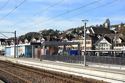 The station platform in 2009 | |||||||||||||||
| General information | |||||||||||||||
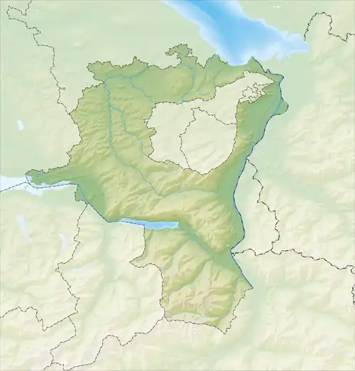
| Location | Bahnhofstrasse Schmerikon, St. Gallen Switzerland | ||||||||||||||
| Coordinates | 47°13′30.576″N 8°56′36.175″E / 47.22516000°N 8.94338194°E | ||||||||||||||
| Elevation | 407 m (1,335 ft) | ||||||||||||||
| Owned by | Swiss Federal Railways | ||||||||||||||
| Line(s) | Rapperswil–Ziegelbrücke | ||||||||||||||
| Distance | 49.3 km (30.6 mi) from Sargans[1] | ||||||||||||||
| Train operators | Südostbahn | ||||||||||||||
| Connections | ZVV / Ostwind | ||||||||||||||
 | ZSG passenger ships | ||||||||||||||
 | PostAuto Schweiz bus route[2] 630 | ||||||||||||||
| Other information | |||||||||||||||
| Fare zone | 995 (Tarifverbund Ostwind)[3] | ||||||||||||||
| Passengers | |||||||||||||||
| 2018 | 1,400 per weekday[4] | ||||||||||||||
| Services | |||||||||||||||
| |||||||||||||||
| |||||||||||||||
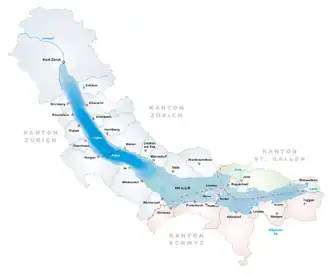
Schmerikon railway station (German: Bahnhof Schmerikon) is a railway station situated in the municipality of Schmerikon in the Swiss canton of St. Gallen. It is located next to the shore of Obersee on the Rapperswil to Ziegelbrücke line.[5][1]
Services
S-Bahn
The station is served by St. Gallen S-Bahn services S6, which operates south-east to Schwanden via Ziegelbrücke and westward to Rapperswil, and S17, which operates between Rapperswil and Sargans via Ziegelbrücke. Both these lines run hourly, combining to provide a half-hourly service to Rapperswil and Ziegelbrücke.
As of the December 2023 timetable change, the following S-Bahn services stop at Schmerikon railway station:[6]
- St. Gallen S-Bahn S6 / S17: half-hourly service between Rapperswil and Ziegelbrücke and hourly service to Schwanden / Linthal or Sargans.
Bus and boat
There is a nearby bus stop served by buses of PostAuto Schweiz.
A landing stage located 240 m (790 ft) to the west of the railway station is served by passenger boat lines of Zürichsee Schifffahrtsgesellschaft (ZSG).[7] The landing stage is within fare zone 183 of the Zürcher Verkehrsverbund (ZVV).[8]
History
The next railway station to the west is now Blumenau, but until 2004 it used to be Bollingen. Until December 2023, the station was served by the inter-regional Voralpen Express, which links Lucerne and St. Gallen.
References
- ^ a b Eisenbahnatlas Schweiz. Verlag Schweers + Wall GmbH. 2012. pp. 12–13. ISBN 978-3-89494-130-7.
- ^ "Linthgebiet" (PDF). Postbus Switzerland. 13 December 2020. Retrieved 27 December 2020.
- ^ "OSTWIND-Zonenplan" (in German). Tarifverbund Ostwind. 13 December 2020. Retrieved 27 December 2020.
- ^ "Passagierfrequenz". Swiss Federal Railways. September 2019. Retrieved 27 December 2020.
- ^ map.geo.admin.ch (Map). Swiss Confederation. Retrieved 20 June 2013.
- ^ "Rapperswil - Ziegelbrücke" (PDF) (in German). Swiss Federal Railways. 15 September 2023. Retrieved 16 December 2023.
- ^ "Welcome to ZSG". Zürichsee-Schifffahrtsgesellschaft (ZSG). Retrieved 5 August 2025.
- ^ "ZVV Tarifzonen | ZVV fare zones" (PDF). www.zvv.ch. ZVV. Retrieved 5 August 2025.
External links
 Media related to Schmerikon railway station at Wikimedia Commons
- Schmerikon railway station – SBB