Saint-Hubert-de-Rivière-du-Loup
Saint-Hubert-de-Rivière-du-Loup | |
|---|---|
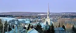 Westward view from Chemin Taché | |
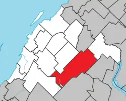 Location within Rivière-du-Loup RCM | |
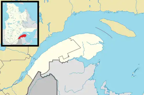 Saint-Hubert-de-Rivière-du-Loup Location in eastern Quebec | |
| Coordinates: 47°49′N 69°09′W / 47.817°N 69.150°W[1] | |
| Country | |
| Province | |
| Region | Bas-Saint-Laurent |
| RCM | Rivière-du-Loup |
| Constituted | January 4, 1894 |
| Named after | Hubertus and Rivière-du-Loup[1] |
| Government | |
| • Mayor | Josée Ouellet |
| • Federal riding | Côte-du-Sud—Rivière-du-Loup—Kataskomiq—Témiscouata |
| • Prov. riding | Rivière-du-Loup–Témiscouata |
| Area | |
• Total | 198.60 km2 (76.68 sq mi) |
| • Land | 192.20 km2 (74.21 sq mi) |
| Population | |
• Total | 1,412 |
| • Density | 7.3/km2 (19/sq mi) |
| • Pop 2016-2021 | |
| • Dwellings | 1,019 |
| Time zone | UTC−5 (EST) |
| • Summer (DST) | UTC−4 (EDT) |
| Postal code(s) | |
| Area codes | 418 and 581 |
| Highways | |
| Website | www |
Saint-Hubert-de-Rivière-du-Loup (French pronunciation: [sɛ̃t‿ybɛʁ də ʁivjɛʁ dy lu]) is a municipality in Quebec, Canada, in the administrative region of Bas-Saint-Laurent and the regional county municipality of Rivière-du-Loup.
Geography
Located in the Notre Dame Mountains, the municipality is dotted with several large lakes, including Grande-Fourche, Saint-Hubert and Saint-François, which attract many holidaymakers. Several watercourses in the Trois Pistoles River watershed flow through the municipality. From Lac de la Grande Fourche in the centre, the Sénescoupé River flows northeast. The Toupiké River crosses the southwest to the northeast. The Petite Fourche River crosses the south-west to its confluence with the Toupiké River. The Plate River crosses the south-east tip towards the north-east. The Mariakèche River makes a brief incursion into the north-west.
Saint-Hubert-de-Rivière-du-Loup is crossed by Route 291.
Notable people
- Leo Kerouac, father of author and poet Jack Kerouac
See also
References
- ^ a b "Banque de noms de lieux du Québec: Reference number 333303". toponymie.gouv.qc.ca (in French). Commission de toponymie du Québec.
- ^ a b "Répertoire des municipalités: Geographic code 12010". www.mamh.gouv.qc.ca (in French). Ministère des Affaires municipales et de l'Habitation.
- ^ a b "Data table, Census Profile, 2021 Census of Population - Saint-Hubert-de-Rivière-du-Loup, Municipalité (MÉ) [Census subdivision], Quebec". 9 February 2022.
External links
 Media related to Saint-Hubert-de-Rivière-du-Loup at Wikimedia Commons
Adjacent Municipal Subdivisions | |
|---|---|
| Cities & towns | |
|---|---|
| Municipalities | |
| Parishes | |
| |