Roudno
Roudno | |
|---|---|
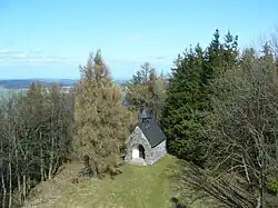 Chapel of Saints Peter and Paul | |
 Flag 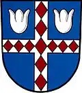 Coat of arms | |
 Roudno Location in the Czech Republic | |
| Coordinates: 49°53′46″N 17°30′49″E / 49.89611°N 17.51361°E | |
| Country | |
| Region | Moravian-Silesian |
| District | Bruntál |
| First mentioned | 1397 |
| Area | |
• Total | 22.20 km2 (8.57 sq mi) |
| Elevation | 577 m (1,893 ft) |
| Population (2025-01-01)[1] | |
• Total | 208 |
| • Density | 9.4/km2 (24/sq mi) |
| Time zone | UTC+1 (CET) |
| • Summer (DST) | UTC+2 (CEST) |
| Postal code | 792 01 |
| Website | www |
Roudno (German: Rautenberg) is a municipality and village in Bruntál District in the Moravian-Silesian Region of the Czech Republic. It has about 200 inhabitants. It lies on the shore of Slezská Harta Reservoir.
Administrative division
Roudno consists of two municipal parts (in brackets population according to the 2021 census):[2]
- Roudno (176)
- Volárna (19)
Demographics
| Year | Pop. | ±% |
|---|---|---|
| 1869 | 1,232 | — |
| 1880 | 1,139 | −7.5% |
| 1890 | 1,013 | −11.1% |
| 1900 | 996 | −1.7% |
| 1910 | 943 | −5.3% |
| 1921 | 846 | −10.3% |
| 1930 | 809 | −4.4% |
| 1950 | 439 | −45.7% |
| 1961 | 463 | +5.5% |
| 1970 | 429 | −7.3% |
| 1980 | 352 | −17.9% |
| 1991 | 223 | −36.6% |
| 2001 | 204 | −8.5% |
| 2011 | 187 | −8.3% |
| 2021 | 195 | +4.3% |
| Source: Censuses[3][4] | ||
References
- ^ "Population of Municipalities – 1 January 2025". Czech Statistical Office. 2025-05-16.
- ^ "Public Census 2021 – basic data". Public Database (in Czech). Czech Statistical Office. 2022.
- ^ "Historický lexikon obcí České republiky 1869–2011" (in Czech). Czech Statistical Office. 2015-12-21.
- ^ "Population Census 2021: Population by sex". Public Database. Czech Statistical Office. 2021-03-27.
External links
Wikimedia Commons has media related to Roudno.