Ropa (river)
| Ropa | |
|---|---|
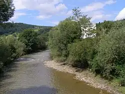 The Ropa near Szymbark | |
| Location | |
| Country | |
| Physical characteristics | |
| Source | slopes of the Low Beskids |
| • location | northeast of Blechnarka, Lesser Poland Voivodeship |
| • coordinates | 49°26′30″N 21°13′20″E / 49.44167°N 21.22222°E |
| • elevation | 790 m (2,590 ft) |
| Mouth | Wisłoka |
• location | Jasło, Podkarpackie Voivodeship |
• coordinates | 49°44′43″N 21°27′05″E / 49.745215°N 21.451375°E |
• elevation | 230 m (750 ft) |
| Length | 78.7 km (48.9 mi) |
| Basin size | 974.1 km2 (376.1 sq mi) |
| Basin features | |
| Progression | Wisłoka→ Vistula→ Baltic Sea |
| Tributaries | |
| • right | Libuszanka Zdynianka |
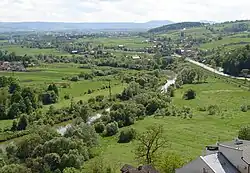
Ropa is a river of mountainous southern Poland, a tributary of the Wisłoka.
Near the town of Łosie, Gorlice County, the Ropa was dammed in 1994 to create Lake Klimkowskie.[1] Downstream it flows through Biecz and joins the Wisłoka at Jasło. During the 2010 Central European floods the Ropa flooded Jasło on June 5.[2]
Its own tributaries include the Libuszanka and the Zdynia.
References
- ^ "Community perception of the Klimkówka Reservoir in Poland". International Journal of Water Resources Development. 30: 649–661. doi:10.1080/07900627.2014.892426.
- ^ "Woda wdarła się do Jasła; "zniszczenia są potężne"" (in Polish). 4 June 2010. Archived from the original on 8 June 2010. Retrieved 5 June 2010.