Rohozná (Jihlava District)
Rohozná | |
|---|---|
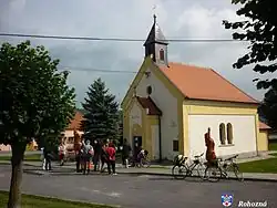 Chapel of Saint Wenceslaus | |
_vlajka.jpg) Flag _znak.jpg) Coat of arms | |
 Rohozná Location in the Czech Republic | |
| Coordinates: 49°21′0″N 15°23′57″E / 49.35000°N 15.39917°E | |
| Country | |
| Region | Vysočina |
| District | Jihlava |
| First mentioned | 1370 |
| Area | |
• Total | 11.44 km2 (4.42 sq mi) |
| Elevation | 554 m (1,818 ft) |
| Population (2025-01-01)[1] | |
• Total | 414 |
| • Density | 36/km2 (94/sq mi) |
| Time zone | UTC+1 (CET) |
| • Summer (DST) | UTC+2 (CEST) |
| Postal code | 588 44 |
| Website | www |
Rohozná (Czech pronunciation: [ˈroɦoznaː]) is a municipality and village in Jihlava District in the Vysočina Region of the Czech Republic. It has about 400 inhabitants.
Rohozná lies approximately 16 kilometres (10 mi) west of Jihlava and 108 km (67 mi) south-east of Prague.
Demographics
| Year | Pop. | ±% |
|---|---|---|
| 1869 | 860 | — |
| 1880 | 941 | +9.4% |
| 1890 | 911 | −3.2% |
| 1900 | 873 | −4.2% |
| 1910 | 868 | −0.6% |
| 1921 | 915 | +5.4% |
| 1930 | 805 | −12.0% |
| 1950 | 593 | −26.3% |
| 1961 | 596 | +0.5% |
| 1970 | 473 | −20.6% |
| 1980 | 438 | −7.4% |
| 1991 | 373 | −14.8% |
| 2001 | 357 | −4.3% |
| 2011 | 374 | +4.8% |
| 2021 | 397 | +6.1% |
| Source: Censuses[2][3] | ||
References
- ^ "Population of Municipalities – 1 January 2025". Czech Statistical Office. 2025-05-16.
- ^ "Historický lexikon obcí České republiky 1869–2011" (in Czech). Czech Statistical Office. 2015-12-21.
- ^ "Population Census 2021: Population by sex". Public Database. Czech Statistical Office. 2021-03-27.
External links
Wikimedia Commons has media related to Rohozná (Jihlava District).