River Meig
| River Meig | |
|---|---|
 | |
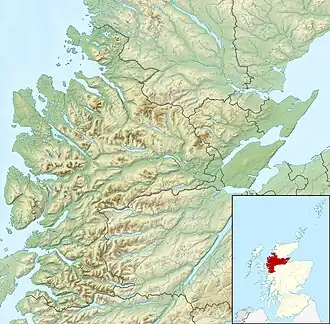 Location of the mouth within Easter Ross | |
| Etymology | "Pouring Forth" |
| Location | |
| Country | Scotland |
| Physical characteristics | |
| Source | |
| • location | Allt an Fhuar-thuill
Allt a' Choire-bheithe An Crom-allt |
| • coordinates | 57°29′01″N 5°08′27″W / 57.483510°N 5.140843°W |
| • elevation | 290m |
| Mouth | |
• location | River Conon |
• coordinates | 57°34′14″N 4°40′54″W / 57.5704849°N 4.681555°W |
• elevation | 30m |
| Length | 37km |
The River Meig (Scottish Gaelic: Mìg) is a river in Easter Ross. It draws its source from the meeting of several allts in the forested hills north of Loch Monar, before flowing northeast through Loch Beannacharain and Loch Meig, before joining the River Conon at the small settlement of Little Scatwell, 2 km south of Loch Luichart.[1] It drains into the Cromarty Firth on the east coast.
The name of the river derives from an Old Gaelic root, minc, with cognates in Latin, Old Welsh, and Old English. It roughly translates to "pouring forth".[2]
Meig Dam was constructed on the River Meig in 1957 as part of the Conon Hydro Scheme, one of a series of post-war infrastructure projects led by the North of Scotland Hydro-Electric Board (NoSHEB). This led to the formation of a reservoir named after the river, Loch Meig.[3][4][5]
North of the river near the settlement of Scardroy is a memorial cairn from the late-20th century dedicated to a 'Colin Grant Sangster, 1930–1994'.[6]
Downstream of Loch Meig is Meig Gorge (Am Mòr-Ghil Mhìg), a popular location for local kayakers. The gorge is best kayaked in dry weather thanks to compensation flow from the nearby dam; it is potentially too dangerous after heavy rainfall. The main drop in the gorge is colloquially known as "Tea Cup Falls".[7]
References
- ^ "River Meig from The Gazetteer for Scotland". www.scottish-places.info. Retrieved 14 January 2024.
- ^ "Contin Parish Place Names ⋆ Ross and Cromarty Heritage". Ross and Cromarty Heritage. Retrieved 14 January 2024.
- ^ "Conon Fishing | Loch Meig". www.cononfishing.com. Retrieved 14 January 2024.
- ^ Payne, Peter Lester (1988). The hydro: a study of the development of the major hydro-electric schemes undertaken by the North of Scotland Hydro-Electric Board. Aberdeen, Scotland: Aberdeen University Press. p. 129. ISBN 978-0-08-036584-8.
- ^ Power from the Glens. Neart nan Gleann (PDF). Scottish Hydro Electric. pp. 10–11.
- ^ "River Meig | Canmore". canmore.org.uk. Retrieved 14 January 2024.
- ^ "The Meig Gorge". Kayak Scotland. Retrieved 14 January 2024.