Rapides Parish, Louisiana
Rapides Parish, Louisiana | |
|---|---|
| Parish of Rapides | |
 Upper portion of the Rapides Parish Courthouse in Alexandria | |
 Flag | |
 Location within the U.S. state of Louisiana | |
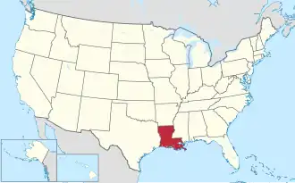 Louisiana's location within the U.S. | |
| Country | |
| State | |
| Region | Central Louisiana |
| Founded | 1807 |
| Named after | The local river rapids |
| Parish seat (and largest city) | Alexandria |
| Area | |
• Total | 3,530 km2 (1,362 sq mi) |
| • Land | 3,410 km2 (1,318 sq mi) |
| • Water | 110 km2 (44 sq mi) |
| • percentage | 8 km2 (3.2 sq mi) |
| Population (2020) | |
• Total | 130,023 |
| • Density | 37/km2 (95/sq mi) |
| Time zone | UTC-6 (CST) |
| • Summer (DST) | UTC-5 (CDT) |
| Area code | 318 |
| Congressional district | 5th |
| Website | Rapides Parish Police Jury |
_IMG_4268.JPG)

Rapides Parish (/ˈræpiːdz/) (French: Paroisse des Rapides) is a parish located in the U.S. state of Louisiana. As of the 2020 census, the population was 130,023.[1] The parish seat and largest city is Alexandria, which developed along the Red River of the South.[2] Rapides is the French word for "rapids". The parish was created in 1807 after the United States acquired this territory in the Louisiana Purchase.[3]
Rapides Parish is included in the Alexandria metropolitan area, Louisiana.
History

In 1763, the land that is now Rapides Parish became the new home of the Apalachee tribe, who were settled there with the permission of Governor Kerlerec. Some Native Americans had come after fleeing the British and their Creek Indian allies from what is now Leon County, Florida. Many of their descendants remain in Natchitoches Parish.
The first French settler was Vincent Porei, who was granted a small tract of land in July 1764 by the Civil and Military Commander of Natchitoches. Nicolas Etienne Marafret Layssard arrived in December 1766, with the permission of Aubrey and Foucault, to establish a "tar works" in the pineries of Rapides, for naval stores. He was later appointed the first Civil Commander of Rapides Parish. During the 1760s, the area was still a dependency of Natchitoches Parish [AGI, PPC, Legajo 187a, 384-384v].
Parts of Catahoula Parish, Grant Parish, Vernon Parish, and Winn Parish were initially part of Rapides Parish territory, but they eventually separated and obtained land from neighboring parishes.
21st-century politics
Since the late 20th century, conservative whites have mostly shifted from the Democratic Party, long in control in Louisiana and other Deep South states, to the Republican Party. The population of Alexandria is heavily Democratic, but voters in the white-majority Rapides Parish frequently favor Republican candidates in competitive presidential elections. In 2012, Republican Mitt Romney carried the parish with 37,193 votes (64.1 percent), compared to Democrat U.S. President Barack Obama's 20,045 (34.6 percent) tabulation.[4] The 2008 returns in Rapides Parish were similar to those of 2012. U.S. Senator John McCain of Arizona won the parish with 36,611 votes (63.6 percent) to President Obama's 20,127 (35 percent).[5]
With 58.8 percent and 63.8 percent, respectively, George W. Bush carried Rapides Parish in both 2000 and 2004 over the Democrats, Vice President Al Gore[6] and John F. Kerry.[7] The last Democrat to win at the presidential level in Rapides Parish was Bill Clinton, who in 1996 received 23,004 votes (46.1 percent) to Robert J. Dole's 21,548 (43.2 percent). Ross Perot, founder of his Reform Party, received 4,670 ballots (9.4 percent).[8]
Geography
According to the U.S. Census Bureau, the parish has a total area of 1,362 square miles (3,530 km2), of which 1,318 square miles (3,410 km2) is land and 44 square miles (110 km2) (3.2%) is water.[9] It is the largest parish in Louisiana by land area.
Water features
Major highways
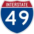 Interstate 49
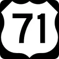 U.S. Highway 71
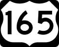 U.S. Highway 165
 U.S. Highway 167
.svg.png) Louisiana Highway 1
Louisiana Highway 1.svg.png) Louisiana Highway 28
Louisiana Highway 28
Adjacent parishes
- Grant Parish (north)
- La Salle Parish (northeast)
- Avoyelles Parish (east)
- Evangeline Parish (southeast)
- Allen Parish (southwest)
- Vernon Parish (west)
- Natchitoches Parish (northwest)
National protected area
- Kisatchie National Forest (part)
Military installations
- Esler Airfield (LA Army National Guard)
- Louisiana National Guard Training Center Pineville (LA Army National Guard)
- Camp Claiborne (defunct)
- Camp Livingston (defunct)
- England Air Force Base (defunct)
National Guard
Demographics
| Census | Pop. | Note | %± |
|---|---|---|---|
| 1820 | 6,065 | — | |
| 1830 | 7,575 | 24.9% | |
| 1840 | 14,132 | 86.6% | |
| 1850 | 16,561 | 17.2% | |
| 1860 | 25,360 | 53.1% | |
| 1870 | 18,015 | −29.0% | |
| 1880 | 23,563 | 30.8% | |
| 1890 | 27,642 | 17.3% | |
| 1900 | 39,578 | 43.2% | |
| 1910 | 44,545 | 12.5% | |
| 1920 | 59,444 | 33.4% | |
| 1930 | 65,455 | 10.1% | |
| 1940 | 73,370 | 12.1% | |
| 1950 | 90,648 | 23.5% | |
| 1960 | 111,351 | 22.8% | |
| 1970 | 118,078 | 6.0% | |
| 1980 | 135,282 | 14.6% | |
| 1990 | 131,556 | −2.8% | |
| 2000 | 126,337 | −4.0% | |
| 2010 | 131,613 | 4.2% | |
| 2020 | 130,023 | −1.2% | |
| U.S. Decennial Census[10] 1790-1960[11] 1900-1990[12] 1990-2000[13] 2010[14] | |||
| Race / Ethnicity (NH = Non-Hispanic) | Pop 1980[15] | Pop 1990[16] | Pop 2000[17] | Pop 2010[18] | Pop 2020[19] | % 1980 | % 1990 | % 2000 | % 2010 | % 2020 |
|---|---|---|---|---|---|---|---|---|---|---|
| White alone (NH) | 96,414 | 91,932 | 83,059 | 81,623 | 76,323 | 71.27% | 69.88% | 65.74% | 62.02% | 58.70% |
| Black or African American alone (NH) | 36,031 | 36,667 | 38,298 | 41,937 | 40,261 | 26.63% | 27.87% | 30.31% | 31.86% | 30.96% |
| Native American or Alaska Native alone (NH) | 429 | 528 | 892 | 968 | 901 | 0.32% | 0.40% | 0.71% | 0.74% | 0.69% |
| Asian alone (NH) | 554 | 879 | 1,071 | 1,545 | 1,805 | 0.41% | 0.67% | 0.85% | 1.17% | 1.39% |
| Native Hawaiian or Pacific Islander alone (NH) | x [20] | x [21] | 39 | 26 | 33 | x | x | 0.03% | 0.02% | 0.03% |
| Other race alone (NH) | 225 | 24 | 91 | 138 | 459 | 0.17% | 0.02% | 0.07% | 0.10% | 0.35% |
| Mixed race or Multiracial (NH) | x [22] | x [23] | 1,148 | 1,958 | 5,151 | x | x | 0.91% | 1.49% | 3.96% |
| Hispanic or Latino (any race) | 1,629 | 1,526 | 1,739 | 3,418 | 5,090 | 1.20% | 1.16% | 1.38% | 2.60% | 3.91% |
| Total | 135,282 | 131,556 | 126,337 | 131,613 | 130,023 | 100.00% | 100.00% | 100.00% | 100.00% | 100.00% |
As of the 2020 United States census, there were 130,023 people, 48,975 households, and 32,667 families residing in the parish. In 2010, there were 131,613 people living in the parish. 63.3% were White, 25.0% Black or African American, 1.83% Asian, 2.15% Native American, 1.56% of some other race and 1.88% of two or more races. 6.85% were Hispanic or Latino (of any race).
In 2000,[24] there were 126,337 people, 47,120 households, and 33,125 families living in the parish. The population density was 93 inhabitants per square mile (36/km2). There were 52,038 housing units at an average density of 39 per square mile (15/km2). The racial makeup of the parish was 66.51% White, 30.43% Black or African American, 0.74% Native American, 0.86% Asian, 0.04% Pacific Islander, 0.42% from other races, and 1.01% from two or more races. 1.38% of the population were Hispanic or Latino of any race.
There were 47,120 households, out of which 34.60% had children under the age of 18 living with them, 49.70% were married couples living together, 16.80% had a female householder with no husband present, and 29.70% were non-families. 26.00% of all households were made up of individuals, and 10.30% had someone living alone who was 65 years of age or older. The average household size was 2.56 and the average family size was 3.09.
In the parish the population was spread out, with 27.20% under the age of 18, 9.50% from 18 to 24, 27.90% from 25 to 44, 22.40% from 45 to 64, and 13.10% who were 65 years of age or older. The median age was 36 years. For every 100 females, there were 91.70 males. For every 100 females age 18 and over, there were 88.00 males.
The median income for a household in the parish was $29,856, and the median income for a family was $36,671. Males had a median income of $29,775 versus $20,483 for females. The per capita income for the parish was $16,088. About 16.40% of families and 20.50% of the population were below the poverty line, including 26.30% of those under age 18 and 16.30% of those age 65 or over.
Government and infrastructure
The Louisiana Department of Public Safety & Corrections formerly operated the J. Levy Dabadie Correctional Center on property adjacent to Louisiana National Guard Training Center Pineville in Pineville in Rapides Parish.[25][26] The facility closed in July 2012.[27]
Rapides Parish is solidly Republican in presidential elections. In 2016, Hillary Clinton suffered the worst defeat for a Democratic candidate in the county since Walter Mondale in 1984, Although her husband, Bill, won the parish in 1996 during his reelection bid, this stands as the last time Rapides Parish voted for a Democratic candidate.
| Year | Republican | Democratic | Third party(ies) | |||
|---|---|---|---|---|---|---|
| No. | % | No. | % | No. | % | |
| 2024 | 36,171 | 67.74% | 16,537 | 30.97% | 687 | 1.29% |
| 2020 | 38,347 | 65.14% | 19,475 | 33.08% | 1,043 | 1.77% |
| 2016 | 36,816 | 64.77% | 18,322 | 32.23% | 1,706 | 3.00% |
| 2012 | 37,193 | 64.10% | 20,045 | 34.55% | 781 | 1.35% |
| 2008 | 36,611 | 63.65% | 20,127 | 34.99% | 783 | 1.36% |
| 2004 | 34,492 | 63.79% | 18,904 | 34.96% | 673 | 1.24% |
| 2000 | 28,831 | 58.81% | 18,898 | 38.55% | 1,295 | 2.64% |
| 1996 | 21,548 | 43.16% | 23,004 | 46.07% | 5,379 | 10.77% |
| 1992 | 22,783 | 43.91% | 20,873 | 40.23% | 8,226 | 15.86% |
| 1988 | 29,977 | 61.31% | 17,928 | 36.67% | 986 | 2.02% |
| 1984 | 32,879 | 65.81% | 16,121 | 32.27% | 963 | 1.93% |
| 1980 | 25,576 | 55.24% | 19,436 | 41.98% | 1,290 | 2.79% |
| 1976 | 17,766 | 45.25% | 20,851 | 53.10% | 647 | 1.65% |
| 1972 | 22,306 | 69.68% | 8,422 | 26.31% | 1,283 | 4.01% |
| 1968 | 10,199 | 28.95% | 8,793 | 24.96% | 16,239 | 46.09% |
| 1964 | 18,122 | 64.46% | 9,992 | 35.54% | 0 | 0.00% |
| 1960 | 8,155 | 34.29% | 9,651 | 40.58% | 5,976 | 25.13% |
| 1956 | 9,105 | 53.84% | 5,961 | 35.25% | 1,845 | 10.91% |
| 1952 | 9,749 | 41.80% | 13,576 | 58.20% | 0 | 0.00% |
| 1948 | 1,707 | 13.07% | 4,730 | 36.22% | 6,623 | 50.71% |
| 1944 | 1,712 | 15.79% | 9,132 | 84.21% | 0 | 0.00% |
| 1940 | 869 | 8.72% | 9,100 | 91.28% | 0 | 0.00% |
| 1936 | 1,257 | 13.55% | 8,017 | 86.45% | 0 | 0.00% |
| 1932 | 680 | 8.23% | 7,578 | 91.77% | 0 | 0.00% |
| 1928 | 2,494 | 35.81% | 4,470 | 64.19% | 0 | 0.00% |
| 1924 | 1,022 | 31.06% | 2,159 | 65.62% | 109 | 3.31% |
| 1920 | 445 | 13.86% | 2,765 | 86.11% | 1 | 0.03% |
| 1916 | 134 | 5.72% | 2,184 | 93.25% | 24 | 1.02% |
| 1912 | 46 | 2.75% | 1,334 | 79.78% | 292 | 17.46% |
Education
Rapides Parish School Board operates public schools.[29]
By 1993 the district had established a secondary school for students with behavior issues, called Redirection Academy. That year, the U.S. federal court system stopped the district from establishing a magnet school for academically advanced students.[30]
Communities
Cities
- Alexandria (parish seat and largest municipality)
- Pineville

Towns
Villages
Unincorporated areas
Census-designated Place
Unincorporated communities
Gallery
-
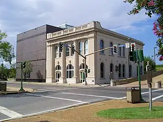 A view of the Alexandria museum in Rapides Parish, Louisiana, USA
 -
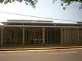 Rapides Parish Library at Alexandria
 -
 Red River at Alexandria
See also
- National Register of Historic Places listings in Rapides Parish, Louisiana
- Jay Chevalier
- Bill Cleveland
- Palustris Experimental Forest
References
- ^ "Census - Geography Profile: Rapides Parish, Louisiana". United States Census Bureau. Retrieved January 22, 2023.
- ^ "Find a County". National Association of Counties. Retrieved June 7, 2011.
- ^ "Rapides Parish". Center for Cultural and Eco-Tourism. Retrieved September 6, 2014.
- ^ "Rapides Parish election returns, November 6, 2012". staticresults.sos.la.gov. Retrieved November 17, 2012.
- ^ "Rapides Parish election returns, November 4, 2008". staticresults.sos.la.gov. Retrieved November 17, 2012.
- ^ "Rapides Parish election returns, November 7, 2000". staticresults.sos.la.gov. Retrieved November 17, 2012.
- ^ "Rapides Parish election returns, November 2, 2004". staticresults.sos.la.gov. Retrieved November 17, 2012.
- ^ "Rapides Parish election returns, November 5, 1996". staticresults.sos.la.gov. Retrieved November 17, 2012.
- ^ "2010 Census Gazetteer Files". United States Census Bureau. August 22, 2012. Archived from the original on September 28, 2013. Retrieved September 1, 2014.
- ^ "U.S. Decennial Census". United States Census Bureau. Retrieved September 1, 2014.
- ^ "Historical Census Browser". University of Virginia Library. Retrieved September 1, 2014.
- ^ "Population of Counties by Decennial Census: 1900 to 1990". United States Census Bureau. Retrieved September 1, 2014.
- ^ "Census 2000 PHC-T-4. Ranking Tables for Counties: 1990 and 2000" (PDF). United States Census Bureau. Archived (PDF) from the original on March 27, 2010. Retrieved September 1, 2014.
- ^ "State & County QuickFacts". United States Census Bureau. Archived from the original on June 6, 2011. Retrieved August 18, 2013.
- ^ "1980 Census of Population - General Population Characteristics - Louisiana - Table 14 - Persons by Race and Table 15 - Total Persons and Spanish Origin Persons by Type of Spanish Origin and Race (p. 20/12-20/20)" (PDF). United States Census Bureau.
- ^ "1990 Census of Population - General Population Characteristics - Louisiana - Table 6 - Race and Hispanic Origin" (PDF). United States Census Bureau. p. 15-38.
- ^ "P004: Hispanic or Latino, and Not Hispanic or Latino by Race – 2000: DEC Summary File 1 – Rapides Parish, Louisiana". United States Census Bureau.
- ^ "P2: Hispanic or Latino, and Not Hispanic or Latino by Race – 2010: DEC Redistricting Data (PL 94-171) – Rapides Parish, Louisiana". United States Census Bureau.
- ^ "P2: Hispanic or Latino, and Not Hispanic or Latino by Race – 2020: DEC Redistricting Data (PL 94-171) – Rapides Parish, Louisiana". United States Census Bureau.
- ^ included in the Asian category in the 1980 Census
- ^ included in the Asian category in the 1990 Census
- ^ not an option in the 1980 Census
- ^ not an option in the 1990 Census
- ^ "U.S. Census website". United States Census Bureau. Retrieved January 31, 2008.
- ^ "Time in Prison Archived October 23, 2012, at WebCite." Louisiana Department of Public Safety & Corrections. 28/40. September 23, 2010.
- ^ "J. Levy Dabadie Correctional Center Archived September 24, 2010, at the Wayback Machine." Louisiana Department of Public Safety and Corrections. Retrieved on September 23, 2010.
- ^ "J. Levy Dabadie Correctional Center." (Archive) Louisiana Department of Public Safety & Corrections. Retrieved on October 23, 2012.
- ^ Leip, David. "Dave Leip's Atlas of U.S. Presidential Elections". uselectionatlas.org. Retrieved March 9, 2018.
- ^ "2020 CENSUS - SCHOOL DISTRICT REFERENCE MAP: Rapides Parish, LA" (PDF). U.S. Census Bureau. Archived (PDF) from the original on July 31, 2022. Retrieved July 31, 2022. - Text list
- ^ Daye, Raymond L. (August 22, 1993). "No 'super school in Rapides". The Town Talk. Alexandria, Louisiana. pp. A-1, A-2 – via Newspapers.com.
External links
Geology
- Snead, J., P. V. Heinrich, and R. P. McCulloh, 2002, Ville Platte 30 x 60 minute geologic quadrangle. Louisiana Geological Survey, Baton Rouge, Louisiana.
Places adjacent to Rapides Parish, Louisiana | ||||||||||||||||
|---|---|---|---|---|---|---|---|---|---|---|---|---|---|---|---|---|
| ||||||||||||||||
Municipalities and communities of , United States | ||
|---|---|---|
| Cities | | |
| Towns | ||
| Villages | ||
| CDPs | ||
| Other communities | ||
| Current |
| ||||
|---|---|---|---|---|---|
| Former |
| ||||