List of Ramsar sites in Ukraine
Ukraine has 50 Ramsar sites designated as Wetlands of International Importance. Ramsar sites in Ukraine have a total surface area of approximately 802,604 hectares (1,983,280 acres). The Ramsar Convention on Wetlands came into effect for Ukraine on 1 December 1991.[1]
Ukraine Wetlands of International Importance
| Name[1] | Oblast | Area (km2) | Designated | Description | Image |
|---|---|---|---|---|---|
| Bakota Bay[2] | Khmelnytskyi 48°35′N 26°56′E / 48.583°N 26.933°E |
15.9 | 29 July 2004 | part of National Park "Podilski Tovtry", Dniester valley | |
| Berda River mouth, Berdiansk Spit and Berdiansk Bay[3] | Zaporizhzhia 46°44′N 36°48′E / 46.733°N 36.800°E |
18 | Sea of Azov near Berdyansk | ||
| Bilosaraisk Bay, Bilosaraisk Spit[4] | Donetsk 46°54′N 37°20′E / 46.900°N 37.333°E |
20 | Sea of Azov near Yalta, Donetsk Oblast | ||
| Great Chapli Depression[5] | Kherson 46°29′N 33°51′E / 46.483°N 33.850°E |
23.59 | part of Askania-Nova Reserve | ||
| Cheremske Mire | Volyn | 328 | 
| ||
| Chilia branch (Kilia) | Odesa | 328 | Danube Delta at Bystroye Channel | 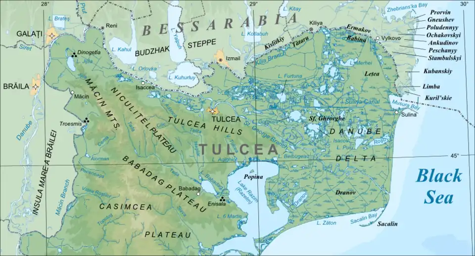
| |
| Desna River floodplains | Sumy 52°19′N 33°23′E / 52.317°N 33.383°E |
42.7 | |||
| Dnieper River Delta | Kherson | 260 | |||
| Dnieper-Orli floodplains | Dnipropetrovsk | 25.6 | |||
| Northern area of the Dniester Liman | Odesa | 200 | |||
| Land of Dniester-Turunchuk | Odesa | 760 | |||
| Aquatic-cliff complex of Karadag | Crimea | 224 | 17 November 2003 | Sublittoral marine areas up to 6 metres depth, bays, a narrow strip of pebble-boulder coast and coastal cliffs up to 120 m high | |
| Karkinitska and Dzharylgatska Bays | Kherson, Crimea 46°00′N 33°5′E / 46.000°N 33.083°E |
870 | 23 November 1995 | The Karkinit Bay is a bay of the Black Sea that separates the southwestern Crimean Peninsula from mainland Ukraine. | 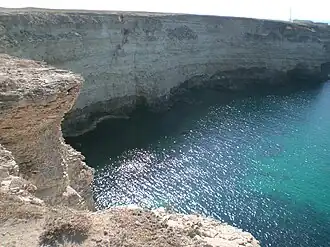
|
| Lake Kartal | Odesa | 5 | |||
| Cape Kazantyp rocky shore habitat | Crimea 45°28′N 35°51′E / 45.467°N 35.850°E |
2.51 | 29 July 2004 | A headland located in the northeastern part of the Crimean peninsula. | 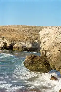
|
| Kremenchuk Floodplains | Poltava | ||||
| Kryva Bay and Kryva Spit | Donetsk | 14 | |||
| Kuhurluy | Odesa | 65 | |||
| Molochnyi Estuary | Zaporizhzhia | 224 | 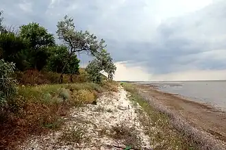
| ||
| Obitochna Spit | Zaporizhzhia | 20 | |||
| Cape Opuk nearshore habitat | Crimea 45°01′N 36°12′E / 45.017°N 36.200°E |
7.75 | |||
| Perebrody Peat Bogs | Rivne | 127.18 | |||
| Polissya Marshes | Zhytomyr | 21.45 | Marshes, mires, and floodplains surrounded by upland pine forests in Polissia Nature Reserve | ||
| Prypiat River floodplains | Volyn | 120 | |||
| Sasyk Lagoon | Odesa | 210 | 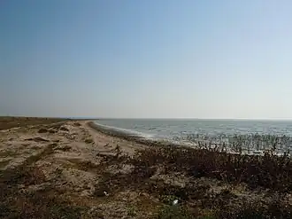
| ||
| Shahany-Alibei-Burnas lakes system | Odesa | 190 | |||
| Shatsk Lakes | Volyn | 328.5 | The largest Ukrainian lake complex, with 23 lakes separated by peat bogs, meadows and forests. | ||
| Lower Smotrych River | Khmelnytskyi | 14.8 | |||
| Stokhid River floodplains | Volyn | 100 | |||
| Lake Synevyr | Zakarpattia | 0.29 | The largest natural water body in the Ukrainian Carpathians | 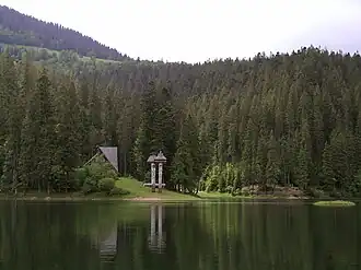
| |
| Central Syvash | Kherson, Crimea 46°07′N 34°15′E / 46.117°N 34.250°E |
800 | |||
| Eastern Syvash | Kherson, Crimea | 1,650 | |||
| Tendra Bay | Kherson | 380 | |||
| Tylihul Estuary | Odesa, Mykolaiv | 260 | 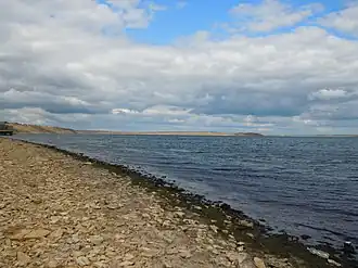
| ||
| Yahorlyk Bay[6] | Kherson, Mykolaiv | 340 | separated from Dnieper-Bug Estuary by Kinburn Peninsula |
References
- ^ a b "Ramsar List" (PDF). Ramsar.org. Retrieved 31 March 2013.
- ^ http://wetlands.biomon.org/?p=216
- ^ http://wetlands.biomon.org/?p=192
- ^ http://wetlands.biomon.org/?p=190
- ^ "Великий Чапельський під | Водно-болотні угіддя". Archived from the original on 25 December 2013. Retrieved 7 October 2018.
- ^ http://wetlands.biomon.org/?p=188
External links
- The Annotated Ramsar List of Wetlands of International Importance: Ukraine
- Wetlands of Ukraine with a list of all wetlands including recognized by the Ramsar Convention and potentially to be recognized in the future