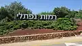
Ramot Naftali
Ramot Naftali
רמות נפתלי | |
|---|---|
 | |
| Etymology: Naftali Heights | |
 Ramot Naftali  Ramot Naftali | |
| Coordinates: 33°6′6″N 35°33′12″E / 33.10167°N 35.55333°E | |
| Country | |
| District | Northern |
| Council | Mevo'ot HaHermon |
| Affiliation | Moshavim Movement |
| Founded | 1945 |
| Founded by | Bnei Peled |
| Population (2023)[1] | 496 |
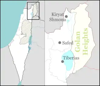
Ramot Naftali (Hebrew: רמות נפתלי, lit. 'Naftali Heights') is a moshav in northern Israel. Located in the Upper Galilee near the Lebanese border, it falls under the jurisdiction of Mevo'ot HaHermon Regional Council. In 2023 it had a population of 496.[1]
History
After the 1948 Arab–Israeli War, Ramot Naftali took over part of the land belonging to the newly depopulated Palestinian Arab villages of Qadas[2] and Al-Nabi Yusha'.[3]
-
 Ramot Naftali, 1945
 -
 Ramot Naftali, 1945
 -
 Ramot Naftali, 1945
 -
 Ramot Naftali, 1946
 -
 Ramot Naftali with Mount Hermon in distance, 1947
 -
 Ramot Naftali, 1947
 -
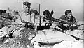 Members of the Yiftach Brigade at Ramot Naftali, 1948
 -
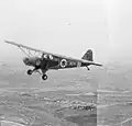 Israel Air Force plane above Ramot Naftali, 1948
 -
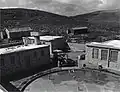
 Ramot Naftali, 1970
Geography
Near Ramot Naftali are the following communities: kibbutz Malkia, kibbutz Yiftah, and moshav Dishon.
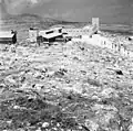
The community is located next to Metzudat Koach, a compound of the British Mandate, where 28 fighters were killed when it was captured during the War of Independence.
-
 Entrance to Ramot Naftali
 -
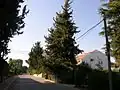 Street in Ramot Naftali
 -
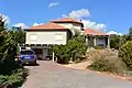 House in Ramot Naftali
 -
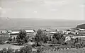
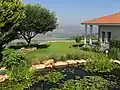 Garden in Ramot Naftali with the Hula Valley in the background
 -
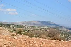
 View of the Mount Hermon from Ramot Naftali
References
- ^ a b "Regional Statistics". Israel Central Bureau of Statistics. Retrieved 11 August 2025.
- ^ Khalidi, Walid (1992). All That Remains: The Palestinian Villages Occupied and Depopulated by Israel in 1948. Washington D.C.: Institute for Palestine Studies. p. 485. ISBN 0-88728-224-5.
- ^ Khalidi, Walid (1992). All That Remains: The Palestinian Villages Occupied and Depopulated by Israel in 1948. Washington D.C.: Institute for Palestine Studies. p. 481. ISBN 0-88728-224-5.
External links
Wikimedia Commons has media related to Ramot Naftali.
- Ramot Naftali in Yigal Alon website