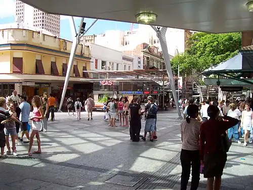
Queen Street bus station
Queen Street | |||||
|---|---|---|---|---|---|
 | |||||
| General information | |||||
| Location | Queen Street, Brisbane | ||||
| Coordinates | 27°28′13″S 153°01′30.6″E / 27.47028°S 153.025167°E | ||||
| Owned by | Department of Transport & Main Roads | ||||
| Operated by | Transport for Brisbane | ||||
| Platforms | 3 | ||||
| Bus routes | 18 | ||||
| Bus stands | 13 | ||||
| Construction | |||||
| Structure type | Underground | ||||
| Accessible | Yes | ||||
| Other information | |||||
| Station code | 000996 (platform 1A) 000997 (platform 1B) 000998 (platform 1C) 000999 (platform 1D) 001001 (platform 1E) 001002 (platform 1F) 001003 (platform 1G) 001004 (platform 1H) 001010 (platform 2A) 001011 (platform 2B) 001013 (platform 2C) 001009 (platform 3A) 001008 (platform 3B) | ||||
| Fare zone | go card 1 | ||||
| Website | Translink | ||||
| History | |||||
| Opened | 26 March 1988 | ||||
| |||||
Queen Street bus station is the primary bus terminus in Brisbane central business district in Queensland, Australia. It is underneath Uptown, Brisbane (formerly the Myer Centre) and Queen Street Mall. It opened on 26 March 1988. At the time it was the largest underground diesel bus station in the world.
The bus station serves 18 routes, operated by Transport for Brisbane.
A limited number of Northern Busway services directly connect King George Square busway station with Queen Street bus station. Most bypass Queen Street bus station and stop at the Cultural Centre busway station on the southern side of the Brisbane River, and vice versa. However, King George Square busway station and Queen Street bus station are only a short walking distance apart.
The southern portal connects the bus station to Victoria Bridge and the Cultural Centre busway station. The former western portal was converted into a tunnel and connects the bus station to King George Square busway station.[1][2]
The bus station was originally divided into several platforms named after Australian native animals. In June 2015, the platforms were renamed with letters and numbers.[3]
| Former platforms |
Current platforms |
|---|---|
| Kangaroo, Platypus | 1A–1H |
| Koala | 2A–2C |
| Crocodile | 3A–3B |
Services
Services depart as follows:[4]
| Platform 1 - servicing northern and southern suburbs | |||
|---|---|---|---|
| Platform | Route | Destination | Suburbs |
| 1A[5] | 100 (BUZ) | Forest Lake (via. Ipswich Rd & Inala) | South Brisbane, Woolloongabba, Annerley, Moorooka, Oxley, Durack, Inala, Forest Lake |
| 1B[6] | 330 (BUZ) | Bracken Ridge | RBWH, Chermside, Zillmere, Taigum, Bracken Ridge |
| 1C[7] | 150 (BUZ) | Browns Plains (via. Garden City & Runcorn) | South Brisbane, Griffith University, Upper Mount Gravatt, Eight Mile Plains, Runcorn, Calamvale, Brown Plains |
| 1D[8] | 140 (BUZ) | Browns Plains / Greenbank (via. Mains Rd & Sunnybank) | South Brisbane, Griffith University, Robertson, Sunnybank, Sunnybank Hills, Calamvale, Parkinson, Browns Plains, Greenbank |
| 1E[9] | 130 (BUZ) | Parkinson / Drewvale (via. Sunnybank & Algester) | South Brisbane, Griffith University, Robertson, Sunnybank, Sunnybank Hills, Calamvale, Algester, Parkinson, Drewvale |
| 1F[10] | 61 | Ashgrove | Petrie Terrace, Paddington, Bardon, Ashgrove |
| 134 | Griffith University | Buranda, Griffith University | |
| 1G[11] | 385 (BUZ) | The Gap | Paddington, Bardon, Ashgrove, The Gap |
| 1H[12] | 345 (BUZ) | Aspley | Normanby, Kelvin Grove, Newmarket, Alderley, Stafford, Stafford Heights, Chermside West, Aspley |
| Platform 2 - servicing eastern and western suburbs | |||
|---|---|---|---|
| Platform | Route | Destination | Suburbs |
| 2A[13] | 200 (BUZ) | Carindale (via. Old Cleveland Rd & Cribb Rd) | South Brisbane, Woolloongabba, Greenslopes, Cooparoo, Camp Hill, Carina, Carindale |
| 2B[14] | 453 | Mount Ommaney (via. Indooroopilly & Jindalee) | South Brisbane, Milton, Toowong, Taringa, Indooroopilly, Fig Tree Pocket, Sinnamon Park, Jindalee, Mount Ommaney |
| 454 | Riverhills (via. Indooroopilly & Horizon Dr) | South Brisbane, Milton, Toowong, Taringa, Indooroopilly, Fig Tree Pocket, Sinnamon Park, Mount Ommaney, Jamboree Heights, Middle Park, Westlake, Riverhills | |
| 460 | Heathwood (via. Indooroopilly, Richlands Station & Forest Lake Shops) | South Brisbane, Milton, Toowong, Taringa, Indooroopilly, Sinnamon Park, Mount Ommaney, Jamboree Heights, Richlands, Forest Lake, Pallara, Heathwood | |
| 2C[15] | 205 | Carindale | Buranda, Greenslopes, Coorparoo, Camp Hill, Carina Heights, Carindale |
| Platform 3 - servicing southern suburbs | |||
|---|---|---|---|
| Platform | Route | Destination | Suburbs |
| 3A[16] | 180 (BUZ) | Garden City (via. South Bank, Cavendish Rd & Mansfield) | South Brisbane, Buranda, Greenslopes, Holland Park West, Holland Park, Mount Gravatt East, Mansfield, Wishart, Upper Mount Gravatt |
| 183 | Wishart | Holland Park, Mount Gravatt, Mansfield, Wishart | |
| 3B[17] | 119 | QEII Hospital (via. Orange Grove Rd & Buranda) | Buranda, Greenslopes, Tarragindi, Salisbury, Coopers Plains, QEII Hospital |
| 120 (BUZ) | Garden City (via. Orange Grove Rd & Griffith University) | South Brisbane, Buranda, Greenslopes, Tarragindi, Salisbury, Coopers Plains, QEII Hospital, Griffith University (Nathan), Upper Mount Gravatt | |
References
- ^ King George Square station TransLink
- ^ Inner Northern Busway - Queen Street to Roma Street Archived 18 March 2017 at the Wayback Machine CIMIC Group
- ^ TransLink Archived 10 May 2018 at the Wayback Machine TransLink Twitter Feed 22 June 2015
- ^ "250630-queen-street-station-locality-map.pdf". translink.widen.net. Retrieved 15 July 2025.
- ^ "Queen Street station, 1A, Brisbane City | Translink". Translink Division, Department of Transport and Main Roads. Retrieved 21 June 2022.
- ^ "Queen Street station, 1B, Brisbane City | Translink". Translink Division, Department of Transport and Main Roads. Retrieved 21 June 2022.
- ^ "Queen Street bus station | Translink". Translink Division, Department of Transport and Main Roads. Retrieved 21 June 2022.
- ^ "Queen Street station, 1D, Brisbane City | Translink". Translink Division, Department of Transport and Main Roads. Retrieved 21 June 2022.
- ^ "Queen Street station, 1E, Brisbane City | Translink". Translink Division, Department of Transport and Main Roads. Retrieved 21 June 2022.
- ^ "Queen Street station, 1F, Brisbane City | Translink". Translink Division, Department of Transport and Main Roads. Retrieved 21 June 2022.
- ^ "Queen Street station, 1G, Brisbane City | Translink". Translink Division, Department of Transport and Main Roads. Retrieved 21 June 2022.
- ^ "Queen Street station, 1H, Brisbane City | Translink". Translink Division, Department of Transport and Main Roads. Retrieved 21 June 2022.
- ^ "Queen Street station, 2A, Brisbane City | Translink". Translink Division, Department of Transport and Main Roads. Retrieved 21 June 2022.
- ^ "Queen Street station, 2b, Brisbane City | Translink". jp.translink.com.au. Retrieved 15 July 2025.
- ^ "Queen Street station, 2C, Brisbane City | Translink". Translink Division, Department of Transport and Main Roads. Retrieved 21 June 2022.
- ^ "Queen Street station, 3A, Brisbane City | Translink". Translink Division, Department of Transport and Main Roads. Retrieved 21 June 2022.
- ^ "Queen Street station, 3B, Brisbane City | Translink". Translink Division, Department of Transport and Main Roads. Retrieved 21 June 2022.
External links
- Queen Street bus station Translink