Port-au-Prince Arrondissement
Port-au-Prince Arrondissement
Arrondissement de Port-au-Prince Pòtoprens Awondisman | |
|---|---|
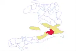 Map of the arrondissement (red) within the Ouest department. | |
| Country | |
| Department | Ouest |
| Area | |
| 735.78 km2 (284.09 sq mi) | |
| • Urban | 161.72 km2 (62.44 sq mi) |
| • Rural | 574.06 km2 (221.65 sq mi) |
| Population (2015)[1] | |
| 2,759,991 | |
| • Density | 3,800/km2 (9,700/sq mi) |
| • Urban | 2,663,925 |
| • Rural | 96,066 |
| Time zone | UTC-5 (Eastern) |
| Postal code | HT61— |
| Communes | 8 |
| Communal Sections | 34 |
| IHSI Code | 011 |
Port-au-Prince (Haitian Creole: Pòtoprens) is an arrondissement in the Ouest department of Haiti. It had 2,109,516 inhabitants at the 2003 Census which was estimated to have risen to 2,759,991 in 2015 in an area of 735.78 sq km (284.09 sq mi).[2][1] Postal codes in the Port-au-Prince Arrondissement start with the number 61.[3]
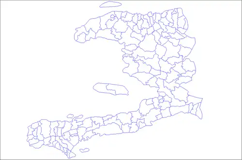
Communes
The arrondissement consists of the following communes:[4]
History
2010 7.0 earthquake
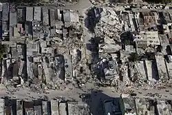
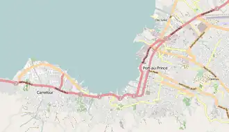
On 12 January 2010, a magnitude 7.0 earthquake struck in the arrondissement, the largest in Haiti in two centuries.[5] The city of Port-au-Prince suffered much damage, and estimates of upwards of 50,000 deaths, with many facilities destroyed.[6] In Pétion-Ville, the earthquake collapsed a hospital in the city.[7] In Carrefour, half of the buildings were destroyed in the worst-affected areas.[8] Roughly half the structures were destroyed in Gressier.[8]
Crime
By 2020, the level of crime in the Arrondissement was considered so bad that a survey team from the World Bank was unable to survey the whole Arrondissement beyond the communes of Port-au-Prince, Delmas, Pétion-Ville, and Tabarre. This was due to it being considered too dangerous to survey elsewhere because of the risk of gun violence and kidnapping in the rest of the Arrondissement.[9] By 2024, it was considered that a lot of the territory within the Port-au-Prince Arrondissement was directly under the control of the Haitian gangs.[10] Most of Port-au-Prince was being run by Jimmy "Barbecue" Chérizier and his Revolutionary Forces of the G9 Family and Allies gang alliance.[11]
See also
References
- ^ a b c "Population totale, population de 18 ans et plus ménages et densités estimés en 2015" [Total Population, Population of 18 and over, Households and Densities Estimated in 2015] (PDF). IHSI (in French). March 2015. Retrieved 8 May 2017.
- ^ Institut Haïtien de Statistique et d'Informatique (IHSI), 7 August 2003.
- ^ "Haiti- An update to its Administrative Organization" (PDF). Haiti Philately Society. Retrieved 5 July 2025.
- ^ "Département de l'Ouest". www.haiticulture.ch (in French). Retrieved 5 July 2025.
- ^ CNN News Morning, 13 January 2010
- ^ CNN, "The Situation Room", 15 January 2010
- ^ "Haitian Earthquake Causes Hospital Collapse". The New York Times. 12 January 2010. Archived from the original on 13 January 2010. Retrieved 12 January 2010.
- ^ a b Millar, Lisa (17 January 2010). "'Haiti Disaster Like "No Other"'". ABC News. Retrieved 5 July 2025.
- ^ "Collecting data amid civil unrest: First enterprise survey in Haiti". World Bank. Retrieved 5 July 2025.
- ^ Pellegrini, Sandra (16 October 2024). "Viv Ansanm: Living together, fighting united – the alliance reshaping Haiti's gangland". ACLED. Retrieved 5 July 2025.
- ^ "Haiti: Gang leader Jimmy 'Barbecue' Chérizier demands talks role". BBC News. 30 March 2024. Retrieved 5 July 2025.
18°30′39″N 72°38′02″W / 18.51083°N 72.63389°W