Pootatuck State Forest
| Pootatuck State Forest | |
|---|---|
 Pond Mountain, Squantz Pond and Candlewood Lake from the scenic overlook on Pootatuck State Forest's Blue Trail. | |
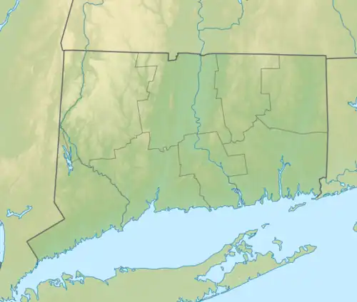 Location in Connecticut  Pootatuck State Forest (the United States) | |
| Location | New Fairfield, Connecticut, United States |
| Coordinates | 41°30′55″N 73°29′53″W / 41.51528°N 73.49806°W[1] |
| Area | 1,103 acres (4.46 km2)[2] |
| Elevation | 1,093 ft (333 m)[1] |
| Established | 1920s [3] |
| Governing body | Connecticut Department of Energy and Environmental Protection |
| Website | Pootatuck State Forest |
Pootatuck State Forest is a Connecticut state forest located mainly in the town of New Fairfield with a small fraction in Sherman. Recreational activities include hiking, mountain biking, letterboxing, hunting, birdwatching, snowmobiling, and cross-country skiing.[3][4] The main forest property borders on and can be accessed via trails from the adjacent Squantz Pond State Park.[4] The name of the forest was derived from the Potatuck people.
History
The land which became Pootatuck State Forest was purchased by Elliott B. Bronson of the State Park and Forest Commission in 1926. The area was protected from Connecticut Light & Power, who was acquiring large tracts of land around Squantz Pond. 960 acres were purchased at a price of $10/acre.[5]
Recreation
The park contains five miles of hiking trails. The Pine Hill Trail is a popular destination for hikers, and is known for the scenic views of Squantz Pond and Candlewood Lake.[6]
Pootatuck is a spot utilized by wild foragers. Morel mushrooms, fiddlehead ferns, and ramps are especially prized. Hen of the woods, chicken of the woods, black trumpet mushrooms, garlic mustard, and Japanese wineberry are also harvested.[7]
Parcels
There are two smaller Pootatuck State Forest property parcels in New Fairfield, Connecticut near to but disconnected from the main property and Squantz Pond State Park.[8]
- The Western Pootatuck State Forest parcel is located north of Beaver Bog Road just west of the intersection of Beaver Bog Road and Short Woods Road. (41°29′38″N 73°29′27″W / 41.493866°N 73.490825°W)
- The Southern Pootatuck State Forest parcel is located between Short Woods Road and CT Route 39 slightly south of the intersection of Beaver Bog Road and Short Woods Road. (41°29′40″N 73°29′05″W / 41.494402°N 73.484836°W)
References
- ^ a b "Pootatuck State Forest". Geographic Names Information System. United States Geological Survey, United States Department of the Interior.
- ^ Legislative Program Review and Investigations Committee (January 23, 2014). "State Parks and Forests: Funding" (PDF). Staff Findings and Recommendations. Connecticut General Assembly. p. A-3. Retrieved March 20, 2014.
- ^ a b "Connecticut State Forests Seedling Letterbox Series - Clues for Pootatuck State Forest". State Parks and Forests. Connecticut Department of Energy and Environmental Protection. Archived from the original on September 21, 2015. Retrieved September 30, 2013.
- ^ a b "Pootatuck State Forest". State Parks and Forests. Connecticut Department of Energy and Environmental Protection. Archived from the original on April 12, 2015. Retrieved September 30, 2013.
- ^ Hawes, Austin F. (2014). Jeff Ward (ed.). History of Forestry in Connecticut (PDF). New Haven, Connecticut: The Connecticut Agricultural Experiment Station. Retrieved August 10, 2025.
- ^ Ferrusi, Ralph (October 14, 2014). "Pine Hill viewpoints are scenic, worthy destinations". Poughkeepsie Journal. Retrieved August 10, 2025.
- ^ Schlack, Layla (April 9, 2024). "Vegan chef Chrissy Tracey goes foraging in CT woods for mushrooms, ramps and more ahead of her new cookbook 'Forage & Feast'". The Register Citizen. Retrieved August 10, 2025.
- ^ "ohranger.com". "Pootatuck State Forest". Retrieved November 21, 2016.
External links
- Pootatuck State Forest Connecticut Department of Energy and Environmental Protection
- Pootatuck State Forest Map Connecticut Department of Energy and Environmental Protection