Plounévézel
Plounévézel
Plonevell | |
|---|---|
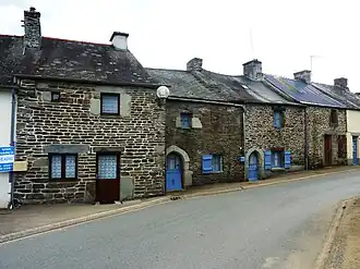 Old houses of Kergroas | |
.svg.png) Coat of arms | |
Location of Plounévézel | |
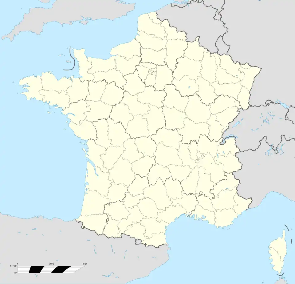 Plounévézel  Plounévézel | |
| Coordinates: 48°17′41″N 3°35′33″W / 48.2947°N 3.5925°W | |
| Country | France |
| Region | Brittany |
| Department | Finistère |
| Arrondissement | Châteaulin |
| Canton | Carhaix-Plouguer |
| Intercommunality | Poher |
| Government | |
| • Mayor (2020–2026) | Stéphane Cotty[1] |
Area 1 | 24.42 km2 (9.43 sq mi) |
| Population (2022)[2] | 1,153 |
| • Density | 47/km2 (120/sq mi) |
| Time zone | UTC+01:00 (CET) |
| • Summer (DST) | UTC+02:00 (CEST) |
| INSEE/Postal code | 29205 /29270 |
| Elevation | 75–181 m (246–594 ft) |
| 1 French Land Register data, which excludes lakes, ponds, glaciers > 1 km2 (0.386 sq mi or 247 acres) and river estuaries. | |
Plounévézel (French pronunciation: [plunevezɛl]; Breton: Plonevell) is a commune in the Finistère department of Brittany in north-western France.
Geography
Plounévézel is located in the east-central part of the Finistère department , in the historic region of Poher, northwest of Carhaix and southeast of the Monts d'Arrée and the Armorique Regional Natural Park.
The municipal boundaries are limited to the south and east by the Hyères (which separates it from Carhaix and Treffrin ), to the north-east by the Polan mill stream (which further downstream takes the name of Goaz ar Guelen stream), a right-bank tributary of the Hyères, which separates the commune from that of Carnoët (these two watercourses then also serving as a departmental boundary between the departments of Finistère and Côtes-d'Armor ), and to the west by the Dourcan stream, another right-bank tributary of the Hyères; their confluence at an altitude of 80 metres, at the level of the road bridge on the D 764 (former RN 764, now the Lorient-Roscoff axis , which runs along the western boundary of the commune), constitutes the lowest point of the commune, on a gentle slope facing south (the highest point, at an altitude of 164 metres, is located in the far north of the commune with Poullaouen, near Kerviolet. The town, in a relatively central location within the communal territory, is around 120 metres above sea level.
Population
Inhabitants of Plounévézel are called in French Plounévézelois.
|
| ||||||||||||||||||||||||||||||||||||||||||||||||||||||||||||||||||||||||||||||||||||||||||||||||||||||||||||||||||
| Source: EHESS[3] and INSEE (1968-2017)[4] | |||||||||||||||||||||||||||||||||||||||||||||||||||||||||||||||||||||||||||||||||||||||||||||||||||||||||||||||||||
See also
References
- ^ "Répertoire national des élus: les maires" (in French). data.gouv.fr, Plateforme ouverte des données publiques françaises. 13 September 2022.
- ^ "Populations de référence 2022" (in French). The National Institute of Statistics and Economic Studies. 19 December 2024.
- ^ Des villages de Cassini aux communes d'aujourd'hui: Commune data sheet Plounévézel, EHESS (in French).
- ^ Population en historique depuis 1968, INSEE
External links
- Official website (in French)
- Base Mérimée: Search for heritage in the commune, Ministère français de la Culture. (in French)
- Mayors of Finistère Association (in French)