Pittsville, Wisconsin
Pittsville, Wisconsin | |
|---|---|
 | |
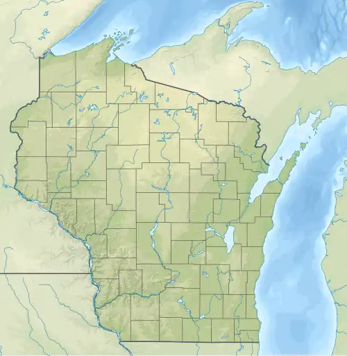
 Location of Pittsville in Wood County, Wisconsin. | |
 Pittsville  Pittsville | |
| Coordinates: 44°26′25″N 90°7′42″W / 44.44028°N 90.12833°W | |
| Country | |
| State | |
| County | Wood |
| Incorporated | March 30, 1887[1] |
| Area | |
• Total | 2.00 sq mi (5.18 km2) |
| • Land | 1.99 sq mi (5.15 km2) |
| • Water | 0.01 sq mi (0.03 km2) |
| Elevation | 1,033 ft (315 m) |
| Population | |
• Total | 813 |
| • Density | 410/sq mi (160/km2) |
| Time zone | UTC-6 (Central (CST)) |
| • Summer (DST) | UTC-5 (CDT) |
| Zip code | 54466 |
| Area codes | 715 & 534 |
| FIPS code | 55-63100[5] |
| GNIS feature ID | 1571567[3] |
| Website | pittsvillewi |
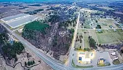
Pittsville is a city in Wood County, Wisconsin, United States. Located in a rural part of the county, Pittsville is surrounded by parks and public land, including; North Wood County Park and Campground, Powers Bluff, Dexter County Park and Campground, Sherwood County Park and Campground, Wood County Forest, Sandhill State Wildlife Area, and Black River State Forest. The population was 813 at the 2020 census. Pittsville is recognized as the exact center of Wisconsin.
History
The first settler in the Pittsville area was James Quick Severn, arriving in 1849,[6] but then leaving. Oliver Wright Pitts and his family arrived in late 1856. They lived in a barn-like structure on the riverbank on what is now the south side of town, which served as a "stopping place" (back-country inn) for loggers moving up and down the Yellow River. Oliver started a sawmill and the place was first called "Pitt's Mill." By 1858, when Oliver's father and family arrived, three other men had joined him there. Oliver's son Thomas taught the first school in 1859. The Pitts also built a shingle mill, and a hotel in the 1870s.[7]: 221–222
Several early mills in Pittsville sawed hardwood into barrel staves and headings, wagon stock, and hubs and spokes for wheels. The population grew. General stores opened and closed. Charles Houston served as a druggist for the town starting in 1879. Catholic services were first held around 1879 and a Congregational church was organized in 1881. A blacksmith shop started in 1881 or 1882.[7]: 222–225 St. John's Lutheran church was organized in 1888.[7]: 226
The railroad arrived in 1883, and with that, growth sped up. The village was platted that same year, and The Pittsville Independent newspaper started that year. In 1886 Pittsville incorporated as a village and the following year as a city. An issue of the paper from 1887 contains advertisements for Christenson & Bro General Store; Roscoe Doud, Son & Co. general store; C.V. Doud & Son general store; McConnell Sisters millinery; Cotey general merchandise and dry goods; McRaith tailor; City Drug Store; a watch dealer and repairer; Dawes boots and shoes; Pittsville market (meat?); Chet Doud livery; Johnson flour, butter and eggs; two saloons; dentist W.H. Packard; and a G.A.R. post. Hiles and Ward advertised surrounding lands from $2.50 to $6.00 per acre. Pittsville's first harness shop openend in 1888 - a flour and feed mill in 1890.[7]: 223–224 A Masonic lodge was chartered in 1886 and an Odd Fellows lodge in 1888.[7]: 227
In 1902 telephone lines reached Pittsville from Wisconsin Rapids. The Pittsville State Bank was organized in 1904. A creamery opened the same year, buying milk from Clark, Jackson and Wood counties. A co-op cheese factory opened in 1919.[7]: 226 The transition from logging and milling to agriculture was under way.
Bad fires destroyed large parts of Pittsville's downtown in 1911, 1924 and 1928. After the 1928 fire, many of the businesses moved from Main Street to 2nd Avenue, which is now highway 80.[6]
Governor Walter J. Kohler, Jr. frequently visited the Pittsville area during the 1950s. On June 27, 1952, he made an Official Proclamation declaring Pittsville the exact center of the State.[8]
Geography
Pittsville is located at 44°26′25″N 90°7′42″W / 44.44028°N 90.12833°W (44.440409, -90.128249).[9]
According to the United States Census Bureau, the city has a total area of 1.98 square miles (5.13 km2), of which, 1.97 square miles (5.10 km2) is land and 0.01 square miles (0.03 km2) is water.[10]
Demographics
| Census | Pop. | Note | %± |
|---|---|---|---|
| 1880 | 163 | — | |
| 1890 | 653 | 300.6% | |
| 1900 | 634 | −2.9% | |
| 1910 | 450 | −29.0% | |
| 1920 | 504 | 12.0% | |
| 1930 | 508 | 0.8% | |
| 1940 | 556 | 9.4% | |
| 1950 | 636 | 14.4% | |
| 1960 | 661 | 3.9% | |
| 1970 | 708 | 7.1% | |
| 1980 | 810 | 14.4% | |
| 1990 | 838 | 3.5% | |
| 2000 | 866 | 3.3% | |
| 2010 | 874 | 0.9% | |
| 2020 | 813 | −7.0% | |
| U.S. Decennial Census[11] | |||
2010 census
As of the census[12] of 2010, there were 874 people, 338 households, and 238 families living in the city. The population density was 443.7 inhabitants per square mile (171.3/km2). There were 378 housing units at an average density of 191.9 per square mile (74.1/km2). The racial makeup of the city was 97.9% White, 0.3% Native American, 0.8% Asian, and 0.9% from two or more races. Hispanic or Latino of any race were 0.8% of the population.
There were 338 households, of which 35.2% had children under the age of 18 living with them, 55.0% were married couples living together, 10.7% had a female householder with no husband present, 4.7% had a male householder with no wife present, and 29.6% were non-families. 25.4% of all households were made up of individuals, and 11.3% had someone living alone who was 65 years of age or older. The average household size was 2.55 and the average family size was 3.03.
The median age in the city was 36 years. 27.5% of residents were under the age of 18; 7.2% were between the ages of 18 and 24; 26% were from 25 to 44; 24.9% were from 45 to 64; and 14.5% were 65 years of age or older. The gender makeup of the city was 50.0% male and 50.0% female.
2000 census
As of the census[5] of 2000, there were 866 people, 331 households, and 238 families living in the city. The population density was 432.9 people per square mile (167.2/km2). There were 351 housing units at an average density of 175.5 per square mile (67.8/km2). The racial makeup of the city was 98.96% White, 0.12% African American, 0.35% Native American, 0.12% from other races, and 0.46% from two or more races. Hispanic or Latino of any race were 0.23% of the population.
There were 331 households, out of which 39.0% had children under the age of 18 living with them, 57.7% were married couples living together, 9.7% had a female householder with no husband present, and 27.8% were non-families. 25.7% of all households were made up of individuals, and 12.1% had someone living alone who was 65 years of age or older. The average household size was 2.60 and the average family size was 3.08.
In the city, the population was spread out, with 29.2% under the age of 18, 8.4% from 18 to 24, 30.8% from 25 to 44, 19.4% from 45 to 64, and 12.1% who were 65 years of age or older. The median age was 34 years. For every 100 females, there were 100.9 males. For every 100 females age 18 and over, there were 97.1 males.
The median income for a household in the city was $36,750, and the median income for a family was $41,964. Males had a median income of $30,500 versus $20,625 for females. The per capita income for the city was $16,257. About 2.2% of families and 5.4% of the population were below the poverty line, including 5.4% of those under age 18 and 12.3% of those age 65 or over.
Notable people
- Red Blanchard, country musician
- Amos E. Germer, Wisconsin legislator and lawyer
- MaryAnn Lippert, Wisconsin legislator and educator
- Matt Hanutke, Wisconsin first 4-years undefeated high school wrestler.
Education

The city is also home to the Pittsville School District, which has a school population of about 600 students.[13]
References
- ^ "Municipal Data System". Wisconsin Department of Administration, Division of Intergovernmental Relations. 2024. Archived from the original on November 8, 2024. Retrieved November 7, 2024.
- ^ "2019 U.S. Gazetteer Files". United States Census Bureau. Archived from the original on October 9, 2020. Retrieved August 7, 2020.
- ^ a b "US Board on Geographic Names". United States Geological Survey. October 25, 2007. Archived from the original on February 2, 2001. Retrieved January 31, 2008.
- ^ "Census Bureau profile: Pittsville city, Wisconsin". United States Census Bureau. May 2023. Retrieved May 13, 2025.
- ^ a b "U.S. Census website". United States Census Bureau. Archived from the original on December 27, 1996. Retrieved January 31, 2008.
- ^ a b "History of Pittsville". City of Pittsville. Retrieved August 2, 2025.
- ^ a b c d e f Jones, George O.; Norman S. McVean; et al. (1923). History of Wood County Wisconsin. Minneapolis – Winona: H. C. Cooper Jr. & Co.
- ^ Center of the State of Wisconsin historical marker. Archived from the original on October 19, 2020. Retrieved March 20, 2019.
- ^ "US Gazetteer files: 2010, 2000, and 1990". United States Census Bureau. February 12, 2011. Archived from the original on February 24, 2021. Retrieved April 23, 2011.
- ^ "US Gazetteer files 2010". United States Census Bureau. Archived from the original on January 25, 2012. Retrieved November 18, 2012.
- ^ "Census of Population and Housing". Census.gov. Archived from the original on April 26, 2015. Retrieved June 4, 2015.
- ^ "U.S. Census website". United States Census Bureau. Archived from the original on December 27, 1996. Retrieved November 18, 2012.
- ^ Pittsville School District
External links
- City of Pittsville
- Sanborn fire insurance maps: 1894 1914
- Maps from plat books: 1909 1928
Municipalities and communities of Wood County, Wisconsin, United States | ||
|---|---|---|
| Cities |  | |
| Villages | ||
| Towns | ||
| CDPs | ||
| Other communities | ||
| Indian reservation | ||
| Footnotes | ‡This populated place also has portions in an adjacent county or counties | |