Passu Sar
| Passu Sar پسو سر | |
|---|---|
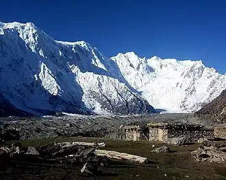 North face of the so called Batura wall with Passu (left half) and Batura (right half) massifs. Passu Sar is the summit on the left of the col in the center. On the right there are Muchu Chhish and Batura I-III. | |
| Highest point | |
| Elevation | 7,478 m (24,534 ft) Ranked 54th[1] |
| Prominence | 647 m (2,123 ft)[1] |
| Listing | Mountains of Pakistan |
| Coordinates | 36°29′16″N 74°35′16″E / 36.48778°N 74.58778°E |
| Geography | |
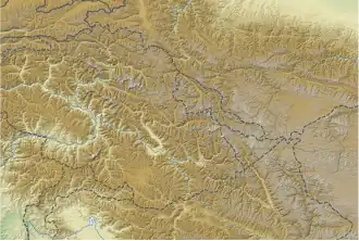 Passu Sar پسو سر Location in Gilgit-Baltistan 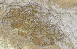 Passu Sar پسو سر Passu Sar پسو سر (Gilgit Baltistan) 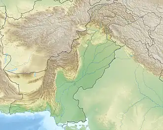 Passu Sar پسو سر Passu Sar پسو سر (Pakistan) | |
30km 19miles Pakistan India The major peaks in Karakoram are rank identified by height. Legend: Location in Gilgit-Baltistan | |
| Location | Hunza District, Gilgit-Baltistan, Pakistan |
| Parent range | Batura Muztagh, Karakoram |
| Climbing | |
| First ascent | 7 August 1994 by Max Wallner, Dirk Naumann, Ralf Lehmann, Volker Wurnig[2] |
| Passu Sar | |||
|---|---|---|---|
| Simplified Chinese | 帕蘇峰 | ||
| |||
Passu Sar (Urdu: پسو سر; or Passu I) is a mountain peak in the Batura Muztagh, a sub-range of the Karakoram mountain range, in the Hunza District of Gilgit-Baltistan, Pakistan. It is the high point of the Passu massif, which also includes Passu Diar (or "Passu East", "Pasu II"). The peak lies on the main ridge of the Batura Muztagh, about 7 km (4.3 mi) east of Batura Sar.
The date of the first successful ascent of Passu Sar is disputed. It was said to have been first climbed in 1978 by a Japanese-Pakistani team, in an expedition which claimed the life of Japanese climber Toshio Takahashi, who fell into a crevasse at 5,800 meters.[3] Another report dates the first assent on 7 August 1994 by the German team of Max Wallner, Dirk Naumann, Ralf Lehmann, and Volker Wurnig.[2][4]
See also
References
- ^ a b Jerzy Wala, Batura Muztagh, orographical sketch map, Gdansk, 1988.
- ^ a b American Alpine Journal, 1995, p. 296.
- ^ "Passu Sar Expedition {7478 m)". Great Karakora Expeditions. Retrieved 9 January 2021.
- ^ Gildea, Damien (2002). "Passu Sar, Attempt". American Alpine Journal. 44 (76). American Alpine Club: 364. Retrieved 9 January 2021.
External links
- Northern Pakistan detailed placemarks in Google Earth Archived 2012-02-04 at the Wayback Machine