Parbung
Parbung
Bungkhawpui | |
|---|---|
Village | |
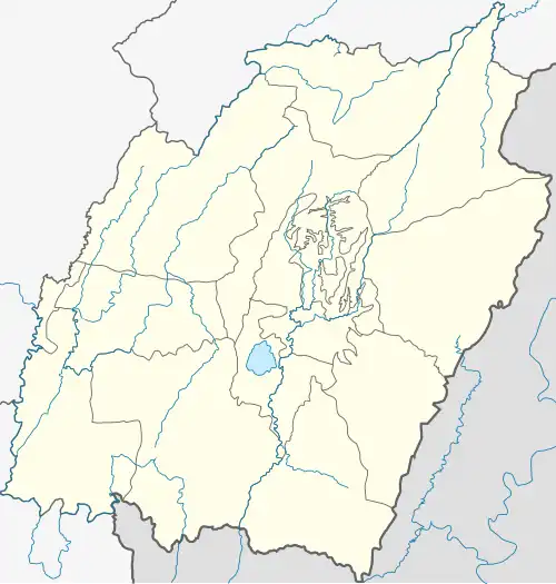 Parbung Location in Manipur, India  Parbung Parbung (India) | |
| Coordinates: 24°14′56″N 93°06′23″E / 24.24897°N 93.10636°E | |
| Country | |
| State | Manipur |
| District | Pherzawl District.[1] |
| Population (2011) | |
• Total | 2,545[2] |
| Languages | |
| • Official | Hmar |
| Time zone | UTC+5:30 (IST) |
| Vehicle registration | MN |
Parbung is a Hmar village in Pherzawl District, Manipur and is the headquarters of the Tipaimukh Sub-Division.[1][3]
Prior to 2017, it used to be the headquarters of the larger Tipaimukh Sub-Division,[4]
It is also the center of a district council constituency of the Churachandpur Autonomous District Council.[5][6]
History
Parbung village was founded by Mr. Ngamneivung in 1897. A memorial stone inscribes the following:
HRIETZINGNA
PARBUNG
KHUO SATTU - NGAMNEIVUNG
HLUO KUM - 11-4-1897
CHAN CHIN THA - 1910
Erected by KLC
Translation:
IN MEMORIAM
PARBUNG
Founder - Ngamneivung
Date of Residence - 11-4-1897
Reception of the Gospel - 1910
Erected by Khawthar Lenglai Club (KLC)
A monolith marking a hundred years of Parbung village is shown below.
Village Authority
| Chairman | Secretary | Members |
|---|---|---|
| H.H. Phaka | Darchunghnung | Thangkung, Chalrosung, Thangsang, T.Ruma, B.L. Thova, Hranghlei, Khumte, Vaia |
Public Utility
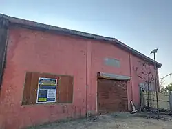
The village has a police station[7] and a community hall.
Healthcare
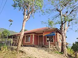
Community Health Centre (CHC) Parbung[8][9] or informally, Pherzawl district hospital[10] is the primary healthcare institution[11][12]
Transport
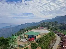
Parbung Heliport is currently undergoing construction in its final stages.[13][14][15]
The National Highway 2 (India) runs through Parbung, connecting Manipur and Mizoram by road.
Schools
Parbung has two private and one government run schools.[16]
Notable People
- Ngursanglur Sanate, BJP politician.
- Ngurdinglien Sanate, former Manipur minister.
References
- ^ a b "Villages | Pherzawl District | India".
- ^ "Village and Town Directory", District Census Handbook, Churachandpur. Directorate of Census Operations, Manipur. 2011. p. 86.
- ^ "Administrative Setup | Pherzawl District | India".
- ^ District Census Handbook, Churachandpur. Directorate of Census Operations, Manipur. 2011. p. 20.
- ^ "Autonomous District Council | Churachandpur District, Government of Manipur | India".
- ^ "Demography | Pherzawl District | India".
- ^ "Police | Pherzawl District | India".
- ^ "CHC, Parbung | Pherzawl District | India".
- ^ "Hospitals | Pherzawl District | India".
- ^ P. D. (15 July 2018). "Staff of Pherzawl District Hospital, Parbung". Pherzawl District Website.
- ^ "Manipur ICTC" (PDF). July 2010. Archived from the original (PDF) on 29 August 2019.
- ^ "Approval of Proposals under Emergency COVID Response Package: Phase-ll (ECRP-I1) for the State of Manipur for implementation from 01.07.2021 to 31.03.2022" (PDF). Archived from the original (PDF) on 2 March 2022.
- ^ "Helicopter services in North-Eastern region" (PDF). sansad.in.
- ^ "Parbung helipad to be inaugurated soon: Manipur CM Biren".
- ^ "Five heliports in Manipur to be fully operationalised by 2024 - the Frontier Manipur". 10 December 2022.
- ^ "Parbung Higher Secondary School | Pherzawl District | India". pherzawl.nic.in. Retrieved 5 August 2025.