Palampur, Himachal Pradesh
Palampur | |
|---|---|
Town | |
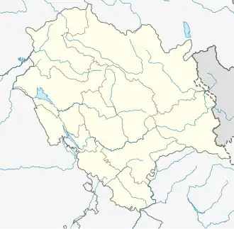 Palampur Location in Himachal Pradesh, India  Palampur Palampur (India)  Palampur Palampur (Asia) | |
| Coordinates: 32°06′35″N 76°32′12″E / 32.109722°N 76.536641°E | |
| Country | |
| State | Himachal Pradesh |
| District | Kangra |
| Named after | Combination of 3 words-Pani, Alam & Pur, meaning "lots of water" in local parlance[3] |
| Member of legislative Assembly | Ashish Butail[4] |
| Government | |
| • Type | Municipal Corporation |
| • Body | Municipal Corporation Palampur[5] |
| Area | |
• Total | 14.96 km2 (5.78 sq mi) |
| Elevation | 1,256 m (4,121 ft) |
| Population (2011) | |
• Total | 40,385[1][2] |
| • Rank | 4th in HP |
| Language | |
| • Official | Hindi[6] |
| • Additional official | Sanskrit[7] |
| Time zone | UTC+5:30 (IST) |
| PIN | 176061 |
| Telephone code | +91 01894 |
| Vehicle registration | HP-37 |
| Avg. annual temperature | 16.8 °C (62.2 °F) |
| Avg. summer temperature | 24 °C (75 °F) |
| Climate | Cwa |
| Website | mcpalampur |
Palampur is a hill station and a municipal corporation situated in the Kangra District in the Indian state of Himachal Pradesh. Palampur is served by the Palampur Himachal railway station (PLMX), situated in Maranda.
Etymology
The term Palampur is formed from the combination of three words—pani (water), alam (environment or 'abode of') and pur (settlement). Thus, Palampur means "a settlement where there is plenty of rainfall".[3]
History
Pre-independence
The expansion of tea estates starting from the mid-19th century led to the development of infrastructure in Palampur, including schools, colleges, and hospitals. The town also emerged as a hub for labourers involved in activities such as plucking, packing, and transporting tea leaves. The tea bush flourished in Palampur's climatic conditions, attracting mostly European tea estate owners.[8]
Geography
Palampur is at 32°07′N 76°32′E / 32.12°N 76.53°E,[9] at a height of around 1300 metres,[10] above sea level. It is in the northwestern region of Himachal Pradesh in north India and is 213 km from the hill station of Shimla.
Distance from major cities
- Distance from Chandigarh: 233 km
- Distance from Delhi: 464 km
- Distance from Shimla: 208 km
- Distance from Pathankot: 112 km
- Distance from Mumbai : 1,834 km
- Distance from Kasauli : 212 km
Climate
Palampur has a monsoonal-influenced humid subtropical climate (Cwa) with not so hot summers and cool winters. Late summer and early spring see massive amount of monsoonal rain.
| Climate data for Palampur | |||||||||||||
|---|---|---|---|---|---|---|---|---|---|---|---|---|---|
| Month | Jan | Feb | Mar | Apr | May | Jun | Jul | Aug | Sep | Oct | Nov | Dec | Year |
| Mean daily maximum °C (°F) | 12.8 (55.0) |
14.7 (58.5) |
18.1 (64.6) |
24.1 (75.4) |
25.7 (78.3) |
25.9 (78.6) |
25.2 (77.4) |
24.1 (75.4) |
23.3 (73.9) |
23.4 (74.1) |
20.6 (69.1) |
14.8 (58.6) |
21.1 (69.9) |
| Mean daily minimum °C (°F) | 1.8 (35.2) |
3.6 (38.5) |
8.8 (47.8) |
10.8 (51.4) |
14.5 (58.1) |
16.3 (61.3) |
16.7 (62.1) |
20 (68) |
15.9 (60.6) |
15.3 (59.5) |
10.7 (51.3) |
4.8 (40.6) |
11.6 (52.9) |
| Average precipitation mm (inches) | 119 (4.7) |
94 (3.7) |
112 (4.4) |
54 (2.1) |
56 (2.2) |
136 (5.4) |
710 (28.0) |
738 (29.1) |
324 (12.8) |
72 (2.8) |
23 (0.9) |
55 (2.2) |
2,493 (98.3) |
| Source: [11] | |||||||||||||
Demographics
As per the 2011 Indian Census, Palampur municipality had a total population of 3,543, of which 1,814 were males and 1,729 were females. It has a sex ratio of 953 females to 1000 males. Population within the age group of 0 to 6 years was 254. The total number of literates in Palampur was 3,004, which constituted 84.8% of the population with male literacy of 85.9% and female literacy of 83.6%. The effective literacy rate of 7+ population of Palampur was 91.3%, of which male literacy rate was 93.0% and female literacy rate was 89.6%. The Scheduled Castes and Scheduled Tribes population was 785 and 17 respectively. Palampur had 842 households in 2011.[2]
In 2020, after the creation of Palampur municipal corporation, it acquired the nearby panchayats and satellite areas, and the population was recounted to 40,385 after merging with the census figures taken in 2011.[1]
Government and politics
Civic administration
In 2020, after the formation of the Palampur municipal corporation, 15 wards were created by merging the satellite areas and 15 panchayats, increasing the total area to 14.96 km2 (5.78 sq mi) and a total population of 40,385, combining those of the merged areas.[1]
Education and research
- CSIR-Institute of Himalayan Bioresource Technology
- Chaudhary Sarwan Kumar Himachal Pradesh Agricultural University
- Sri Sai University
Notable persons
Soldiers
Politicians
References
- ^ a b c d "Palampur Municipal Corporation to have 15 wards: SDM". Tribune. 1 November 2020. Retrieved 26 February 2021.
- ^ a b "Census of India: Palampur". www.censusindia.gov.in. Retrieved 5 January 2020.
- ^ a b "Spatial Environmental Planning and Competence Building Project" (PDF). Hp.gov.in. Retrieved 20 March 2022.
- ^ "Personal information". evidhan.nic.in. Retrieved 25 September 2023.
- ^ "Municipal Council Palampur | District Kangra, Government of Himachal Pradesh | India". hpkangra.nic.in. Retrieved 24 February 2021.
- ^ "Report of the Commissioner for linguistic minorities: 52nd report (July 2014 to June 2015)" (PDF). Commissioner for Linguistic Minorities, Ministry of Minority Affairs, Government of India. pp. 33–34. Archived from the original (PDF) on 28 December 2017. Retrieved 16 February 2016.
- ^ Pratibha Chauhan (17 February 2019). "Bill to make Sanskrit second official language of HP passed". The Tribune. Shimla. Archived from the original on 18 February 2019. Retrieved 18 February 2019.
- ^ Shaukat Hayat Khan: Memoirs, Lahore:Jang Publications, 1993
- ^ "Maps, Weather, and Airports for Palampur, India".
- ^ "Palampur Guide". jüSTa. 29 March 2022.
- ^ "CLIMATE: PALAMPUR". Climate-Data. Retrieved 31 March 2017.
External links
 Palampur, Himachal Pradesh travel guide from Wikivoyage