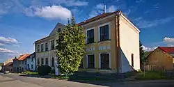
Ondratice
Ondratice | |
|---|---|
 Municipal office | |
 Flag 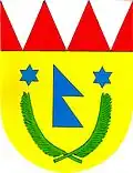 Coat of arms | |
 Ondratice Location in the Czech Republic | |
| Coordinates: 49°21′47″N 17°3′49″E / 49.36306°N 17.06361°E | |
| Country | |
| Region | Olomouc |
| District | Prostějov |
| First mentioned | 1348 |
| Area | |
• Total | 3.21 km2 (1.24 sq mi) |
| Elevation | 271 m (889 ft) |
| Population (2025-01-01)[1] | |
• Total | 345 |
| • Density | 110/km2 (280/sq mi) |
| Time zone | UTC+1 (CET) |
| • Summer (DST) | UTC+2 (CEST) |
| Postal code | 798 07 |
| Website | www |
Ondratice is a municipality and village in Prostějov District in the Olomouc Region of the Czech Republic. It has about 300 inhabitants.
Ondratice lies approximately 14 kilometres (9 mi) south of Prostějov, 30 km (19 mi) south-west of Olomouc, and 207 km (129 mi) south-east of Prague.
Demographics
| Year | Pop. | ±% |
|---|---|---|
| 1869 | 521 | — |
| 1880 | 643 | +23.4% |
| 1890 | 618 | −3.9% |
| 1900 | 696 | +12.6% |
| 1910 | 766 | +10.1% |
| 1921 | 739 | −3.5% |
| 1930 | 691 | −6.5% |
| 1950 | 618 | −10.6% |
| 1961 | 589 | −4.7% |
| 1970 | 479 | −18.7% |
| 1980 | 397 | −17.1% |
| 1991 | 360 | −9.3% |
| 2001 | 343 | −4.7% |
| 2011 | 322 | −6.1% |
| 2021 | 322 | +0.0% |
| Source: Censuses[2][3] | ||
References
- ^ "Population of Municipalities – 1 January 2025". Czech Statistical Office. 2025-05-16.
- ^ "Historický lexikon obcí České republiky 1869–2011" (in Czech). Czech Statistical Office. 2015-12-21.
- ^ "Population Census 2021: Population by sex". Public Database. Czech Statistical Office. 2021-03-27.
External links
Wikimedia Commons has media related to Ondratice.