Olonkinbyen
Olonkinbyen | |
|---|---|
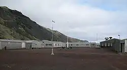 Olonkinbyen on Jan Mayen island | |
| Etymology: Olonkin City | |
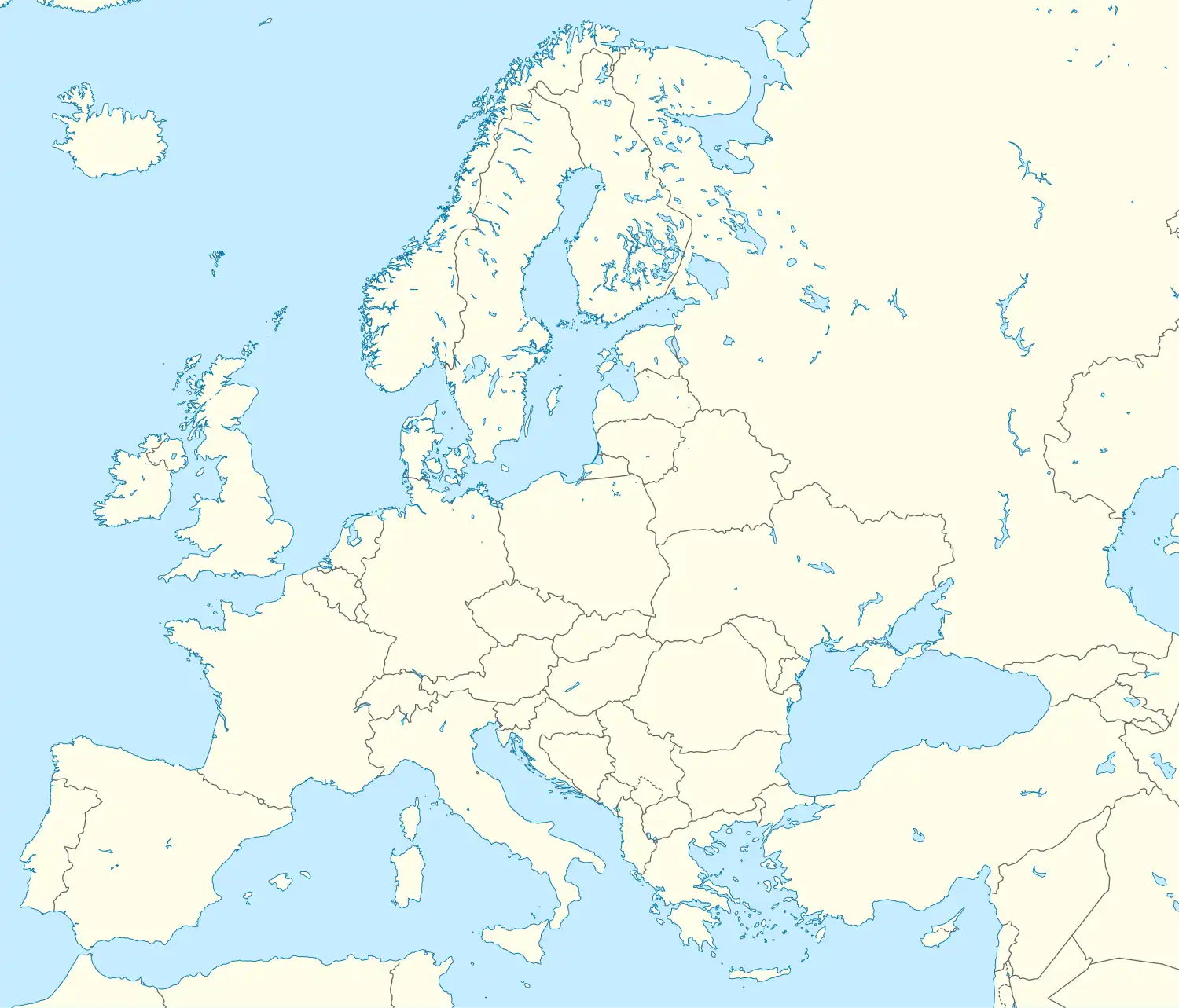 Olonkinbyen Location of Olonkinbyen in Europe | |
| Coordinates: 70°55′19″N 8°42′54″W / 70.92194°N 8.71500°W | |
| Country | |
| ISO | Svalbard and Jan Mayen |
| Island | Jan Mayen |
| Established | 1962 |
| Area | |
• Total | 0.3 km2 (0.1 sq mi) |
| Elevation | 8 m (26 ft) |
| Population | |
• Total | c. 18 |
| Time zone | UTC+01:00 (CET) |
| • Summer (DST) | UTC+02:00 (CEST) |
| Website | jan |
Olonkinbyen (literally The Olonkin Town) is the only settlement on the Norwegian island of Jan Mayen (aside from isolated cottage huts such as Puppebu[1]). It was named after Russian-Norwegian explorer Gennady Olonkin, who participated in Arctic expeditions and served on Jan Mayen during several periods between 1928 and 1936.[2]
The only inhabitants on the island are the 18 personnel, 14 working for the Norwegian Armed Forces and 4 for the Norwegian Meteorological Institute, though the population can temporarily increase to as many as 35. Olonkinbyen houses the staff that operate the meteorological observation station, Loran-C station, Jan Mayensfield air field and other infrastructure. The meteorological observation service staff are responsible for the radiosonde releases and synoptic weather observations. The crew of the meteorological station is engaged for six months at a time. Personnel rotation typically occurs twice per year, in April and October, and there are no permanent residents. However, the station chief — a military officer — generally stays for a full year.
Supplies are delivered eight times a year by aircraft, landing at Jan Mayensfield, located about 5 km northeast of Olonkinbyen. Fuel and heavy goods are transported by boat during the summer. The settlement generates its own electrical power via three generators.[3][4]
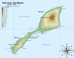
The settlement is located on the eastern coast of the southern part of Jan Mayen, in the area known as Trollsletta. It lies approximately 20 km northeast of Hoybergodden, 25 km northeast of Sørkapp (the southern tip of the island), and 5 km northeast of Rudolftoppen, the highest peak in southern Jan Mayen.
The station was built in 1961 and officially opened in 1962, originally in connection with the construction of the LORAN-C transmitter. The LORAN-C antenna was in operation until 2015 and was dismantled in 2017.[5]
In addition to its military and meteorological functions, the island hosts scientific instrumentation, including a seismograph operated by the University of Bergen, a magnetometer operated by the University of Tromsø, and a satellite-controlled radio station remotely managed from Bodø since 1995. The weather station, located approximately 3 km north of Olonkinbyen, performs radiosonde launches twice daily and issues synoptic observations six times per day.
Climate
Olonkinbyen has a tundra climate (Köppen classified as ET), the warmest month is August and the coldest month is March.
| Climate data for Olonkinbyen | |||||||||||||
|---|---|---|---|---|---|---|---|---|---|---|---|---|---|
| Month | Jan | Feb | Mar | Apr | May | Jun | Jul | Aug | Sep | Oct | Nov | Dec | Year |
| Mean daily maximum °C (°F) | −5 (23) |
−5 (23) |
−5 (23) |
−3 (27) |
0 (32) |
3 (37) |
5 (41) |
5 (41) |
3 (37) |
1 (34) |
−2 (28) |
−4 (25) |
−1 (31) |
| Mean daily minimum °C (°F) | −10 (14) |
−11 (12) |
−11 (12) |
−9 (16) |
−5 (23) |
−2 (28) |
0 (32) |
1 (34) |
−1 (30) |
−4 (25) |
−7 (19) |
−9 (16) |
−6 (22) |
| Average precipitation cm (inches) | 7.6 (3) |
5.1 (2) |
7.6 (3) |
5.1 (2) |
5.1 (2) |
5.1 (2) |
5.1 (2) |
7.6 (3) |
7.6 (3) |
10 (4) |
7.6 (3) |
7.6 (3) |
81.1 (32) |
| Source: [6] | |||||||||||||
References
- ^ Hytter på Jan Mayen (in Norwegian)
- ^ "Gennadij Olonkin". polarhistorie.no. Archived from the original on February 20, 2020. Retrieved October 1, 2016.
- ^ Images and Information on Olonkin City Archived 2006-05-22 at the Wayback Machine
- ^ "Oppgavene på Jan Mayen". Meteorologisk institutt. Retrieved October 1, 2016.
- ^ "Senderen på Jan Mayen tas ned" (in Norwegian). Norwegian Armed Forces. Retrieved July 18, 2025.
- ^ World Climate Guide