Ogasawara, Tokyo
Ogasawara
小笠原村 | |
|---|---|
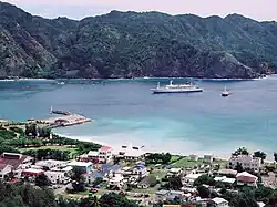
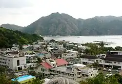 The main settlement on Chichijima | |
 Flag  Seal | |
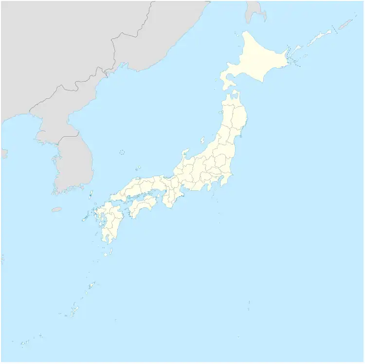
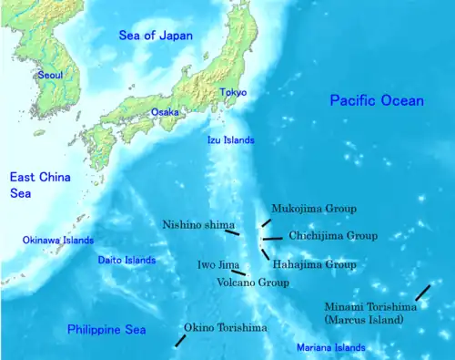 Location of the islands of Ogasawara Village | |
 Ogasawara Location in the North Pacific 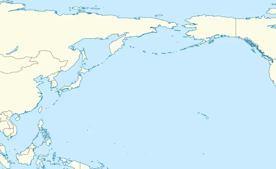 Ogasawara Ogasawara (North Pacific )  Ogasawara Ogasawara (Asia) | |
| Coordinates: 27°5′40″N 142°11′31″E / 27.09444°N 142.19194°E | |
| Country | Japan |
| Region | Kantō[1] |
| Prefecture | Tokyo Metropolis |
| Government | |
| • Mayor | Masaaki Shibuya |
| Area | |
• Total | 106.88 km2 (41.27 sq mi) |
| Population (October 1, 2023) | |
• Total | 2,930 |
| • Density | 27.4/km2 (71/sq mi) |
| Time zone | UTC+09:00 (JST) |
| City hall address |
|
| Website | en |
| Symbols | |
| Bird | Bonin white-eye |
| Flower | Munin Himetsubaki (Schima mertensiana) |
| Tree | Screw pine |
Ogasawara (小笠原村, Ogasawara-mura)[2] is a village in Ogasawara Subprefecture, Tokyo Metropolis, Japan, that governs the Bonin Islands, Volcano Islands, and three remote islands (Nishinoshima, Minamitorishima and Okinotorishima).
History
In 1940, five municipalities were created in the islands, which had been unincorporated before, two on Chichijima, two on Hahajima, and one on Iwojima.[3]
- Ōmura (大村) on Chichijima
- Ōgimura-Fukurosawa (扇村袋沢村) on Chichijima
- Kitamura (北村) on Hahajima
- Okimura (沖村) on Hahajima
- Iōtō (硫黄島村) on Iwojima (Iōtō), which includes all of the Volcano Islands
Both villages of Kita Iwo Jima became part of the newly created Iwojima municipality in 1940:
- Ishinomura (east)
- Nishimura (west)
Following World War II, the islands were administered by the United States. The islands were returned to Japanese control in 1968 and organized as Ogasawara Village.
Airport plan
In August 2020, the Tokyo Metropolitan Government held a council about a potential airport.[4] It would be operational in 10 years at the earliest.[4] The mayor of Ogasawara Village, Kazuo Morishita said the airport was a long-standing wish of the village, and Governor Koike said at a regular press conference that day, that the new plan would be an effective measure to secure necessary air routes for the islanders.[4]
Village crest
The village crest or emblem, used as the seal and on the flag, depicts three Bonin white-eye birds – one parent and two young. They are grouped such that together they represent the kanji ko (小), the first character of the native spelling of Ogasawara. These birds are regarded as a special natural monument (特別天然記念物), as the island is their only natural habitat.[5][6]
Geography
The municipality consists of the following groups and single isolated islands:
- Bonin Islands (小笠原群島, Ogasawara Guntō), 73 square kilometres (28 sq mi)
- Mukōjima rettō (聟島列島), 6.57 square kilometres (2.54 sq mi)
- Chichijima rettō (父島列島), 38.89 square kilometres (15.02 sq mi)
- Hahajima rettō (母島列島), 27.54 square kilometres (10.63 sq mi)
- Volcano Islands (火山列島, Kazan-rettō) 29.71 square kilometres (11.47 sq mi)
- Kita Iwojima (北硫黄島, Kita-Iōtō; lit. "North Sulphur Island") 5.57 square kilometres (2.15 sq mi)
- Iwojima (硫黄島, Iōtō; lit. "Sulphur Island") 20.6 square kilometres (8.0 sq mi)
- Minami Iwojima (南硫黄島, Minami-Iōtō; lit. "South Sulphur Island") 3.54 square kilometres (1.37 sq mi)
- Nishinoshima (西之島, lit. "Western Island"; also known as Rosario Island), a single isolated island west of Hahajima rettō and part of the Volcano Islands, 0.29 square kilometres (0.11 sq mi)[7]
- Okinotorishima (沖ノ鳥島 or 沖鳥島; lit. "Remote Bird Island") 0.01 square kilometres (0.0039 sq mi)
- Minamitorishima (南鳥島; lit. "Southern Bird Island"; also known as Marcus Island) 1.4 square kilometres (0.54 sq mi)
The southernmost (uninhabited) group is known as the Volcano Islands. 700 kilometres (430 mi) further south is Okinotorishima, and 1,900 kilometres (1,200 mi) further east is Minamitorishima.
The population of the municipality resides on Chichi-jima (pop. about 2300) and Haha-jima (pop. about 500). The administration and village hall is located in the village of Omura on Chichi-jima. In addition, there is an air base with 400 soldiers on Iwojima of the Volcano Islands.
Demographics
Per Japanese census data,[8] the population of Ogasawara has remained relatively steady in recent decades.
| Year | Pop. | ±% |
|---|---|---|
| 1980 | 1,879 | — |
| 1990 | 2,361 | +25.7% |
| 2000 | 2,824 | +19.6% |
| 2010 | 2,785 | −1.4% |
| 2020 | 2,929 | +5.2% |
Education
Ogasawara Village operates the islands' public elementary and junior high schools.[9]
- Ogasawara Village Municipal Ogasawara Elementary School (小笠原村立小笠原小学校) in Chichi-jima
- Ogasawara Village Municipal Ogasawara Junior High School (小笠原村立小笠原中学校) in Chichi-jima[10]
- Ogasawara Village Municipal Haha-jima Elementary School and Junior High School (小笠原村立母島小中学校) on Haha-jima
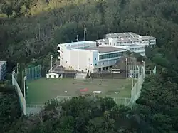
The Tokyo Metropolitan Government Board of Education operates Ogasawara High School on Chichi-jima.[11]
See also
References
- ^ "伊豆・小笠原諸島における 情報通信インフラ整備状況の調査" [Survey On Improvement Conditions Of Telecommunication Infrastructures In Izu-Ogasawara Islands] (PDF). Kantō Bureau of Telecommunications (in Japanese). Archived from the original (PDF) on 24 October 2007. Retrieved 16 October 2008.
- ^ "Ogasawara vill". Retrieved 4 June 2023.
- ^ "沿革" [History] (in Japanese). Archived from the original on 26 September 2009. Retrieved 15 September 2009.
- ^ a b c "小笠原に垂直離着陸可能な「ティルトローター機」案…滑走路500m、環境に配慮" [Proposal For A Tilt-Rotor Aircraft Capable Of Vertical Takeoff And Landing On Ogasawara Islands... 500m Runway, Environmentally Friendly] (in Japanese). Yomiuri. 2 August 2020. Archived from the original on 27 October 2020.
- ^ "小笠原村紋章の制定" [Establishment Of The Ogasawara Village Crest] (in Japanese). Ogasawara Village Office. Retrieved 21 August 2025.
- ^ "Natural Monuments". Ogasawara Village Office. Retrieved 21 August 2025.
- ^ Pacific Science (2006), vol. 60, no. 3:355–365
- ^ "Ogasawara population statistics". City Population. Thomas Brinkhoff.
- ^ "学校教育" [School Education] (in Japanese). Ogasawara Village Office. Archived from the original on 9 March 2018. Retrieved 8 March 2018.
- ^ "小笠原村立小笠原中学校" [Ogasawara Village Ogasawara Junior High School] (in Japanese). Ogasawara Village Ogasawara Junior High School.
- ^ "東京都立小笠原高等学校" [Tokyo Metropolitan Ogasawara High School] (in Japanese). Tokyo Metropolitan Board of Education. Archived from the original on 27 December 2017. Retrieved 27 December 2017.
External links
- Official website

- "Ogasawara subtropical moist forests". Terrestrial Ecoregions. World Wildlife Fund.