Oaklands, New South Wales
| Oaklands New South Wales | |
|---|---|
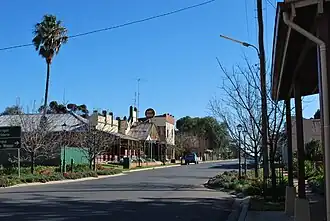 Milthorpe Street, the main street of Oaklands, 2009 | |
 Oaklands | |
| Coordinates | 35°32′0″S 146°10′0″E / 35.53333°S 146.16667°E |
| Population | 304 (2021 census)[1] |
| Postcode(s) | 2646 |
| Elevation | 128 m (420 ft) |
| Location |
|
| LGA(s) | Federation Council |
| County | Urana |
| State electorate(s) | Murray |
| Federal division(s) | Farrer |
Oaklands is a town in the Riverina district of southern New South Wales, Australia. It is 615 kilometres south-west of the state capital, Sydney, and 105 kilometres north-west of Albury. Oaklands is in the Federation Council local government area and, at the 2021 census, had a population of 304.[1]
Oaklands has a pub, bowls club, swimming pool, kindergarten-to-Year-12 school, and a day-care centre.
History
The earliest European settlers in the district of Oaklands were the Tyson brothers, James and William, who established themselves in 1846. [2]
Oaklands post office was opened on 16 June 1890.[3]
The major industry in the Oaklands region is agriculture, including the production of wheat and rice and is a major grain handling area. It is the home of the Oaklands Diuris, a threatened native orchid that is currently only found in the Oaklands region.[4]
Rail
A standard gauge branch line from the New South Wales Government Railways Main South line at The Rock was extended from Lockhart to Oaklands in 1912.[5]
A broad gauge branch line from the Victorian Railways North East line at Benalla was extended from Yarrawonga to Oaklands in 1938, creating a break-of-gauge station until the New South Wales line was closed south of Boree Creek. There were several stations between Yarrawonga and Oaklands, which are now the site of grains silos.[6]
After the conversion to standard gauge of the Victorian North East railway in 2008, the Oaklands branch was for a time a gauge orphan. Following persistent lobbying, the 113-kilometre (70 mi) branch was also converted to standard gauge.
Oaklands is 321 km by rail from Melbourne,[6] and was 675 km by rail from Sydney.[5]
| Preceding station | Former services | Following station | ||
|---|---|---|---|---|
| Terminus | Oaklands Line | Coorabin towards The Rock
| ||
Gallery
-
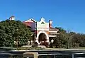
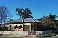 Former post office, 2009
 -
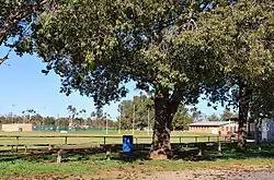 Australian rules football ground, 2009
 -
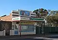 Former butcher shop, 2009
 -
 Former CBC bank, 2009
References
- ^ a b Australian Bureau of Statistics (28 June 2022). "Oaklands". 2021 Census QuickStats. Retrieved 28 September 2023.
- ^ Terry, Mona (1985). The Light Shines On. A History of Oaklands. Lions Club of Oaklands. p. 275. ISBN 0958929904.
- ^ Phoenix Auctions History. "Post Office List". Retrieved 13 February 2021.
- ^ NSW Department of Environment and Conservation - Oaklands Diuris Retrieved 1 November 2006
- ^ a b "Oaklands Branch". www.nswrail.net. Retrieved 11 December 2006.
- ^ a b "Oaklands Line". Vicsig. Retrieved 18 August 2025.
External links
 Media related to Oaklands, New South Wales at Wikimedia Commons