New Berlinville, Pennsylvania
New Berlinville, Pennsylvania | |
|---|---|
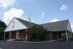 St. Andrew United Methodist Church in New Berlinville | |
 New Berlinville  New Berlinville | |
| Coordinates: 40°20′43″N 75°37′59″W / 40.34528°N 75.63306°W | |
| Country | United States |
| State | Pennsylvania |
| County | Berks |
| Township | Colebrookdale |
| Area | |
• Total | 1.51 sq mi (3.91 km2) |
| • Land | 1.51 sq mi (3.90 km2) |
| • Water | 0.00 sq mi (0.01 km2) |
| Elevation | 390 ft (120 m) |
| Population | |
• Total | 1,382 |
| • Density | 917.05/sq mi (354.12/km2) |
| Time zone | UTC-5 (Eastern (EST)) |
| • Summer (DST) | UTC-4 (EDT) |
| ZIP code | 19545 |
| Area codes | 610 & 484 |
| FIPS code | 42-53208 |
| GNIS feature ID | 1182285[3] |
New Berlinville is a census-designated place (CDP) in Colebrookdale Township, Pennsylvania. It is located along Pennsylvania Route 100, approximately one mile northeast of the borough of Boyertown. As of the 2010 census, the population was 1,368 residents.
| Census | Pop. | Note | %± |
|---|---|---|---|
| 2020 | 1,382 | — | |
| U.S. Decennial Census[4] | |||
References
- ^ "ArcGIS REST Services Directory". United States Census Bureau. Retrieved October 12, 2022.
- ^ "Census Population API". United States Census Bureau. Retrieved October 12, 2022.
- ^ "New Berlinville". Geographic Names Information System. United States Geological Survey, United States Department of the Interior.
- ^ "Census of Population and Housing". Census.gov. Retrieved June 4, 2016.
External links
 Media related to New Berlinville, Pennsylvania at Wikimedia Commons
Places adjacent to New Berlinville, Pennsylvania | |
|---|---|
