|
National Route 1B |
|---|
|
 |
|
| Length | 135 km (84 mi) |
|---|
|
| East end |   QL 1 / QL 4A in Dong Dang, Cao Loc QL 1 / QL 4A in Dong Dang, Cao Loc |
|---|
| Major intersections |
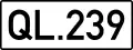 QL 239 in Van Quan QL 239 in Van Quan- QL 239 in Binh Gia
|
|---|
| East end | intersection near the Gia Bay Bridge, Thái Nguyên |
|---|
|
|
|---|
|
| Country | Vietnam |
|---|
|
|
|---|
|
|
|
|
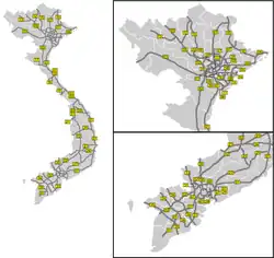
National Route 1B is a 135 km long east-west Vietnamese highway. The starting point is in Dong Dang town, Cao Loc district, Lang Son province at the intersection of National highways 1 and 4A. The end of the route is at the crossroads near Gia Bay bridge in Thai Nguyen city. National Route 1B runs through the districts of Cao Loc, Van Quan, Binh Gia, Bac Son, Vo Nhai, and Dong Hy.[1]
References
|
|---|
Expressways | | North–South | |
|---|
| Northern | |
|---|
| Central |
- CT.17 Vinh–Thanh Thủy
- CT.18 Vung Ang–Cha Lo
- CT.19 Cam Lo–Lao Bao
- CT.20 Quy Nhon–Pleiku–Le Thanh
- CT.21 Da Nang–Thanh My–Ngoc Hoi–Bo Y
- CT.22 Quang Nam–Quang Ngai
- CT.23 Phu Yen–Dak Lak
- CT.24 Khanh Hoa–Buon Ma Thuot
- CT.25 Nha Trang–Da Lat
- CT.26 Lien Khuong–Buon Ma Thuot
- CT.42 Quang Ngai–Kon Tum
|
|---|
| Southern | |
|---|
| Belt |
- CT.37 Hanoi Ring Road 3
- CT.38 Hanoi Ring Road 4
- CT.39 Hanoi Ring Road 5
- CT.40 HCMC Ring Road 3
- CT.41 HCMC Ring Road 4
|
|---|
| |
|---|
| National Roads | |
|---|