Muyinga Province
Muyinga Province | |
|---|---|
 | |
| Country | |
| Capital | Muyinga |
| Area | |
• Total | 1,836.26 km2 (708.98 sq mi) |
| Population (2008 census) | |
• Total | 632,409 |
| • Density | 340/km2 (890/sq mi) |
Muyinga Province was one of the provinces of Burundi. In 2025, it was merged into the new province of Buhumuza.[1]
Location
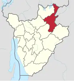
Muyinga Province was in the northeast of Burundi, bordering Tanzania to the east and Rwanda to the north. It was south of Kirundo Province, east of Ngozi Province and north of Karuzi Province and Cankuzo Province. Muyinga Province was in the Bweru natural region apart from an area in the north that is in the Bugesera natural region.[2]
Communes
It was divided administratively into the following communes:
- Commune of Buhinyuza
- Commune of Butihinda
- Commune of Gashoho
- Commune of Gasorwe
- Commune of Giteranyi
- Commune of Muyinga
- Commune of Mwakiro
References
- ^ Manirakiza, Patrick (2025-07-06). "Burundi's new Governors sworn in following major provincial reforms". Burundi Times. Retrieved 2025-07-24.
- ^ Atlas des quatre sites Ramsar, p. 12.
Sources
- Atlas des quatre sites Ramsar: Localisation et Resources (PDF) (in French), Ministry of Water, Environment and Urbanism, October 2014, retrieved 2024-06-22