Mount Tarampa, Queensland
| Mount Tarampa Queensland | |||||||||||||||
|---|---|---|---|---|---|---|---|---|---|---|---|---|---|---|---|
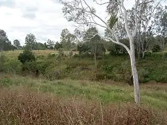 Lower Lockyer Creek, Mount Tarampa, 2011 | |||||||||||||||
 Mount Tarampa | |||||||||||||||
| Coordinates | 27°27′55″S 152°29′04″E / 27.4652°S 152.4844°E | ||||||||||||||
| Population | 501 (2021 census)[1] | ||||||||||||||
| • Density | 16.27/km2 (42.13/sq mi) | ||||||||||||||
| Postcode(s) | 4311 | ||||||||||||||
| Area | 30.8 km2 (11.9 sq mi) | ||||||||||||||
| Time zone | AEST (UTC+10:00) | ||||||||||||||
| Location |
| ||||||||||||||
| LGA(s) | Somerset Region | ||||||||||||||
| State electorate(s) | Nanango | ||||||||||||||
| Federal division(s) | Blair | ||||||||||||||
| |||||||||||||||
Mount Tarampa is a rural locality in the Somerset Region, Queensland, Australia.[2] In the 2021 census, Mount Tarampa had a population of 501 people.[1]
Geography
Lockyer Creek delineates the southern and eastern borders of Mount Tarampa. The region is primarily characterized by flat agricultural land, with the exception of a hill of 150 metres in elevation, also known as Mount Tarampa, situated in the southern portion of the area.[3]
History
Mount Tarampa Provisional School opened on 23 July 1906, becoming Mount Tarampa State School on 1 January 1909.[4]
Demographics
In the 2016 census, Mount Tarampa had a population of 481 people.[5]
In the 2021 census, Mount Tarampa had a population of 501 people.[1]
Education

Mount Tarampa State School is a government primary (Prep-6) school for boys and girls at 9 Profkes Road (27°27′19″S 152°29′24″E / 27.4552°S 152.4899°E).[6][7][8] In 2016, the school had an enrolment of 44 students with 4 teachers (3 equivalent full-time) and 6 non-teaching staff (3 equivalent full-time).[9] In 2018, the school had an enrolment of 60 students with 4 teachers and 7 non-teaching staff (4 full-time equivalent).[10]
There are no secondary schools in Mount Tarampa. The nearest government secondary school is Lowood State High School in Lowood to the east. There are also non-government schools in Gatton, Laidley, Rosewood, and Ipswich suburbs.[11]
Heritage listings
Mount Tarampa has the following heritage-listed sites:
- Mount Tarampa State School, 9 Profkes Road[12]
References
- ^ a b c Australian Bureau of Statistics (28 June 2022). "Mount Tarampa (SAL)". 2021 Census QuickStats. Retrieved 28 February 2023.
- ^ "Mount Tarampa – locality in Somerset Region (entry 44904)". Queensland Place Names. Queensland Government. Retrieved 29 December 2020.
- ^ "Queensland Globe". State of Queensland. Retrieved 12 September 2017.
- ^ Queensland Family History Society (2010), Queensland schools past and present (Version 1.01 ed.), Queensland Family History Society, ISBN 978-1-921171-26-0
- ^ Australian Bureau of Statistics (27 June 2017). "Mount Tarampa (SSC)". 2016 Census QuickStats. Retrieved 20 October 2018.
- ^ "Mt Tarampa State School". Mount Tarampa State School. 29 November 2020. Retrieved 13 July 2025.
- ^ "State and non-state school details". Queensland Government. 9 July 2018. Archived from the original on 21 November 2018. Retrieved 21 November 2018.
- ^ "Mount Tarampa State School". Retrieved 21 November 2018.
- ^ "Annual Report 2016" (PDF). Mount Tarampa State School. Archived (PDF) from the original on 12 September 2017. Retrieved 12 September 2017.
- ^ "ACARA School Profile 2018". Australian Curriculum, Assessment and Reporting Authority. Retrieved 28 January 2020.
- ^ "Layers: Locality; Schools and school catchments". Queensland Globe. Queensland Government. Retrieved 13 July 2025.
- ^ "Mt Tarampa State School (entry 602853)". Queensland Heritage Register. Queensland Heritage Council. Retrieved 10 February 2018.
External links
![]() Media related to Mount Tarampa, Queensland at Wikimedia Commons
Media related to Mount Tarampa, Queensland at Wikimedia Commons