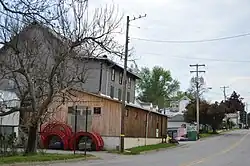
West Sunbury, Pennsylvania
West Sunbury, Pennsylvania | |
|---|---|
 | |
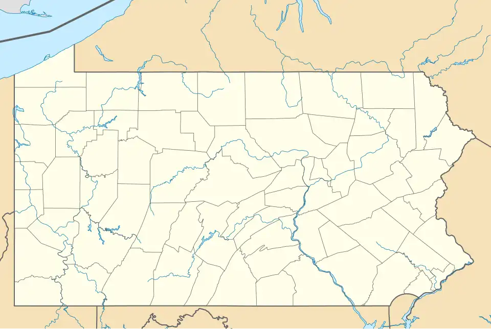
 Location of West Sunbury in Butler County, Pennsylvania. | |
 West Sunbury | |
| Coordinates: 41°00′22″N 79°53′46″W / 41.00611°N 79.89611°W | |
| Country | United States |
| State | Pennsylvania |
| County | Butler |
| Settled | 1828 |
| Incorporated | 1866 |
| Government | |
| • Type | Borough Council |
| • Mayor | Richard Wagner |
| Area | |
• Total | 0.11 sq mi (0.29 km2) |
| • Land | 0.11 sq mi (0.29 km2) |
| • Water | 0.00 sq mi (0.00 km2) |
| Population (2010) | |
• Total | 192 |
• Estimate (2019)[2] | 181 |
| • Density | 1,645.45/sq mi (634.82/km2) |
| Time zone | UTC-5 (Eastern (EST)) |
| • Summer (DST) | UTC-4 (EDT) |
| Zip code | 16061 |
| FIPS code | 42-84064 |
West Sunbury is a borough in Butler County, Pennsylvania, United States. The population was 192 at the 2010 census.[3]
History
On July 29, 1929, Amelia Earhart landed at the Sunbury Airport to attend a local air show. Less than two months later, September 17, she was forced to land there again due to bad weather while flying from Long Island to Kansas City.[4]
On the morning of December 25, 2022, the borough's primary marketplace burnt down.[5] This significantly impacted most of the residents, as the next closest general store was in a neighboring town.[6]
Geography
West Sunbury is located in north-central Butler County.[7] Pennsylvania Routes 138 and 308 run together through the center of the borough as Main Street. Via PA 308, it is 10 miles (16 km) south to Butler, the county seat.
According to the United States Census Bureau, West Sunbury has a total area of 0.11 square miles (0.29 km2), all land.[3]
The borough has a rudimentary privately owned public airport to the north of the urban area.[8][9][10][11]
Demographics
| Census | Pop. | Note | %± |
|---|---|---|---|
| 1870 | 216 | — | |
| 1880 | 243 | 12.5% | |
| 1890 | 238 | −2.1% | |
| 1900 | 254 | 6.7% | |
| 1910 | 283 | 11.4% | |
| 1920 | 217 | −23.3% | |
| 1930 | 246 | 13.4% | |
| 1940 | 259 | 5.3% | |
| 1950 | 262 | 1.2% | |
| 1960 | 252 | −3.8% | |
| 1970 | 216 | −14.3% | |
| 1980 | 203 | −6.0% | |
| 1990 | 177 | −12.8% | |
| 2000 | 104 | −41.2% | |
| 2010 | 192 | 84.6% | |
| 2019 (est.) | 181 | [2] | −5.7% |
| Sources:[12][13][14] | |||
As of the 2000 census,[13] there were 104 people, 42 households, and 25 families residing in the borough. The population density was 1,021.8 inhabitants per square mile (394.5/km2). There were 47 housing units at an average density of 461.8 per square mile (178.3/km2). The racial makeup of the borough was 100.00% White. Hispanic or Latino of any race were 1.92% of the population.
There were 42 households, out of which 33.3% had children under the age of 18 living with them, 47.6% were married couples living together, 14.3% had a female householder with no husband present, and 38.1% were non-families. 31.0% of all households were made up of individuals, and 14.3% had someone living alone who was 65 years of age or older. The average household size was 2.48 and the average family size was 3.19.
In the borough the population was spread out, with 26.9% under the age of 18, 7.7% from 18 to 24, 27.9% from 25 to 44, 22.1% from 45 to 64, and 15.4% who were 65 years of age or older. The median age was 36 years. For every 100 females there were 116.7 males. For every 100 females age 18 and over, there were 76.7 males.
The median income for a household in the borough was $25,625, and the median income for a family was $33,750. Males had a median income of $27,000 versus $15,750 for females. The per capita income for the borough was $12,643. There were 14.8% of families and 21.3% of the population living below the poverty line, including 32.1% of under eighteens and 12.5% of those over 64.
Arts and culture
In late June 2012, an airshow was held over West Sunbury.[15]
Education
Students in the borough and surrounding region belong to the Moniteau School District.[16]
Children in kindergarten through sixth grade receive education at the only elementary school, Dassa McKinney, located east of borough. Students continue their education at Moniteau Jr./Sr. High School, located to the north of borough.
Notable people
- Janet Anderson, 1982 U.S. Women's Open golf champion
- Bob Glenn, baseball player and civil engineer
- Brice Schwab, American football player
References
- ^ "2019 U.S. Gazetteer Files". United States Census Bureau. Retrieved July 28, 2020.
- ^ a b "Population and Housing Unit Estimates". United States Census Bureau. May 24, 2020. Retrieved May 27, 2020.
- ^ a b "Geographic Identifiers: 2010 Demographic Profile Data (G001): West Sunbury borough, Pennsylvania". U.S. Census Bureau, American Factfinder. Archived from the original on February 12, 2020. Retrieved March 27, 2014.
- ^ Strawser, Justin (December 26, 2022). "Amelia Earhart landed in Sunbury twice". The Daily Item. Retrieved August 2, 2025.
- Available for free are the following source: Strawser, Justin (December 27, 2022). "Amelia Earhart landed in Sunbury twice". The Daily Item. Retrieved August 2, 2025 – via Yahoo News.
{{cite web}}: CS1 maint: url-status (link)
- Available for free are the following source: Strawser, Justin (December 27, 2022). "Amelia Earhart landed in Sunbury twice". The Daily Item. Retrieved August 2, 2025 – via Yahoo News.
- ^ "Families displaced after fire tears through historic Butler County town market on Christmas - CBS Pittsburgh". www.cbsnews.com. December 26, 2022. Retrieved August 2, 2025.
- ^ "This small Pennsylvania community is still overcoming challenges nearly two years after a devastating fire - CBS Pittsburgh". www.cbsnews.com. September 30, 2024. Retrieved August 2, 2025.
- ^ "US Gazetteer files: 2010, 2000, and 1990". United States Census Bureau. February 12, 2011. Retrieved April 23, 2011.
- ^ "Sunbury Seaplane Base". www.pa.gov. Retrieved August 2, 2025.
- ^ "Sunbury Airport". www.pa.gov. Retrieved August 2, 2025.
- ^ "AirNav: 71N - Sunbury Airport". www.airnav.com. Retrieved August 2, 2025.
- ^ "71N - SUNBURY | iFlightPlanner". www.iflightplanner.com. Retrieved August 2, 2025.
- ^ "Census of Population and Housing". U.S. Census Bureau. Retrieved December 11, 2013.
- ^ a b "U.S. Census website". United States Census Bureau. Retrieved January 31, 2008.
- ^ "Incorporated Places and Minor Civil Divisions Datasets: Subcounty Resident Population Estimates: April 1, 2010 to July 1, 2012". Population Estimates. U.S. Census Bureau. Retrieved December 11, 2013.
- ^ "Butler Aircraft Modeling Society Marks Anniversary With Model Planes Show - CBS Pittsburgh". www.cbsnews.com. June 29, 2012. Retrieved August 2, 2025.
- ^ "2020 CENSUS - SCHOOL DISTRICT REFERENCE MAP: Butler County, PA" (PDF). U.S. Census Bureau. Retrieved October 18, 2024. - Text list
External links
Municipalities and communities of Butler County, Pennsylvania, United States | ||
|---|---|---|
| City |  | |
| Boroughs | ||
| Townships | ||
| CDPs | ||
| Unincorporated communities | ||
| Footnotes | ‡This populated place also has portions in an adjacent county or counties | |