Mlýnské Struhadlo
Mlýnské Struhadlo | |
|---|---|
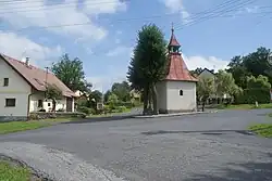 Chapel in the centre of Mlýnské Struhadlo | |
 Mlýnské Struhadlo Location in the Czech Republic | |
| Coordinates: 49°25′54″N 13°28′12″E / 49.43167°N 13.47000°E | |
| Country | |
| Region | Plzeň |
| District | Klatovy |
| First mentioned | 1437 |
| Area | |
• Total | 4.04 km2 (1.56 sq mi) |
| Elevation | 498 m (1,634 ft) |
| Population (2025-01-01)[1] | |
• Total | 54 |
| • Density | 13/km2 (35/sq mi) |
| Time zone | UTC+1 (CET) |
| • Summer (DST) | UTC+2 (CEST) |
| Postal code | 339 01 |
| Website | www |
Mlýnské Struhadlo is a municipality and village in Klatovy District in the Plzeň Region of the Czech Republic. It has about 50 inhabitants.
Mlýnské Struhadlo lies approximately 15 kilometres (9 mi) east of Klatovy, 36 km (22 mi) south of Plzeň, and 100 km (62 mi) south-west of Prague.
Demographics
| Year | Pop. | ±% |
|---|---|---|
| 1869 | 228 | — |
| 1880 | 245 | +7.5% |
| 1890 | 253 | +3.3% |
| 1900 | 242 | −4.3% |
| 1910 | 284 | +17.4% |
| 1921 | 280 | −1.4% |
| 1930 | 261 | −6.8% |
| 1950 | 192 | −26.4% |
| 1961 | 179 | −6.8% |
| 1970 | 125 | −30.2% |
| 1980 | 95 | −24.0% |
| 1991 | 69 | −27.4% |
| 2001 | 54 | −21.7% |
| 2011 | 52 | −3.7% |
| 2021 | 56 | +7.7% |
| Source: Censuses[2][3] | ||
References
- ^ "Population of Municipalities – 1 January 2025". Czech Statistical Office. 2025-05-16.
- ^ "Historický lexikon obcí České republiky 1869–2011" (in Czech). Czech Statistical Office. 2015-12-21.
- ^ "Population Census 2021: Population by sex". Public Database. Czech Statistical Office. 2021-03-27.
External links
Wikimedia Commons has media related to Mlýnské Struhadlo.