Mirkovce
Mirkovce | |
|---|---|
 | |
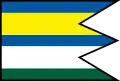 Flag | |
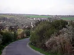
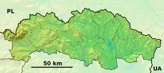 Mirkovce Location of Mirkovce in the Prešov Region  Mirkovce Location of Mirkovce in Slovakia | |
| Coordinates: 48°54′N 21°20′E / 48.90°N 21.33°E | |
| Country | |
| Region | |
| District | Prešov District |
| First mentioned | 1320 |
| Area | |
• Total | 9.55 km2 (3.69 sq mi) |
| Elevation | 320 m (1,050 ft) |
| Population (2021)[3] | |
• Total | 1,416 |
| Time zone | UTC+1 (CET) |
| • Summer (DST) | UTC+2 (CEST) |
| Postal code | 820 6[2] |
| Area code | +421 51[2] |
| Car plate | PO |
| Website | www |
Mirkovce (Hungarian: Mérk) is a village and municipality in Prešov District in the Prešov Region of eastern Slovakia.
History
In historical records the village was first mentioned in 1320.
Geography
The municipality lies at an altitude of 290 metres and covers an area of 9.54 km2 (3.68 sq mi) (2020-06-30/-07-01).[4]
Population
It has a population of about 1,393 people (2020-12-31).[5]
References
- ^ "Hustota obyvateľstva - obce [om7014rr_ukaz: Rozloha (Štvorcový meter)]". www.statistics.sk (in Slovak). Statistical Office of the Slovak Republic. 31 March 2022. Retrieved 31 March 2022.
- ^ a b c "Základná charakteristika". www.statistics.sk (in Slovak). Statistical Office of the Slovak Republic. 17 April 2015. Retrieved 31 March 2022.
- ^ "Počet obyvateľov podľa pohlavia - obce (ročne)". www.statistics.sk (in Slovak). Statistical Office of the Slovak Republic. 31 March 2022. Retrieved 31 March 2022.
- ^ "Statistic of Slovak places by Dušan Kreheľ – Export". Retrieved 5 July 2021.
- ^ "Statistic of Slovak places by Dušan Kreheľ – Export". Retrieved 5 July 2021.
External links
 Media related to Mirkovce at Wikimedia Commons
- Official website
