Mikado, Michigan
Mikado, Michigan | |
|---|---|
.jpg) | |
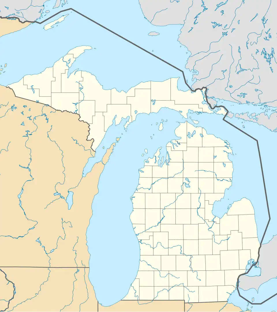 Mikado Location within the state of Michigan  Mikado Location within the United States | |
| Coordinates: 44°35′27″N 83°25′22″W / 44.59083°N 83.42278°W | |
| Country | United States |
| State | Michigan |
| County | Alcona |
| Township | Mikado |
| Settled | 1886 |
| Elevation | 653 ft (199 m) |
| Time zone | UTC-5 (Eastern (EST)) |
| • Summer (DST) | UTC-4 (EDT) |
| ZIP code(s) | 48745 |
| Area code | 989 |
| GNIS feature ID | 632295[1] |
Mikado (/maɪˈkeɪˈdoʊ/ my-KAY-doe)[2][3] is an unincorporated community in Alcona County in the U.S. state of Michigan.[1] The community is located within Mikado Township along the intersection of county highways F-30 and F-41.
As an unincorporated community, Mikado has no legally defined boundaries or population statistics of its own but does have its own post office with the 48745 ZIP Code.[4][5]
Geography

Mikado is a small rural community located about 30 miles (48 km) north of Tawas City.[2] It is located in northeast Mikado Township in southern Alcona County. The community is in the Northern Michigan region a few miles inland from the Lake Huron shoreline and sits at an elevation of 653 feet (199 m) above sea level.[1]
U.S. Route 23 runs about 5.0 miles (8.0 km) to the west along the Lake Huron shoreline, and M-72 is an equal distance to the north. The community is directly served by two county-designated highways. F-41 runs north–south, while F-30 run east–west through the center of the community. F-41 is sometimes referred to locally as Old M-171, which was its former designation as a state highway, while F-30 is referred to as Mikado–Glennie Road to the west and East Mikado Road to the east. Other nearby unincorporated communities include Gustin and Killmaster to the north, Alvin to the south, Springport to the northeast, and Greenbush to the east. The village of Lincoln is about 6.0 miles (9.7 km) to the north, and the city of Harrisville is about 10.5 miles (16.9 km) to the northeast.
Van Etten Creek is a small stream that runs through the community just to the southeast, while Pine River also flows just to the west of the community.[6][7] The Mikado Township Civic Center, which houses the township government, is located within the center of the community at 2291 South F-41.[8] Mikado is served by Oscoda Area Schools to the south in Oscoda in Iosco County.[9]
Mikado has its own post office that uses the 48745 ZIP Code. The post office is located in the center of the community at 2256 South F-41.[10] The post office serves a large area that includes the majority of Mikado Township, the southwest portion of Harrisville Township, the western portion of Greenbush Township, and the southeast portion of Millen Township. The post office also serves the northwestern portion of Oscoda Township to the south in Iosco County.[4][5]
History
Early history
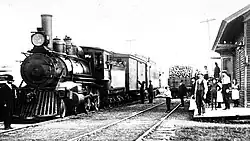
In the early 1880s, the Detroit, Bay City and Alpena Railroad expanded its railway line through Alcona County. The line was constructed a few miles inland just west of the community of Greenbush. Daniel Bruce, who resided in Greenbush, moved west in early 1886 and settled along the railway line. He built a hotel and livery barn to serve traveling lumbermen in anticipation of the growing lumber industry. Numerous other families settled along the railway, and the new community became known as West Greenbush.[11]
Bruce was very persistent in having a train depot built here. He walked overnight through the snow to arrive in Tawas City in time to convince railroad officials to agree to build the depot, in which he also paid $360 ($12,300 in 2025 dollars) of his own money toward the agreement. A train depot was built soon after and provided a direct link to West Harrisville to the north and Au Sable to the south.[12][13]
Near West Greenbush, the community of Handy was settled within close proximity to the north along the railway. Handy also received a train depot and was granted the area's first post office under the name Roy on March 23, 1886.[14][15] Roy and West Greenbush quickly grew as a lumbering communities, and Bruce petitioned the state to open a post office in his own community. He suggested the names Bruceville or Bruce Crossing for the name of the post office. The name Bruceville was rejected, and Bruce Crossing was already the name of another community in Michigan. The new post office was granted under the name Mikado by the assistant postmaster general, who had recently seen The Mikado opera and favored the name. This resulted in the usual designation of a Japanese name for a Michigan community.[12] The community of West Greenbush received a post office and changed its name to Mikado on May 11, 1886. Philip Partridge served as the first postmaster. The surrounding area was also set aside from Greenbush Township and established as Mikado Township that same year. St. Raphael Church was dedicated on August 13, 1895 in Mikado. The church remains in operation and is part of the Roman Catholic Diocese of Gaylord.[16]
The community of Roy failed to develop, and the post office was disestablished on June 23, 1898. The train depot also closed around 1900.[14][17] Mail service to Roy was now handled by the Mikado post office, although Roy soon after became a ghost town.[15]
Village of Mikado
.jpg)
In 1906, the community officially incorporated as a village. While the lumber industry began declining the area, Mikado transitioned into a farming community. Much of the land surrounding the community was converted into farmland, and the community continued to grow and included a large cedar yard, grain elevator, bank, the post office, sawmill, cheese factory, brick yard, and several grocery stores.[18] In 1907, Mikado received its own school in the form of a log one-room schoolhouse called the Bailey School.[19]
As a newly incorporated municipality, Mikado was listed in the 1910 census and recorded a population of 100.[20] Soon after, the lumber industry ceased operation in the area, and the train depot closed. The depot would later be demolished, and the railway lines were removed. Due to population loss and lack of further development, Mikado did not record its own individual population statistics in the 1920 census, although it was still listed on the census as an incorporated village within Mikado Township.[21] Mikado was not listed at all in the 1930 census or afterward, as at some point around that time, Mikado surrendered its village status and returned to an unincorporated community.[22]
Recent history
.jpg)
Mikado benefited from the original U.S. Route 23 (US 23), which ran directly through Mikado beginning in late-1926 as part of a more inland route running from Standish to Mackinaw City.[23] In 1932, US 23 was realigned to a more scenic route along the shores of Lake Huron, where it would instead pass through the community of Greenbush to the east.[24] The roadway through Mikado was then redesignated as state highway M-171, which served as a bypass route of US 23 from Oscoda to Spruce.[24] By early 1961, M-171 was decommissioned entirely.[25] In October 1970, the same roadway through Mikado was commissioned as one of the state's first county-designated highways when it was designated as F-41, which follows the same 31.8-mile (51.2 km) route of the former M-171.[26] While F-41 runs north–south through Mikado, the main east–west roadway through the community was also commissioned as F-30 in 1973. This roadway runs for 21.9 miles (35.2 km) from Greenbush westward to Glennie.[27]
With the closure of the train depot and removal of the railway lines, Mikado is no longer served by any railroad. The Lake State Railway runs to the east parallel to US 23 but has no connection to Mikado.[28]
The Bailey School, which opened in 1907, remained in operation until the end of the 1940–41 school year. At that time, students in Mikado were transferred to Oscoda Area Schools. The building remained unused until the township restored it in 1973. In 1998, the entire structure was disassembled and moved to Sturgeon Point State Park in Haynes Township. It now serves as a historic schoolhouse museum and is listed as an Alcona County Historic Site.[19][29]
In July 2011, the community of Mikado celebrated its 125th anniversary with a Fourth of July parade, which included an old-fashioned baseball game, music, children's activities, and other festivities.[18]
Notable people
- Edith Bondie, Chippewa basketmaker, born in Mikado[30]
References
- ^ a b c U.S. Geological Survey Geographic Names Information System: Mikado, Michigan
- ^ a b Michigan Economic Development Corporation (2025). "Pure Michigan: Mikado". Retrieved July 18, 2025.
- ^ State of Michigan (2025). "Pronunciation Guide - 'You Say it How in Michigan?'". Retrieved July 18, 2025.
- ^ a b "48745 ZIP Code map" (Map). Google Maps. Retrieved July 17, 2025.
- ^ a b UnitedStatesZipCodes.org (2025). "ZIP Code 48745: Mikado". Retrieved July 17, 2025.
- ^ U.S. Geological Survey Geographic Names Information System: Van Etten Creek
- ^ U.S. Geological Survey Geographic Names Information System: Pine River
- ^ Mikado Township (2025). "Mikado Township". Retrieved July 25, 2025.
- ^ Michigan Geographic Framework (15 November 2013). "Alcona County School Districts" (PDF). Retrieved July 18, 2025.
- ^ U.S. Postal Service (2025). "Mikado – Post Office". Retrieved July 24, 2025.
- ^ Romig 1986, p. 368.
- ^ a b Mikado Township Planning Commission (10 May 2017). "Mikado Township Master Plan (2017)" (PDF). Retrieved July 22, 2025.
- ^ Michiganrailroads.com (2025). "Station: Mikado, MI". Retrieved July 22, 2025.
- ^ a b Romig 1986, p. 487.
- ^ a b Dodge, Ray (1990) [1970, 1971]. Michigan Ghost Towns: Of the Lower Peninsula (formerly Michigan Ghost Towns I & II). Alpena, Michigan: Thunder Bay Press Michigan. p. 19. ISBN 0-932-21264-6.
- ^ Resurrection of the Lord Cluster (2025). "St. Raphael Church". Retrieved July 20, 2025.
- ^ Michiganrailroads.com (2025). "Station: Handy, MI". Retrieved July 20, 2025.
- ^ a b Peterson, Cheryl (6 July 2011). "Mikado readies for 125th celebration" (PDF). Alcona County Review. Retrieved July 22, 2025.
- ^ a b Alcona Historical Society. "Bailey School". Retrieved July 25, 2025.
- ^ U.S. Census Bureau (1913). "Thirteenth Census of the United States; taken in 1910: Statistics For Michigan" (PDF). p. 574. Retrieved July 24, 2025.
- ^ U.S. Census Bureau. "1920 United States Census: Michigan" (PDF). p. 12. Retrieved July 25, 2025.
- ^ U.S. Census Bureau. "1950 United States Census: Michigan" (PDF). p. 22-14. Retrieved July 24, 2025.
- ^ Michigan State Highway Department (December 1, 1926). Official Highway Condition Map (Map). [c. 1:823,680]. Lansing: Michigan State Highway Department.
- ^ a b Michigan State Highway Department & Rand McNally (October 1, 1932). Official Michigan Highway Map (Map). [c. 1:840,000]. Lansing: Michigan State Highway Department. §§ H12–I12. OCLC 12701053.
- ^ Michigan State Highway Department (1961). Official Highway Map (Map). [c. 1:918,720]. Lansing: Michigan State Highway Department. §§ G13–H13. OCLC 12701120, 51857665. Retrieved October 17, 2019 – via Michigan History Center. (Includes all changes through July 1, 1961)
- ^ "County Primary Road Marking System Okayed". The Holland Evening Sentinel. October 5, 1970. p. 6. ISSN 1050-4044. OCLC 13440201. Retrieved May 17, 2017 – via Newspapers.com.
- ^ Michigan Department of State Highways and Transportation (1974). Michigan, Great Lake State: Official Transportation Map (Map). c. 1:918,720. Lansing: Michigan Department of State Highways and Transportation. OCLC 12701177, 83138602. Retrieved October 17, 2019 – via Michigan History Center.
- ^ Michigan Department of Transportation (March 2017). "Michigan's Railroad System: Railroads Operating in Michigan" (PDF). Retrieved July 23, 2025.
- ^ Historical Marker Database (2025). "Bailey School". Retrieved July 25, 2025.
- ^ Smithsonian American Art Museum (2025). "Artist Edith Bondie". Retrieved July 15, 2025.
Sources
- Romig, Walter (October 1, 1986) [1973]. Michigan Place Names: The History of the Founding and the Naming of More Than Five Thousand Past and Present Michigan Communities (Paperback). Detroit, Michigan: Wayne State University Press. pp. 368 and 487. ISBN 978-0-8143-1838-6.
Municipalities and communities of Alcona County, Michigan, United States | ||
|---|---|---|
| City |  | |
| Village | ||
| Civil townships | ||
| CDPs | ||
| Other communities | ||
| Ghost town | ||