Manakara
Manakara | |
|---|---|
 Rail-run-way crossing | |
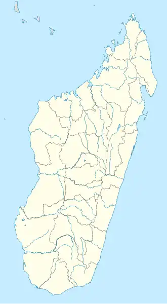 Manakara Location in Madagascar | |
| Coordinates: 22°09′0″S 48°00′0″E / 22.15000°S 48.00000°E | |
| Country | |
| Region | Fitovinany |
| District | Manakara |
| Area | |
• Total | 29.1 km2 (11.2 sq mi) |
| Population (2018 census) | |
• Total | 44,237 |
| • Density | 1,500/km2 (3,900/sq mi) |
| Postal code | 316 |
.jpg)
Manakara is a city in Madagascar. It is the capital of the Fitovinany Region and of the district of Manakara Atsimo. The city is located at the east coast near the mouth of the Manakara River and has a small port. Its temperature on average is 27 degrees Celsius, the high is 32 and low is 10.
Infrastructure
Railroad
Manakara is the endpoint of the Fianarantsoa-Côte Est railway (FCE), which connects the city of Fianarantsoa with the sea.
Roads
The National road 12, from Irondro (North, 118km, intersection with RN 25) - Manakara to Farafangana (224 km, south) and Vangaindrano (299 km).
The bridge over the Manakara River that connected the northern and southern parts of the city partially collapsed in September 2012.[1]
Airport
Manakara Airport is one of the few places where a railway crosses a runway. There are no commercial flights to Manakara.
Education
French international schools:
- École primaire française Les Pangalanes[2]
Twin cities
 Parthenay (France)
References
- ^ (in French) - www.madagate.com Manakara: Inconvénients d’un pont impraticable Archived 2013-01-31 at the Wayback Machine
- ^ "École primaire française Les Pangalanes." AEFE. Retrieved on May 7, 2015.
External links
22°09′S 48°00′E / 22.150°S 48.000°E
Capital: | ||
| Ikongo (17) - 310 | 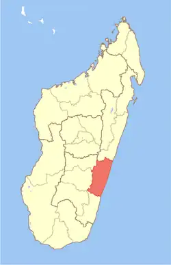 | |
| Manakara (42) - 316 |
| |
| Vohipeno (19) - 321 | ||
3 districts; 78 communes | ||