Malynivka, Kharkiv Oblast
Malynivka
Малинівка | |
|---|---|
 Coat of arms | |
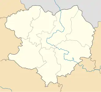 Malynivka Location in Kharkiv Oblast 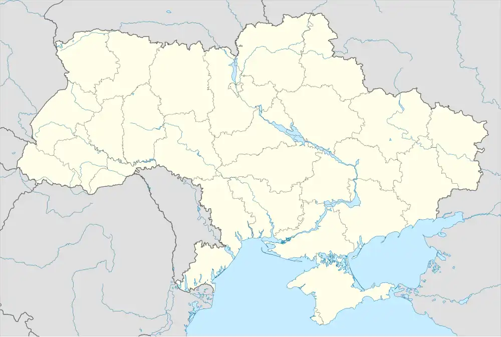 Malynivka Location in Ukraine | |
| Coordinates: 49°47′50″N 36°42′50″E / 49.79722°N 36.71389°E | |
| Country | |
| Oblast | |
| Raion | Chuhuiv Raion |
| Population (2022) | |
• Total | 7,428 |
| Time zone | UTC+2 (EET) |
| • Summer (DST) | UTC+3 (EEST) |
Malynivka (Ukrainian: Малинівка) is a rural settlement in Chuhuiv Raion of Kharkiv Oblast in Ukraine. It is located on the right bank of the Donets. Malynivka hosts the administration of Malynivka settlement hromada, one of the hromadas of Ukraine.[1] Population: 7,428 (2022 estimate).[2]
Until 26 January 2024, Malynivka was designated urban-type settlement. On this day, a new law entered into force which abolished this status, and Malynivka became a rural settlement.[3]
Geography
Malynivka is located in the central and northern parts of the Kharkiv Oblast.[4][5]
The territory of Malynivka is located on the Central Russian Upland, within the forest steppe natural zone. The relief of the settlement is an undulating plain with ravines and gullies.[6]
The climate of Malynivka is temperate continental with cold winters and hot summers. The average annual temperature is +8.7 °C (in January -4.5, in July +22). The average annual rainfall is 520 mm. The highest rainfall occurs in the summer. There are large forest areas (pine and deciduous trees) on the territory of the settlement. Malynivka is located on the left bank of the Siverskyi Donets River, 4 km from the town of Chuguev. The soils of the community are chernozems and meadow soils.[7][6][8]
Mineral resources of Malynivka: loams, clays, sandstones.[4]
Economy
Agriculture and processing industries will be developed in the village; Malynivka is known for its flour and greenhouse vegetables. The Prime distillery operates in the village.[9]
Transportation
Malynivka railway station is on the railway connecting Kharkiv and Kupiansk-Vuzlovyi. There is passenger traffic.[5]
The settlement has road access to Highway M03 connecting Kharkiv and Sloviansk.[10]
References
- ^ "Малиновская громада" (in Russian). Портал об'єднаних громад України. Retrieved 2025-07-15
- ^ Чисельність наявного населення України на 1 січня 2022 [Number of Present Population of Ukraine, as of January 1, 2022] (PDF) (in Ukrainian and English). Kyiv: State Statistics Service of Ukraine. Archived (PDF) from the original on 4 July 2022.
- ^ "Что изменится в Украине с 1 января". glavnoe.in.ua (in Russian). 2024-04-01.Retrieved 2024-04-28
- ^ a b Харківська область. Географічний атлас. Серія «Моя мала Батьківщина» – 2021 рISBN 978-617-7208-58-6 Retrieved 2025-07-15
- ^ a b "Історична довідка | Малинівська селищна рада Чугуївського району Харківська область". malinivska-sr.gov.ua (in Ukrainian). Retrieved 2025-07-15.
- ^ a b "Географія". Харківська обласна військова адміністрація (in Ukrainian). Retrieved 2025-07-15.
- ^ Харківська область. Географічний атлас. Серія «Моя мала Батьківщина» – 2021 р. ISBN 978-617-7208-58-6 Retrieved 2025-07-03
- ^ Сегіда К. Ю., Редін В. І., Чабань М. Т. Географія Харківської області: «Економічна та соціальна географія». – Харків, 2012. – 56 с. Retrieved 2025-07-15
- ^ "Стратегія розвитку Чугуївської міської територіальної громади на період до 2027 року". Чугуївська міська рада Харківської області (in Ukrainian). 2025-04-04. Retrieved 2025-07-15.
- ^ Постанова Кабінету Міністрів України від 30 січня 2019 року № 55 «Про затвердження переліку автомобільних доріг загального користування державного значення» Retrieved 2025-07-15