Malampa Province
Malampa | |
|---|---|
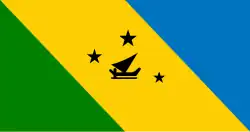 Flag | |
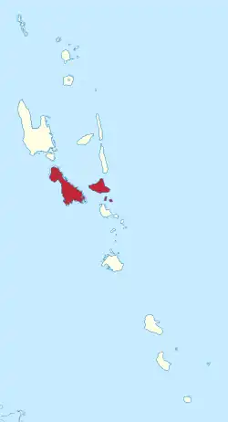 Malampa in Vanuatu | |
| Country | |
| Capital | Lakatoro |
| Area | |
• Total | 2,779 km2 (1,073 sq mi) |
| Population (2016)[1] | |
• Total | 40,928 |
| • Density | 15/km2 (38/sq mi) |
Malampa is one of the six provinces of Vanuatu, located in the center of the country. It consists of three main islands:
Penama takes its name from the first syllable of their names, being MALakula, AMbrym, and PAama.
It includes a number of other islands – the small islands of Uripiv, Norsup, Rano, Wala, Atchin and Vao off the coast of Malakula, and the volcanic island of Lopevi (currently uninhabited). Also included are the Maskelynes Islands and some more small islands along the south coast of Malakula.
Administrative divisions
Malampa Province are subdivided into ten area councils, which are further subdivided into populated places (i.e.: villages, communities, etc.).
- Central Malekula Area Council
- North Ambrym Area Council
- North East Malekula Area Council
- North West Malekula Area Council
- Paama Area Council
- South East Ambrym Area Council
- South East Malekula Area Council
- South Malekula Area Council
- South West Malekula Area Council
- West Ambrym Area Council
Population
It has a population of 36,722 (2009 census) [2] people and an area of 2,779 km2. Its capital is Lakatoro on Malakula.
Islands
| Name | Population | Area in km2 |
|---|---|---|
| Akhamb | 646 | |
| Ambrym | 7,275 | 678 |
| Arseo | 0 | |
| Atchin | 738 | |
| Avock | 241 | |
| Khoti | 14 | |
| Lopevi | 0 | |
| Malakula | 22,934 | 2,041 |
| Maskelynes Islands | 1,022 | |
| Norsup | 88 | |
| Paama | 1,627 | |
| Rano | 304 | |
| Tomman | 253 | |
| Uri | 28 | |
| Uripiv | 384 | |
| Vao | 898 | |
| Wala | 270 |
Mountains
- Pénot
- Maroum
Bays
- Black Sand Bay
- South West Bay
References
- ^ "Census & Surveys". Vanuatu National Statistics Office. Archived from the original on 2013-05-01. Retrieved 27 May 2013.
- ^ 2009 Census Summary release final Archived 2013-12-21 at the Wayback Machine - Government of Vanuatu