Madhubani, India
Madhubani
Mithila | |
|---|---|
District | |
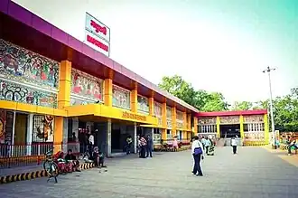 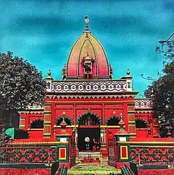 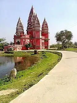 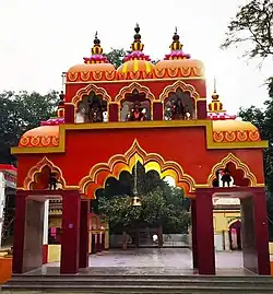  Clockwise from top: Madhubani City skyline, Madhubani railway station, Kali Mandir, Police Line mandir, Hanuman Mandir, School Student. | |
| Nickname: Art City of Mithila | |
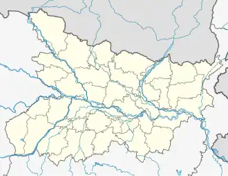 Madhubani Location in Bihar, India  Madhubani Madhubani (India) | |
| Coordinates: 26°21′07″N 86°04′19″E / 26.35194°N 86.07194°E | |
| Country | |
| State | |
| Region | Mithila (region) |
| District | Madhubani |
| Founded by | Mahaveer Singh, A resident of Thengha Village |
| Government | |
| • Type | Madhubani Municipal Corporation |
| Area | |
• Total | 46.56 km2 (17.98 sq mi) |
| Elevation | 56 m (184 ft) |
| Population (2011) | |
• Total | 164,156 |
| • Density | 3,500/km2 (9,100/sq mi) |
| Demonym | Maithil |
| Languages | |
| • Official | Maithili |
| • Additional official | Hindi, Maithili |
| • Regional Language | Maithili |
| Time zone | UTC+5:30 (IST) |
| PIN | |
| Telephone code | 06276 |
| ISO 3166 code | IN-BR |
| Vehicle registration | BR-32 |
| Sex ratio | 1000/926 ♂/♀ |
| Lok Sabha constituency | Madhubani |
| Vidhan Sabha constituency | Madhubani, Bisfi |
| Website | madhubani |
Madhubani is a city Municipal Corporation and headquarter of Madhubani district. Madhubani is situated in the Indian state of Bihar. It comes under Darbhanga Division. It is situated at 26 km northeast of Darbhanga City. The Madhuban Raj in Madhubani was created as a consequence.[2] The word "Madhuban" means "forest of honey", from which Madhubani is derived, but sometimes it is also known as "madhu"+"vaani" meaning "sweet" "voice/language".[3]

Geography
Madhubani is situated about 35 km from the Nepal Border, 26 km from Darbhanga, 180 km from Patna and 100 km from Saharsa.
Madhubani Town is located at 26°22′N 86°05′E / 26.37°N 86.08°E.[4] It has an average elevation of 56 metres.
Demographics
As of 2011 India census,[5] Madhubani Town had a population of 166,285. Males constitute 53% of the population and females 47%. Madhubani Town has an average literacy rate of 58.62, against the national average of 62.39%: male literacy is 70.14%, and female literacy is 46.16%. In Madhubani Town, 16% of the population is under 6 years of age.
Urban Haat
The first urban haat of Bihar have built in Araria Sangram of Madhubani district, which is known as Mithilahaat, which is a park in Madhubhani, made by the Bihar State Tourism Development Corporation (BSTDC) and inaugurated by Bihar Chief Minister Nitish Kumar on January 11, 2023.
Trade
Laukaha is a nearby town close to the border of Nepalese town of Thadi. Laukaha in India and Thadi in Nepal are a part of one of the agreed route for Mutual Trade between India and Nepal and import and export to Nepal happen via Laukaha.[6] Government of Nepal has set up a dedicated customs office in the town.[7] and Government of India has set up a Land Customs Station with a Superintendent level officer.[8]
Education
Notable people
- Nischalananda Saraswati , 145th Shankaracharya of the Govardhana Peetha at Puri.
- Bhogendra Jha
- Arknath Chaudhary
- Chandramani Datta
- Mahasundari Devi
- Sita Devi
- Ashish Jha
- Ganganath Jha
- Narendra Jha
- Sanjay Kumar Jha
- Sriram Jha
- Mangani Lal Mandal
- Ramprit Mandal
- Ram Prit Paswan
- Chaturanan Mishra
- Lalit Narayan Mishra
- Mohan Mishra
- Prem Chandra Mishra
- Maṇḍana Miśra
- Amrish Ranjan Pandey
- Mohammad Shams Aalam Shaikh
- Gajendra Thakur
- Vidyapati, Maithili poet
- Devendra Prasad Yadav
- Hukmdev Narayan Yadav
- Ashok Kumar Yadav
- Maithili Thakur
References
- ^ Madhubani
- ^ Singh, Mahaveer (1998). Land and society in India: agrarian relations in colonial North Bihar. Orient Blackswan. ISBN 978-81-250-0643-5.
- ^ "Madhubani | India | Britannica.com". Encyclopædia Britannica. Retrieved 12 November 2016.
- ^ "Maps, Weather, and Airports for Madhubani, India". fallingrain.com. Retrieved 12 November 2016.
- ^ "Census of India 2001: Data from the 2001 Census, including cities, villages and towns (Provisional)". Census Commission of India. Archived from the original on 16 June 2004. Retrieved 1 November 2008.
- ^ "India Nepal Trade Agreement. India-Nepal Foreign Treaty of Trade Agreement". eximguru.com. Retrieved 12 September 2019.
- ^ "Department of Customs, Nepal – Custom Contact Offices". customs.gov.np. Retrieved 12 September 2019.
- ^ "No. |".