Machar, Ontario
Machar | |
|---|---|
| Township of Machar | |
 Machar | |
| Coordinates: 45°52′N 79°28′W / 45.867°N 79.467°W | |
| Country | Canada |
| Province | Ontario |
| District | Parry Sound |
| Incorporated | 1889 |
| Government | |
| • Type | Township |
| • Mayor | Lynda Carleton |
| • Fed. riding | Parry Sound-Muskoka |
| • Prov. riding | Parry Sound—Muskoka |
| Area | |
| • Land | 182.65 km2 (70.52 sq mi) |
| Population (2021)[1] | |
• Total | 969 |
| • Density | 5.3/km2 (14/sq mi) |
| Time zone | UTC-5 (EST) |
| • Summer (DST) | UTC-4 (EDT) |
| Postal Code | P0A |
| Area codes | 705, 249 |
| Website | www.townshipofmachar.ca |
Machar is a township in the Canadian province of Ontario.
Located in the Almaguin Highlands region of Parry Sound District, Machar surrounds but does not include the village of South River.
Etymology
This township in Parry Sound District was named by Sir Oliver Mowat in 1875 after Rev. John Machar (1796-1863), a founder of the Presbyterian Church of Upper Canada in 1831 and of Queen's College (University) in 1841, where he served as principal from 1843 to 1853.[2]
Communities
- Bray Lake
- Eagle Lake
- King Lake
- Maecks Subdivision
Demographics
In the 2021 Census of Population conducted by Statistics Canada, Machar had a population of 969 living in 459 of its 875 total private dwellings, a change of 9.9% from its 2016 population of 882. With a land area of 182.65 km2 (70.52 sq mi), it had a population density of 5.3/km2 (13.7/sq mi) in 2021.[1]
|
|
| |||||||||||||||||||||||||||||||||||||||||||||||||||||||||||||||||||||
| Source: Statistics Canada[1][3][4] | |||||||||||||||||||||||||||||||||||||||||||||||||||||||||||||||||||||||
See also
References
- ^ a b c d "Machar, Ontario (Code 3549054) Census Profile". 2021 census. Government of Canada - Statistics Canada. Retrieved 2025-07-23.
- ^ Rayburn, Alan (1997). Place Names of Ontario. Toronto: University of Toronto Press. p. 202. ISBN 0-8020-7207-0.
- ^ 1996, 2001, 2006
- ^ "1971 Census of Canada - Population Census Subdivisions (Historical)". Catalogue 92-702 Vol I, part 1 (Bulletin 1.1-2). Statistics Canada. July 1973.
External links
Places adjacent to Machar, Ontario | |
|---|---|
| Towns | 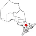 | |
|---|---|---|
| Townships | ||
| Villages | ||
| First Nations | ||
| Indian reserves | ||
| Local services boards | ||
| Unorganized areas | ||
| ||