Lys (Dora Baltea)
| Lys | |
|---|---|
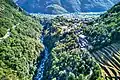
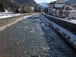 The Lys at Gressoney-Saint-Jean | |
.png) | |
| Location | |
| Country | Italy |
| Physical characteristics | |
| Source | |
| • location | Monte Rosa |
| • coordinates | 45°53′00″N 7°48′40″E / 45.88333°N 7.81111°E |
| • elevation | 2,500 m (8,200 ft) |
| Mouth | Dora Baltea |
• coordinates | 45°35′24″N 7°47′33″E / 45.5900°N 7.7925°E |
| Length | 40 km (25 mi) |
| Basin features | |
| Progression | Dora Baltea→ Po→ Adriatic Sea |
The Lys (Walser German: Liisu or Lyesu) is a small 40 kilometres (25 mi) river (classified as a torrente).
Geography
The Lys River originates from the Lys Glacier, located on the southern side of the Monte Rosa massif, at the foot of Vincent Pyramid (elevation: 4,215 metres / 13,829 ft). It flows through the Gressoney Valley, which is flanked by a road and passes through the following municipalities:
The Lys converges with the Dora Baltea (French: Doire baltée) as a right-bank tributary at Pont-Saint-Martin.
Its left-side tributaries include: Avant-Cir, Glassit, Loo, Mos, Niel, Pacoulla, and Tourrison. From the right, it receives: Rû de Nantay, Stolen, and Valbona.
The river is classified as a torrente, meaning a fast-flowing mountain stream typical of the Alps.
Gallery
-
 The sources of the Lys at the Lys glacier in the Monte Rosa mountain massif, below the Vincent Pyramid and close to the giant Lyskamm (4.533 m)
 -
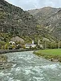
 The river close to Gaby
 -
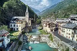
 The river close to Issime
 -
 In Fontainemore
 -
-
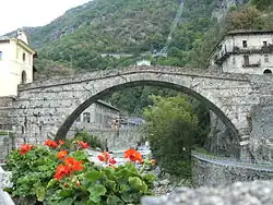
 The river Lys in the Perloz municipality