List of islands of the Channel Islands
This is a list of islands within the Channel Islands in the English Channel off the coast of Normandy. This group of islands includes the Bailiwick of Guernsey, the Bailiwick of Jersey and Chausey.
Inhabited islands
| Name | Image | Coordinates | Population | Area (hectares) | Elevation (metres) |
|---|---|---|---|---|---|
| Alderney | 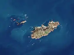 | 🌍[1] | 2167[2] (Mar 2023) | 780[a] | 90 |
| Sark | 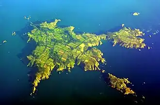 | 🌍 | 562[3] (Apr 2022) | 550[a] | 114 |
| Herm |  | 🌍 | 60 (2002) | 200[a] | 66 |
| Guernsey | 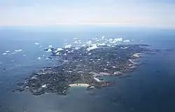 | 🌍 | 63276 (2019) | 6,340[a] | 110 |
| Jersey |  | 🌍 | 105500[4] (Dec 2017) | 11,820[a] | 143 |
| Grande-Île | 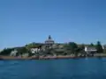 | 🌍 | 30 | 45 | 31 |
Uninhabited islands in the Bailiwick of Guernsey
Uninhabited islands, islets and rock formations include the following:[5]
Islets around Alderney
| Name | Image | Coordinates | Area (hectares) |
|---|---|---|---|
| Burhou[6] | 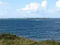 | 🌍 | 13[a] |
| Ortac | 🌍 | ||
| Les Casquets | 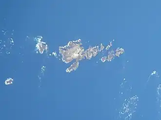 | 🌍 | |
| Houmet des Pies | 🌍[7] | ||
| Raz[8] | 🌍 | ||
| L'Etac de la Quoiré[9] | 🌍[7] | ||
| Clonque Rock[10] | 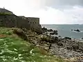 | 🌍[7] | |
| Renonquet | 🌍 | ||
| Coque Lihou | 🌍[7] | ||
| Corbet Rock | 🌍[7] | ||
| Fourquie | 🌍[7] | ||
| Houmet Herbé | 🌍[7] | ||
| Le Puits Jervais | 🌍[7] | ||
| L'Equêt | 🌍[7] | ||
| Les Etacs | 🌍[7] | ||
| Les Homeaux Florains | 🌍[7] |
Islets around Sark
| Name | Image | Coordinates | Area (hectares) |
|---|---|---|---|
| Brecqhou[6] | 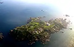 | 🌍 | 35.2[a][11] |
| Les Burons | 🌍[7] | ||
| Baleine | 🌍[7] | ||
| Moie de Breniere[6] | 🌍[7] | ||
| Moie de Port Gorey | 🌍[7] | ||
| Moie de la Bretagne | 🌍[7] | ||
| Moie de la Fontaine | 🌍[7] | ||
| Tintageu | 🌍[7] | ||
| Les Autelets[12] |  | 🌍[7] | |
| Bec du Nez |  | 🌍[7] | |
| L'Etac[6] |  | 🌍[7] | |
| Moie du Mouton | 🌍[7] | ||
| La Grune | 🌍[7] | ||
| Courbée du Nez | 🌍[7] |
Islets around Herm
| Name | Image | Coordinates | Area (hectares) |
|---|---|---|---|
| Caquorobert | 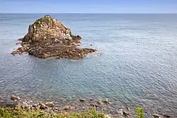 | 🌍 | |
| Jethou[6] | 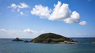 | 🌍 | 18[b] |
| Crevichon[6] | 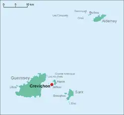 | 🌍 | 3.0[a] |
| Grande Fauconnière[6] | 🌍[1] | ||
| Goubinuere | 🌍[7] | ||
| Homet | 🌍[7] | ||
| La Conchée[13] | 🌍[7] | ||
| Godin | 🌍[7] | ||
| Hermetier | | 🌍 |
Islets around Guernsey
| Name | Image | Coordinates | Area (hectares) |
|---|---|---|---|
| Lihou[6] | 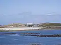 | 🌍 | 15[b] |
| Lihoumel | |||
| Houmets | 🌍 | ||
| Brehon | 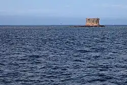 | 🌍 | |
| Les Hanois[5] | 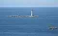 | 🌍[7] | |
| La Grosse Rock[14] | 🌍[7] | ||
| Crève Coeur | 🌍[7] | ||
| Cul de l'Autel | 🌍[7] | ||
| La Conchée | 🌍[7] | ||
| La Platte Fougère[15] | 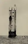 | 🌍 |
Uninhabited islands in the Bailiwick of Jersey
The Bailiwick includes the uninhabited (or nearly uninhabited) islands and islets of:[5]
| Name | Image | Coordinates | Area (hectares) | Notes |
|---|---|---|---|---|
| Minquiers[16] | 🌍 | Other islets nearby include Maîtresse Île / Maîtr' Île, Les Maisons, Le Niêsant, Les Faucheurs, La Haute Grune | ||
| Écréhous[17] | 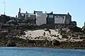 | 🌍 | Other islets nearby include Maîtr'Île, La Marmotchiéthe, Lé Bliantch'Île, Les D'mies, La Grand' Naithe, L'Êtchièrviéthe, Lé Fou, La Froutchie | |
| Les Dirouilles[17] | 🌍 | |||
| Pierres de Lecq[18] | 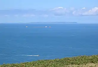 | 🌍 | Other islets nearby include L'Êtchièrviéthe; La Rocque du Nord; L'Êtaîse or L'Êtaîthe; Lé Bel; Lé Longis; La P'tite Mathe; La Grôsse (Great Rock); La Grand' Mathe; La Greune dé Lé or La Bonnette; La Greune du Seur-Vouêt; L'Orange; La Vouêtaîse, La Vouêtaîthe or La Vouêt'rêsse; La Cappe; La Douoche; Lé Byi; La Rocque Mollet; L'Êtché au Nord-Vouêt; La Galette; La Briarde; La Sprague; La Niêthole Jean Jean or Lé Gouoillot. | |
| Île Agois |  | 🌍 | ||
| La Motte |  | 🌍 | Tidal island, also known as Green Island. | |
| L'Islet | .jpg) | 🌍 | Site of Elizabeth Castle. | |
| Île au Guerdain |  | 🌍[7] | Site of Janvrin's Tomb. | |
| Icho | 🌍 | Site of Icho Tower . | ||
| L'Avarison | .jpg) | 🌍 | Site of Seymour Tower. | |
| Île Mâitre | 🌍[7] | |||
| Marmotier | 🌍[7] | |||
| La Sambue | 🌍[7] | |||
| Long Echet |  | 🌍[7] |
Islands in Chausey
The archipelago of Chausey comprises 365 islands at low tide, compared to only 52 islands at high tide.[19]
| Name | Image | Coordinates | Area (hectares) |
|---|---|---|---|
| Grande-Île | | 🌍 | 45 |
| La Genétaie | 🌍 | 1.82 | |
| La Meule | 🌍 | 1.38 | |
| La Houllée | 🌍 | 0.86 | |
| L'îles aux Oiseaux | 🌍 | 0.62 | |
| Grand Épail | 🌍 | 0.29 |
Notes
References
- ^ a b OpenStreetMap (in multiple languages), 9 August 2004, Wikidata Q936
- ^ https://alderney.gov.gg/data
- ^ https://img1.wsimg.com/blobby/go/5ff82f30-38d7-4ae5-98f1-e93b4ee65820/downloads/ITEM%2000%20-%20P%26F%20Census%202022%20Report%20CENSUS%20REPORT.pdf?ver=1735639335352
- ^ http://www.gov.je/Government/JerseyInFigures/Population/Pages/Population.aspx
- ^ a b c Coysh, Victor (1985). Channel Islets. Guernsey: Guernsey Press. ISBN 0902550128.
- ^ a b c d e f g h "Gull Breeding Sites in the Bailiwick of Guernsey". Archived from the original on 4 March 2016. Retrieved 4 November 2015.
- ^ a b c d e f g h i j k l m n o p q r s t u v w x y z aa ab ac ad ae af ag ah ai aj ak al Geographic Names Server, Wikidata Q1194038
- ^ "Fort Ile de Raz". Visit Alderney. Archived from the original on 18 July 2024. Retrieved 4 November 2015.
- ^ "Region 8. Longis Bay and Essex Hill to Bluestone Bay;". Flora.org.gg. Archived from the original on 18 July 2024. Retrieved 4 November 2015.
- ^ "Fort Clonque". The Landmark Trust. Archived from the original on 18 July 2024. Retrieved 4 November 2015.
- ^ https://www.brecqhou-stamps.co.uk/
- ^ "Les Autelets, Sark". Archived from the original on 18 July 2024. Retrieved 2 May 2019.
- ^ "MV Prosperity Memorial". BBC. Archived from the original on 18 July 2024. Retrieved 23 December 2019.
- ^ "2009 Liberation Grosse Rocque flag raised". BBC. Archived from the original on 18 July 2024. Retrieved 23 December 2019.
- ^ "Flashy Concrete Repair". Archived from the original on 13 October 2015. Retrieved 4 November 2015.
- ^ "Les Minquiers, Jersey". Ramsar.
- ^ a b "Les Écrehous & Les Dirouilles, Jersey". Ramsar.
- ^ "Les Pierres de Lecq". Ramsar.
- ^ Eames, Andrew (23 May 2023). "The beautiful Channel Island you've probably never heard of". The Daily Telegraph. Retrieved 11 June 2024.