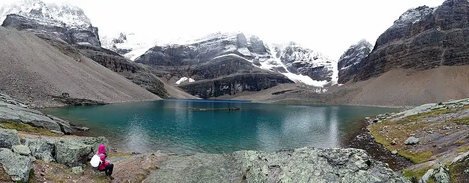
Lake Oesa
| Lake Oesa | |
|---|---|
 Lake Oesa & the trail (backgd) to Abbot Pass | |
 Lake Oesa | |
| Location | Yoho National Park, British Columbia, Canada |
| Coordinates | 51°21′18″N 116°18′14″W / 51.355°N 116.304°W |
| Type | lake |
| Surface elevation | 2,267 metres (7,438 ft) |
Lake Oesa is a body of water located at an elevation of 2,267 metres (7,438 ft)[1] in the mountains of Yoho National Park, near Field, British Columbia, Canada,[2] while a trail at the far end of the lake leads to Abbot Pass.
The lake gets its name from a Stoney language (Native American language) term for 'corner'.[3] It can be reached via a 3.2-kilometre (2.0 mi) climbing trail which starts at Lake O'Hara and ascends approximately 250 metres (820 ft).[4][5] An alpine trail along the Yukness Ledges connects Lake Oesa to nearby Opabin Lake.[6]
See also
References
- ^ Altitude at daftlogic.com
- ^ Lake O'Hara and Lake Oesa
- ^ Origin of Names in British Columbia
- ^ "Lake O'Hara Trails Map - Parks Canada". Archived from the original on 2016-03-05. Retrieved 2015-09-08.
- ^ "Lake Oesa - Lake O'Hara Trails Club" (PDF). Archived from the original (PDF) on 2016-08-26. Retrieved 2016-11-15.
- ^ Lake O'Hara to Lake Opabin via Lake Oesa and Yukness Ledges (trailpeak.com)