Lake Kucherla
| Lake Kucherla | |
|---|---|
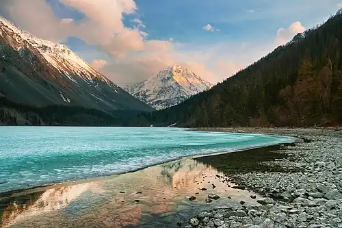 Sunset at Kucherla Lake | |
 Lake Kucherla 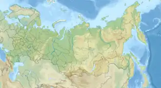 Lake Kucherla | |
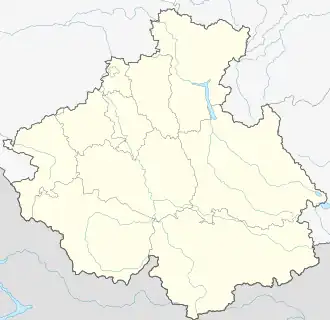
| Location | Siberia |
| Coordinates | 49°52′33″N 86°24′52″E / 49.87583°N 86.41444°E |
| Surface area | 3 square kilometres (1.2 sq mi) |
| Max. depth | 54.8 metres (180 ft) |
| Surface elevation | 1,790 metres (5,870 ft) |
Lake Kucherla (Russian: Кучерлинское) is located in the Altai Mountains and Katun Nature Reserve of Siberia.[1] Together with Lake Teletskoye, Belukha Mountain, and the Ukok Plateau it forms a natural UNESCO World Heritage Site entitled "Golden Mountains of Altai". It is a glacial lake.[2]
The lake is surrounded by alpine meadows and peaks over 3,000 metres (9,800 ft) high. It is situated at the height of 1,790 metres (5,870 ft) above mean sea level, stretching for 4.67 kilometres (2.90 mi) from north to south.[2] The lake area is 3 square kilometres (1.2 sq mi). It is up to 54.8 metres (180 ft) deep. The lake is popular with tourists and holds a stock of grayling.
References
- ^ Darin, A. V.; Chu, G.; Sun, Q.; Babich, V. V.; Kalugin, I. A.; Markovich, T. I.; Novikov, V. S.; Darin, F. A.; Rakshun, Y. V. (2020-09-23). "Archive data on climate changes and seismic events in glacial clays of Lake Kucherla (Altai region, Russia)". Geodynamics & Tectonophysics. 11 (3): 624–631. Bibcode:2020GeTec..11..624D. doi:10.5800/GT-2020-11-3-0495. ISSN 2078-502X.
- ^ a b Darin, Andrey (2019-12-05). "Layer Counting and Isotopic Analysis of the Recent Bottom Sediments of the Glacial Lake Kucherla (Russia, Gorny Altai)". 19th SGEM International Multidisciplinary Scientific GeoConference EXPO Proceedings 19th, Energy and Clean Technologies. Vol. 9. doi:10.5593/sgem2019V/4.2/S06.035. ISBN 978-619-7408-98-0.
External links
Wikimedia Commons has media related to Lake Kucherla.