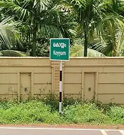
Koyyam
Koyyam | |
|---|---|
village | |
| Coordinates: 12°02′N 75°28′E / 12.04°N 75.46°E | |
| Country | |
| State | Kerala |
| District | Kannur |
| Government | |
| • Body | Chengalayi Grama panchayat |
| Languages | |
| • Official | Malayalam, English |
| Time zone | UTC+5:30 (IST) |
| PIN | 670142 |
| ISO 3166 code | IN-KL |
| Vehicle registration | KL-59 |
| Mayyil | Taliparamba |
| Literacy | 100%% |
| Assembly constituency | Irikkur |
| Lok Sabha constituency | Kannur |
| Climate | cool (Köppen) |
Koyyam (കൊയ്യം) is the part of Chengalai Panchayat, Kannur district, in the state of Kerala on the southwestern coast of India. Koyyam LP school is situated in "Koyyam". Koyyam Govt High School situated in Perinthaleri, Koyyam. The new bridge is constructed from koyyam to Velam, Mayyil. The transportation is very now much easier to Kannur Town after completing the Koyyam Bridge(23 km). The bridge made koyyam is a very accessible place to the new Kannur International Airport, Mattannur. Main Airport Road will be passing through Koyyam from chempanthotti & Valakkai. This will be parallel route for existing Parassinikkadavu from Taliparamba to Mattannur. Also it will be a major road connectivity for the people from high range areas like alakkode/ Karuvanchal/ Naduvil to the airport
History
While specific historical records of Koyyam village are limited, its story is woven into the broader historical and cultural fabric of Kannur and North Malabar:
1. Ancient Kingdoms & Regional Influence
The area that now comprises Kannur was once part of the Chera dynasty, a prominent southern kingdom ruling Kerala between the 9th and 12th centuries.
Following that era, the Mooshaka dynasty—later known as the Kolathiris—rose to prominence, governing the region, including areas around Koyyam.
Their kingdom engaged in extensive trade with Persia and Arabia during the 12th and 13th centuries.
2. Early Visitors & Trade Links
Medieval travelers such as Marco Polo, Faxian, and Ibn Battuta mentioned and visited the region around Kannur, reflecting its significance in trade and culture.
The area was even referred to as “Naura” in ancient Greek texts such as the Periplus of the Erythraean Sea, underscoring its maritime importance.
3. Colonial Times & Cultural Fusion
All the Raja's at that time maintained ties with the Portuguese and Dutch, and Fort Angelo was granted to the Portuguese under their permission.
Then British Ruled the area as a part of Madras Presidency. Even Uppu Satyagraha Salt March was supported by people from Koyyam.
4. Koyyam in Contemporary Times
Today, Koyyam is a vibrant village under the Chengalayi Gram Panchayat in Kannur district. It has achieved a remarkable 100% literacy rate, reflecting Kerala’s commitment to education.
Transport infrastructure has improved in recent years, especially with the construction of the bridge connecting Koyyam to Velam, making access to Kannur town and the Kannur International Airport much easier.
And it is a very fast-developing village in Kerala,
Temples & masjid
- Koyyam Sree Maha Vishnu Temple
- Madathil Chukannamma kshethram
- Vayakkott Sree Dharmasastha Kshethram
- Puliyathan Parambu Muthappan madappura
- Koyyam Puthiya Bhagavathi Kavu
- Koyyam Juma Masjid
- Shoukathul Islam madrasa
- Kadavath Chukannamma Kshethram
- Kizhakkan Kottam
- Chothepparamb Chukannamma Kshethram
- Pathalamoorthi Pottan Devasdhanam
Schools
- Koyyam LP School, Koyyam.
- Koyyam Govt High School.
- Parakkadi ALP School
- Perunthaleri AUP School
- Thavarool ALP School
Places of Interest Nearby
- Muthappan Temple.Parassinikkadavu
- Paithalmala Tourism
- Rajarajeshwara Temple Taliparamba
- Trichambaram Temple Sreekrishna Kshetram
- Cloud9 Farms & Resort
- Karimbam, Taliparamba Agriculture Farm
- Kottiyoor Temple
- Madayi Kavu
Transportation
Buses are available from Kannur town through Taliparamba and Mayyil to Koyyam often. Otherwise you can take a bus to Kasargod/Payyannur from the main bus stand (new/old) and get down at Taliparamba. 20min/30min inter well you will get bus from Taliparamba to Koyyam (Morning 7am to 7:45pm) Or else you can take bus to Mayyil via puthiyatheru from in front of railway station/caltux junction in NH and get down at mayyil and you can catch auto rickshaw from the town to reach Koyyam. Different Routes for the Personal Transport- 1. Talasseri - Anjarakkandi - Chalode -Kololam - Vadavankulam Jn - Cheruvathala Motta/Pavannur Motta - Mayyil/Velam - Koyyam 2. Kannur - Puthiyatheru Jn - Mayyil/Velam - Koyyam. 3. Kannur - Kakkad - Pulluppi - Kannadiparamba - Kolacheri Mukku - Mayyil/Velam - Koyyam 4. Kannur - Mele Chovva - Valiyannur - Munderi Motta - Chekkikulam - Cherubathala motta - Mayyil - Velam - Koyyam 5. Vadakara - Panoor - Koothuparamba-Mattannur/Anjarakkandi - Chalode - Kololam - Vadavankulam Jan Pavannur Motta/Cheruvathala Motta - Mayyil/Velam - Koyyam 6. Taliparamba - Muyyam - Bavuparambu - Nanicheri Bridge - Mullakkodi - Velam - Koyyam 7. Taliparamba - Chiravakku - Kurumathur - Valakkai - Koyyam 8. Parassini Kadavu - Padikkunnu - Velam - Koyyam
Enter/ Exit from the national highway passes through Valapattanam town/ Puthiya theru Jn. Or the new Kannur Bypass can be accessed at Kottakkunnu/ Mundayad/ Pulluppi Kadavu Goa and Mumbai can be accessed on the northern side and Cochin and Thiruvananthapuram can be accessed on the southern side. The road to the east of Iritty connects to Mysore and Bangalore. The nearest railway station is Kannur on Mangalore-Palakkad line. Trains are available to almost all parts of India subject to advance booking over the internet. There are airports nearby are at Mattanur, Mangalore and Calicut. All of them are international airports. direct flights are available to different countries and different states in India. Kannur International Airport is 20 to 25 km distance řrom Koyyam.