Kostiantynivka, Sumy Oblast
Kostiantynivka
Костянтинівка | |
|---|---|
Village | |
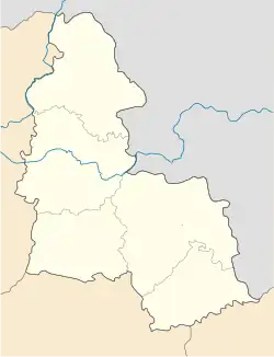 Kostiantynivka Location of Kindrativka 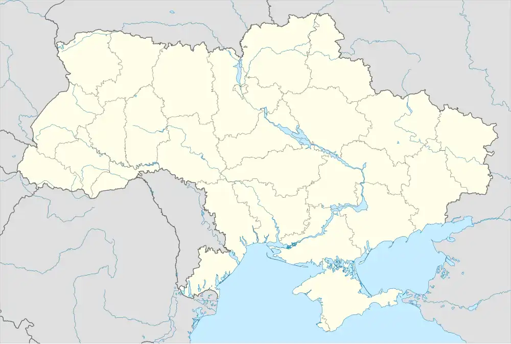 Kostiantynivka Kostiantynivka (Ukraine) | |
| Coordinates: 51°10′17″N 34°45′52″E / 51.17139°N 34.76444°E | |
| Country | |
| Oblast | Sumy Oblast |
| Raion | Sumy Raion |
| Hromada | Khotin settlement hromada |
| Population (2001) | |
• Total | 246[1] |
| Time zone | UTC+2 |
| • Summer (DST) | UTC+3 |
| Postal code | 42315 |
| Area code | +380 542 |
Kostiantynivka is a village in Ukraine, in Khotin settlement hromada, Sumy Raion, Sumy Oblast, Ukraine. Until 2016, the local government body was the Kindrativka Village Council.
Geography
The village of Kostiantynivka is located 1.5 km from the left bank of the Sinyak River. At a distance of 2.5 km are the villages of Kindrativka and Novokostyantynivka. The village is located on the border with Russia.
The Muzhitsa River originates on the western outskirts of the village.
History
On June 12, 2020, in accordance with the Resolution of the Cabinet of Ministers of Ukraine No. 723-r "On the Determination of Administrative Centers and Approval of Territories of Territorial Communities of Sumy Region", it became part of the Khotin settlement hromada.[2]
On July 19, 2020, as a result of the administrative-territorial reform and liquidation of the Sumy Raion (1923—2020), the village became part of the newly formed Sumy Raion.[3]
Russo-Ukrainian War
On July 14, 2024, the village was shelled by Russian forces. 6 explosions were recorded, which probably came from a helicopter.[4]
Russian forces first entered the village before 29 May 2025.[5] The village was captured by Russian forces on 29 May 2025.[5]
Demographics
According to the 2001 Ukrainian census, the village's population was 246 people.[1] The main languages of the village were:[6]
Notable people
The following were born in the village:
- Hanna Vlasivna Koba - deputy of the Verkhovna Rada of the Ukrainian SSR of the 11th convocation.
- Mykhailo Volodymyrovych Nadezhdin - a Soviet and Ukrainian artist, painter, Honoured Artist of Ukraine (1994), People's Artist of Ukraine (1997). Laureate of the A. O. Osmerkin Prize. Deputy of the Kirovohrad Oblast Council.
References
- ^ a b "Table: 19A0501_07_059. Number of actual population in rural areas, Sumska oblast (1,2,3,4)". Retrieved 30 July 2025.
- ^ "Кабінет Міністрів України - Про визначення адміністративних центрів та затвердження територій територіальних громад Сумської області". www.kmu.gov.ua (in Ukrainian). Archived from the original on 25 October 2021. Retrieved 2025-07-30.
- ^ "Постанова Верховної Ради України від" (in Ukrainian). 2020-07-17. Retrieved 2025-07-30.
- ^ "На Сумщині внаслідок обстрілів пошкоджені три будинки і комунальний заклад". debaty.sumy.ua (in Ukrainian). 2024-07-14. Retrieved 2025-07-30.
- ^ a b "Institute for the Study of War". Institute for the Study of War. 2025-05-29. Retrieved 2025-07-30.
- ^ "Table: 19A0501_07_059. Number of actual population in rural areas, Sumska oblast (1,2,3,4)". Retrieved 30 July 2025.