Kitsissut Islands
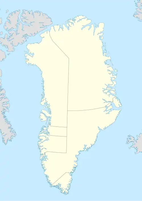
Map of the Kitsissut Islands | |
 Kitsissut Islands | |
| Geography | |
|---|---|
| Location | Labrador Sea Southern Greenland |
| Coordinates | 59°59′N 45°10′W / 59.983°N 45.167°W |
| Highest elevation | 101 m (331 ft) |
| Administration | |
Greenland | |
| Municipality | Kujalleq |
| Demographics | |
| Population | 0 |
Kitsissut (old spelling Kitsigsut) is an island group in the Kujalleq municipality in southern Greenland.
Geography
Kitsissut is an island chain located about 60 kilometres (37 miles) to the west-northwest of Cape Farewell and 15 km to the south-southeast of Cape Egede 5 km from the shore. It is a cluster of numerous small islets and rocks, with a length of less than 30 km and a width of 8 km, divided into two subgroups: Northern Kitsissut (Danish: Nordlige Kitsissut) in the northwest and the smaller Southern Kitsissut (Danish: Sydlige Kitsissut) in the southeast.[1][2]
Angissoq is the largest island, with a length of 3.7 km and a width of 3 km. It is also the highest island with a peak in its centre on which a beacon stands.[3]
Climate
The Kitsissut Islands experience a tundra climate (Köppen: ET); with short, cool summers and long, very cold winters.[4]
| Climate data for Kitsissut Islands (Angissoq) (59°21′N 45°08′W / 59.35°N 45.13°W) (14 m (46 ft) AMSL) (1991-2020 data) | |||||||||||||
|---|---|---|---|---|---|---|---|---|---|---|---|---|---|
| Month | Jan | Feb | Mar | Apr | May | Jun | Jul | Aug | Sep | Oct | Nov | Dec | Year |
| Record high °C (°F) | 9.6 (49.3) |
9.3 (48.7) |
9.3 (48.7) |
12.0 (53.6) |
14.3 (57.7) |
14.1 (57.4) |
16.1 (61.0) |
16.0 (60.8) |
15.0 (59.0) |
13.8 (56.8) |
11.2 (52.2) |
9.7 (49.5) |
16.1 (61.0) |
| Mean daily maximum °C (°F) | −1.1 (30.0) |
−1.6 (29.1) |
−0.9 (30.4) |
1.5 (34.7) |
3.5 (38.3) |
5.4 (41.7) |
6.7 (44.1) |
7.2 (45.0) |
6.2 (43.2) |
3.9 (39.0) |
1.7 (35.1) |
0.1 (32.2) |
2.7 (36.9) |
| Daily mean °C (°F) | −2.8 (27.0) |
−3.3 (26.1) |
−2.5 (27.5) |
−0.1 (31.8) |
1.7 (35.1) |
3.2 (37.8) |
4.5 (40.1) |
5.2 (41.4) |
4.5 (40.1) |
2.4 (36.3) |
0.3 (32.5) |
−1.4 (29.5) |
1.0 (33.8) |
| Mean daily minimum °C (°F) | −4.4 (24.1) |
−5.0 (23.0) |
−4.2 (24.4) |
−1.8 (28.8) |
−0.2 (31.6) |
1.0 (33.8) |
2.2 (36.0) |
3.3 (37.9) |
2.9 (37.2) |
1.0 (33.8) |
−1.1 (30.0) |
−2.8 (27.0) |
−0.8 (30.6) |
| Record low °C (°F) | −16.1 (3.0) |
−15.9 (3.4) |
−16.3 (2.7) |
−9.5 (14.9) |
−9.4 (15.1) |
−5.1 (22.8) |
−2.5 (27.5) |
−2.8 (27.0) |
−1.8 (28.8) |
−6.2 (20.8) |
−9.1 (15.6) |
−13.0 (8.6) |
−16.1 (3.0) |
| Average relative humidity (%) | 71.8 | 71.8 | 72.1 | 77.9 | 82.8 | 87.9 | 89.7 | 90.7 | 85.7 | 77.8 | 75.9 | 73.8 | 79.8 |
| Source: Danish Meteorological Institute (1991-2020 temperature & humidity)[5] | |||||||||||||
See also
References
- ^ Kitsissut
- ^ Sailing Directions (Enroute), Pub. 181: Greenland and Iceland (PDF). Sailing Directions. United States National Geospatial-Intelligence Agency. 2017. p. 6-7.
- ^ Prostar Sailing Directions 2005 Greenland and Iceland Enroute, p. 10
- ^ Beck, Hylke E; McVicar, Tim R; Vergopolan, Noemi; et al. (October 23, 2023). "High-resolution (1 km) Köppen-Geiger maps for 1901–2099 based on constrained CMIP6 projections". Nature. Retrieved August 10, 2025.
- ^ Cappelen, J; Drost Jensen, C; Laursen, Ellen Vaarby; Stannius, Lotte Sligting; Thomsen, Rikke Sjølin (December 20, 2021). Hansen, Ane; Rasmussen, Leif; Scharling, Mikael (eds.). "Climatological Standard Normals 1991-2020 – Greenland" (PDF). Danish Meteorological Institute. Retrieved August 10, 2025.