Kendur
Kendur
Temple Village | |
|---|---|
Census Town | |
 Kendur Location in West Bengal,India  Kendur Kendur (India) | |
| Coordinates: 23°02′00″N 87°47′00″E / 23.0333°N 87.7833°E | |
| Country | India |
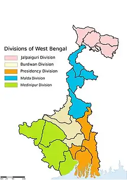
| State | West Bengal |
| District | Purba Bardhaman |
| Government | |
| • Type | Gram Panchayat |
| • Body | Gopalbara Gram Panchayat |
| Area | |
• Census Town | 5 km2 (2 sq mi) |
| • Land | 4.12 km2 (1.59 sq mi) |
| • Water | 0.88 km2 (0.34 sq mi) |
| • Urban | 1.8 km2 (0.7 sq mi) |
| • Rural | 3.4 km2 (1.3 sq mi) |
| Elevation | 30 m (100 ft) |
| Highest elevation | 35 m (115 ft) |
| Lowest elevation | 10 m (30 ft) |
| Population (2011) | |
• Census Town | 3,639 |
• Estimate (August 2025) | 4,500 |
| • Density | 900/km2 (2,000/sq mi) |
| • Urban | 500+ |
| • Rural | 3,000+ |
| Language | |
| • Official | Bengali |
| • Additional-Official | English |
| Time zone | UTC+5:30 (Indian Standard Time) |
| Pin | 713427 |
| Telephone | +91-342 |
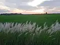
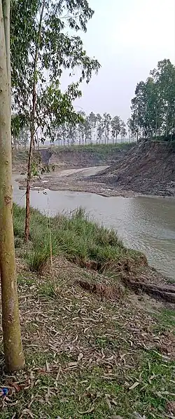
Kendur is a village located in Khandoghosh, Purba Bardhaman District in West Bengal, India. Its correct pronunciation is 'Kedur'.[1][2][3][4][5][6][7]


Location
Kendur is located in Khandoghosh community development block in Purba Bardhaman district in West Bengal, India.
Transportation services
Public Bus Stand-Within The Village
Private Bus Stand-Within The Village
Nearest Railway Station-Seharabazar Railway Station
Nearest Airport-Kazi Nazrul Islam Airport in Andal
Cab Service-Within 8-10 Kilometers
Food
Rasgulla is most popular sweet in this region.
Demographics
Languages spoken in Kendur
- Bengali (90.7%)
- Santali (6.26%)
- Hindi (3.30%)
- Others (0.70%)
Bengali is the most spoken language followed by Santali and Hindi.[1][8]
Climate
| Climate data for Kendur (1991 to 2020) | |||||||||||||
|---|---|---|---|---|---|---|---|---|---|---|---|---|---|
| Month | Jan | Feb | Mar | Apr | May | Jun | Jul | Aug | Sep | Oct | Nov | Dec | Year |
| Record high °F (°C) | 97.9 (36.6) |
101.8 (38.8) |
104.7 (40.4) |
114.8 (46.0) |
115.7 (46.5) |
113.4 (45.2) |
103.6 (39.8) |
99.0 (37.2) |
100.4 (38.0) |
96.8 (36.0) |
95.0 (35.0) |
91.4 (33.0) |
115.7 (46.5) |
| Mean daily maximum °F (°C) | 77.5 (25.3) |
84.9 (29.4) |
92.1 (33.4) |
97.9 (36.6) |
97.9 (36.6) |
95.7 (35.4) |
91.4 (33.0) |
91.0 (32.8) |
90.7 (32.6) |
90.0 (32.2) |
86.5 (30.3) |
80.4 (26.9) |
90.1 (32.3) |
| Mean daily minimum °F (°C) | 53.4 (11.9) |
61.5 (16.4) |
68.5 (20.3) |
76.1 (24.5) |
78.1 (25.6) |
79.2 (26.2) |
78.6 (25.9) |
78.1 (25.6) |
77.0 (25.0) |
73.9 (23.3) |
64.2 (17.9) |
56.5 (13.6) |
71.1 (21.7) |
| Record low °F (°C) | 39.9 (4.4) |
42.6 (5.9) |
53.1 (11.7) |
58.3 (14.6) |
59.7 (15.4) |
65.5 (18.6) |
66.9 (19.4) |
62.6 (17.0) |
60.8 (16.0) |
59.7 (15.4) |
49.6 (9.8) |
39.9 (4.4) |
39.9 (4.4) |
| Average rainfall inches (mm) | 0.37 (9.3) |
0.85 (21.7) |
1.15 (29.2) |
2.37 (60.2) |
3.67 (93.3) |
8.53 (216.7) |
12.29 (312.1) |
10.46 (265.7) |
8.70 (221.0) |
4.61 (117.0) |
0.39 (9.8) |
0.25 (6.3) |
53.64 (1,362.4) |
| Average rainy days | 0.8 | 1.7 | 2.2 | 3.1 | 5.8 | 10.3 | 15.1 | 13.9 | 11.2 | 5.8 | 0.8 | 0.6 | 71.2 |
| Average relative humidity (%) (at 17:30 IST) | 61 | 62 | 59 | 62 | 65 | 73 | 81 | 80 | 81 | 78 | 67 | 61 | 70 |
| Source: Indian Metreological Department | |||||||||||||
Education
Colleges:-
- Kendur ITI College
Schools:-
- Amra Primary School
- Baura High School[10]
- Baura Primary School
- Kendur High School[10]
- Kendur Primary School
Healthcare
There are two Primary Health Centres in Kendur each with two beds.[11][12][13]
References
- ^ a b english. "Kendur Pin Code - 713427, All Post Office Areas PIN Codes, Search bardhaman Post Office Address". ABP Live. Retrieved 2 August 2025.
- ^ "Pin Code: KENDUR, BARDHAMAN, WEST BENGAL, India, Pincode.net.in". pincode.net.in. Retrieved 2 August 2025.
- ^ "Kendur Village | Map of Kendur Village in Khandaghosh Tehsil, Barddhaman of West Bengal". www.mapsofindia.com. Retrieved 2 August 2025.
- ^ "Where is Kendur, West Bengal, India on Map Lat Long Coordinates". www.latlong.net. Retrieved 2 August 2025.
- ^ "Kendur", Wikipedia, 2 August 2025, retrieved 5 August 2025
- ^ Caṭṭopādhyāẏa, Ekakaṛi (2001). Bardhamāna Jelāra itihāsa o lokasaṃskr̥ti. Kalakātā: Ryāḍikyāla. ISBN 978-81-85459-36-3.
- ^ http://wbdemo5.nic.in/writereaddata/Directoryof_District_Block_GPs(RevisedMarch-2008).doc.
{{cite web}}: Missing or empty|title=(help) - ^ "C.D. Block Wise Primary Census Abstract Data(PCA)". 2011 census: West Bengal – District-wise CD Blocks. Registrar General and Census Commissioner, India. Archived from the original on 21 July 2024. Retrieved 17 August 2025.
- ^ "Climatological Tables of Observatories in India 1991-2020" (PDF). India Meteorological Department. Retrieved 8 April 2024.
- ^ a b "West Bengal Council of Higher Secondary Education". Budwan. WBCHSE. Retrieved 29 January 2019.
- ^ "Primary health care - India". www.who.int. Retrieved 16 August 2025.
- ^ "Primary Health Centres (PHCs)". www.pib.gov.in. Archived from the original on 28 December 2024. Retrieved 16 August 2025.
- ^ https://cbhidghs.mohfw.gov.in/index4.php?lang=1&level=0&linkid=110&lid=112.
{{cite web}}: Missing or empty|title=(help)
Cities, towns and locations in Purba Bardhaman district, Burdwan division | ||||||||||
|---|---|---|---|---|---|---|---|---|---|---|
| Cities, municipal and census towns |
|  | ||||||||
| Locations other than cities and towns |
| |||||||||
| Related topics |
| |||||||||