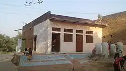
Kanhai Ka Pura, Madhya Pradesh
Kanhai Ka Pura
Maharajpura | |
|---|---|
Rural | |
 | |
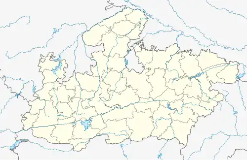 Kanhai Ka Pura Location in Madhya Pradesh, India  Kanhai Ka Pura Kanhai Ka Pura (India) | |
| Coordinates: 26°18′06″N 79°02′26″E / 26.3016226°N 79.0404649°E | |
| Country | |
| State | Madhya Pradesh |
| District | Bhind |
| Block | Roun |
| Tehsil | Mihona |
| Founded by | Kanhai |
| Government | |
| • MLA | Amrish Sharma (Bhartiya Janta Party) |
| • DM | Sanjeev Shrivastava |
| • Sarpanch | Vibha Rajawat |
| Area | |
• Total | 0.80 km2 (0.31 sq mi) |
| Elevation | 151 m (495 ft) |
| Population (2020) | |
• Total | 600 |
| Demonym | Purawale |
| Languages | |
| • Official | Hindi |
| Time zone | UTC+5:30 (IST) |
| PIN | 477441 |
| Telephone code | 07534 |
| Vehicle registration | MP-30 |
| Website | bhind |
Kanhai Ka Pura is a village[1] in Bhind district[2] and it comes under Surghan Gram Panchayat which comes under Mihona Tehsil and it comes under Lahar[3] Vidhan Sabha. It is an assembly constituency in Bhind district in the Indian state of Madhya Pradesh. As of 2011 India census, Kanhai Ka Pura has a population of over 530.
Geography
Kanhai Ka Pura is located at 26°18′06″N 79°02′26″E / 26.3016226°N 79.0404649°E.[4]
References
- ^ "ग्राम पंचायत, सुरघान जनपद पंचायत, रौन , जिला भिण्ड". Archived from the original on 9 January 2023. Retrieved 21 December 2021.
- ^ "Gram Panchayats | District Bhind, Government of Madhya Pradesh | India".
- ^ "CEO Madhya Pradesh".
- ^ "Kanhai Ka Pura · Madhya Pradesh 477441, India".