Jafar Kola
Jafar Kola
جعفركلا | |
|---|---|
village | |
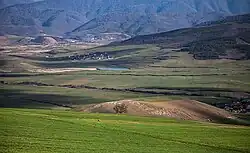 Jafar Kola (Top left) and Pahnedar | |
 Jafar Kola | |
| Coordinates: 36°09′34″N 53°15′57″E / 36.15944°N 53.26583°E | |
| Country | |
| Province | Mazandaran |
| County | Sari |
| Bakhsh | Dodangeh |
| Rural District | Farim |
| Population (2016) | |
• Total | 42 |
| Time zone | UTC+3:30 (IRST) |
Jafar Kola (Persian: جعفركلا, also Romanized as Ja‘far Kolā)[1] is a village in Farim Rural District, Dodangeh District, Sari County, Mazandaran Province, Iran. At the 2016 census, its population was 42, in 20 families.[2] Down from 60 in 2006.[3]
References
- ^ Jafar Kola can be found at GEOnet Names Server, at this link, by opening the Advanced Search box, entering "-3837092" in the "Unique Feature Id" form, and clicking on "Search Database".
- ^ Census of the Islamic Republic of Iran, 1395 (2016): Mazandaran Province. amar.org.ir (Report) (in Persian). The Statistical Center of Iran. Archived from the original (Excel) on 7 October 2021. Retrieved 19 December 2022.
- ^ "Census of the Islamic Republic of Iran, 1385 (2006)" (Excel). Statistical Center of Iran. Archived from the original on 2011-09-20.