Hesar-e Hasan Beyk
Hesar-e Hasan Beyk
Persian: حصارحسن بيك | |
|---|---|
Village | |
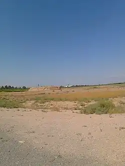 Landscape near Hesar-e Hasan Beyk | |
 Hesar-e Hasan Beyk | |
| Coordinates: 35°12′28″N 51°42′41″E / 35.20778°N 51.71139°E[1] | |
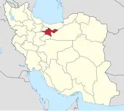
| Country | Iran |
| Province | Tehran |
| County | Varamin |
| District | Javadabad |
| Rural District | Behnamarab-e Jonubi |
| Population (2016)[2] | |
• Total | 940 |
| Time zone | UTC+3:30 (IRST) |
Hesar-e Hasan Beyk (Persian: حصارحسن بيك)[a] is a village in Behnamarab-e Jonubi Rural District[4] of Javadabad District in Varamin County, Tehran province, Iran.
Demographics
Population
At the time of the 2006 National Census, the village's population was 1,019 in 262 households.[5] The following census in 2011 counted 1,007 people in 305 households.[6] The 2016 census measured the population of the village as 940 people in 291 households.[2]
See also
Notes
References
- ^ OpenStreetMap contributors (7 August 2025). "Hesar Hassan Beik, Behnamarab-e Jonubi RD, Javadabad District, Varamin County, Tehran Province, Iran" (Map). OpenStreetMap (in Persian). Retrieved 7 August 2025.
- ^ a b سرشماري عمومي نفوس و مسكن 1395 : استان تهران [General Population and Housing Census 2016: Tehran Province]. مرکز آمار ایران [Statistical Centre of Iran] (in Persian). Archived from the original (Excel) on 12 December 2021. Retrieved 25 June 2025.
- ^ Hesar-e Hasan Beyk can be found at GEOnet Names Server, at this link, by opening the Advanced Search box, entering "-3782698" in the "Unique Feature Id" form, and clicking on "Search Database".
- ^ Mousavi, Mir-Hossein (9 August 1987) [تاریخ تصویب (Approval date) 1366/05/18 (Iranian Jalali calendar)]. تغییر نام بخش پلشت تابع شهرستان ورامین از استان تهران به پاکدشت و ایجاد و تشکیل 8 دهستان شامل روستاها و مزارع و مکانها در شهرستان مذکور [Changing the name of Pleshet District under Varamin County from Tehran province to Pakdasht and creating and forming eight rural districts including villages, farms and places in the said county]. لام تا کام [Lam ta Kam] (in Persian). وزارت کشور [Ministry of the Interior]. هیات وزیران [Council of Ministers]. شناسه [ID] D78E7BEE-933E-4FDE-9D4B-8FDC593F00D2. شماره دوره [Course number] 66, شماره جلد [Volume number] 11. Archived from the original on 21 June 2025. Retrieved 21 June 2025.
- ^ سرشماري عمومي نفوس و مسكن 1385 : استان تهران [General Population and Housing Census 2006: Tehran Province]. مرکز آمار ایران [Statistical Centre of Iran] (in Persian). Archived from the original (Excel) on 20 September 2011. Retrieved 22 June 2025.
- ^ سرشماري عمومي نفوس و مسكن 1390 : استان تهران [General Population and Housing Census 2011: Tehran Province]. Iran Data Portal—Syracuse University (in Persian). مرکز آمار ایران [Statistical Centre of Iran]. Archived from the original (Excel) on 20 January 2023. Retrieved 25 June 2025.
| Capital | |||||||||||||||||||||
|---|---|---|---|---|---|---|---|---|---|---|---|---|---|---|---|---|---|---|---|---|---|
| Districts |
| ||||||||||||||||||||