Harrower Peak
| Harrower Peak | |
|---|---|
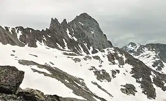 North aspect | |
| Highest point | |
| Elevation | 13,057 ft (3,980 m)[1] |
| Prominence | 932 ft (284 m)[1] |
| Coordinates | 43°05′37″N 109°35′45″W / 43.09361°N 109.59583°W[1] |
| Geography | |
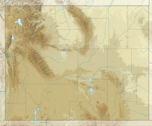 Harrower Peak Location in Wyoming 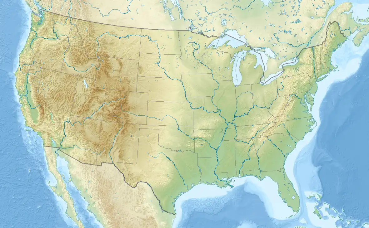 Harrower Peak Location in the United States | |
| Location | Sublette County, Wyoming, U.S. |
| Parent range | Wind River Range |
| Topo map | USGS Fremont Peak South |
| Climbing | |
| First ascent | 1926 (Albert R. Ellingwood) |
Harrower Peak (13,057 ft (3,980 m)) is located in the northern Wind River Range in the U.S. state of Wyoming, and it is the 28th tallest mountain in the state.[2][3] Harrower Peak is in the Bridger Wilderness of Bridger-Teton National Forest and the Harrower Glacier is less than .50 mi (0.80 km) northeast of the peak.[2] Harrower Peak is named after the late James King Harrower of Pinedale, Wyoming, who was a prominent wilderness and wildlife advocate, forest ranger, game warden, and regional historian.[4][5]
Hazards
Encountering bears is a concern in the Wind River Range.[6] There are other concerns as well, including bugs, wildfires, adverse snow conditions and nighttime cold temperatures.[7]
Importantly, there have been notable incidents, including accidental deaths, due to falls from steep cliffs (a misstep could be fatal in this class 4/5 terrain) and due to falling rocks, over the years, including 1993,[8] 2007 (involving an experienced NOLS leader),[9] 2015[10] and 2018.[11] Other incidents include a seriously injured backpacker being airlifted near SquareTop Mountain[12] in 2005,[13] and a fatal hiker incident (from an apparent accidental fall) in 2006 that involved state search and rescue.[14] The U.S. Forest Service does not offer updated aggregated records on the official number of fatalities in the Wind River Range.
References
- ^ a b c "Harrower Peak, Wyoming". Peakbagger.com. Retrieved December 6, 2013.
- ^ a b Fremont Peak South, WY (Map). TopoQwest (United States Geological Survey Maps). Retrieved December 6, 2013.
- ^ "Wyoming 13,000-foot Peaks". Peakbagger.com. Retrieved December 6, 2013.
- ^ Boardman, Eli (February 2023). A Guide to Hiking and Climbing Wyoming's Highest Peaks: The Wyoming 13ers (Revised ed.). Middletown, Del.: Independent Publisher. p. 81. ISBN 979-8839935280.
- ^ Dorothy, Jackie (December 1, 2024). "Legacy Of 1920s Wyoming Park Rancher: Mountain Peaks, Red Desert Elk Herds, Mountain Man Museum". Cowboy State Daily. Retrieved July 17, 2025.
- ^ "Bear Safety in Wyoming's Wind River Country". WindRiver.org. April 24, 2017. Archived from the original on July 26, 2021. Retrieved May 31, 2022.
- ^ Ballou, Dawn (July 27, 2005). "Wind River Range condition update - Fires, trails, bears, Continental Divide". PineDaleOnline News. Archived from the original on April 21, 2021. Retrieved May 31, 2022.
- ^ "Falling Rock, Loose Rock, Failure to Test Holds, Wyoming, Wind River Range, Seneca Lake". American Alpine Club. 1993. Archived from the original on July 26, 2021. Retrieved May 31, 2022.
- ^ MacDonald, Dougald (August 14, 2007). "Trundled Rock Kills NOLS Leader". Climbing. Archived from the original on July 26, 2021. Retrieved May 31, 2022.
- ^ "Officials rule Wind River Range climbing deaths accidental". Casper Star-Tribune. December 9, 2015. Archived from the original on July 26, 2021. Retrieved May 31, 2022.
- ^ Dayton, Kelsey (August 24, 2018). "Deadly underestimation". WyoFile News. Archived from the original on July 26, 2021. Retrieved May 31, 2022.
- ^ Funk, Jason (2009). "Squaretop Mountain Rock Climbing". Mountain Project. Archived from the original on July 26, 2021. Retrieved May 31, 2022.
- ^ "Injured man rescued from Square Top Mtn - Tip-Top Search & Rescue helps 2 injured on the mountain". PineDaleOnline News. July 22, 2005. Archived from the original on July 26, 2021. Retrieved May 31, 2022.
- ^ "Incident Reports - September, 2006 - Wind River Search". WildernessDoc.com. September 1, 2006. Archived from the original on January 27, 2020. Retrieved May 31, 2022.